Henrico County | |
|---|---|
 The Old Henrico County Courthouse in
Richmond. | |
 Flag  Seal | |
 Location within the U.S. state of
Virginia | |
 Virginia's location within the
U.S. | |
| Country | |
| State | |
| Founded | 1634 [1] |
| Named for | Citie of Henricus |
| Area | |
| • Total | 245 [2] sq mi (Formatting error: invalid input when rounding km2) |
| • Land | 237.65 sq mi (615.5 km2) |
| • Water | 7.35 sq mi (19.0 km2) 3% (approx) [2]% |
| Population | |
| • Estimate (2013) | 316,973 [3] |
| • Density | 1,334/sq mi (515/km2) |
| Time zone | UTC−5 ( Eastern) |
| • Summer ( DST) | UTC−4 ( EDT) |
| Congressional districts | 3rd, 7th |
| Website |
henrico |
Henrico County (formerly Henrico Shire) /hɛnˈraɪkoʊ/, officially the County of Henrico, is a county located in the Commonwealth of Virginia. As of the 2010 census, the population was 306,935. [3] In 2013, the population was estimated to be 316,973, [3] making it the fifth-most populous county in Virginia and the sixth-most populous county-equivalent in Virginia. Henrico County is included in the Richmond, VA Metropolitan Statistical Area.
Named after the Citie of Henricus, Henrico became one of the eight original Shires of Virginia in 1634. [1] It is one of the oldest counties in the United States. The City of Richmond was officially part of Henrico County until 1842, when it became a fully independent city. [4] The present-day Henrico County curves around the City of Richmond, surrounding it to the west, north, and east. The county is bounded by the Chickahominy River to the north and the James River and Richmond to the south. [5]
Richmond International Raceway is located in the central portion of Henrico County near Mechanicsville, just north of the Richmond city limits. Additionally, Richmond International Airport is located in the eastern portion of Henrico County in Sandston. Top private employers in the county include Capital One, Bon Secours Richmond Health System, and Anthem. [6]
History
In 1611, Thomas Dale founded the Citie of Henricus on an island in the James River that is now called Farrar's Island. [7] Henricus was named for Henry Frederick, Prince of Wales and was destroyed during the Indian massacre of 1622. [8]
In 1634, Henrico Shire was created one of the eight original Shires of Virginia established by the British in the Virginia Colony. [1] Since then, 11 counties and 3 independent cities have been formed from the original territory of Henrico Shire. [4]
| County/City | Year Founded |
|---|---|
| Goochland County | 1728 |
| Albemarle County | 1744 |
| Chesterfield County | 1749 |
| Cumberland County | 1749 |
| Amherst County | 1761 |
| Buckingham County | 1761 |
| Fluvanna County | 1777 |
| Powhatan County | 1777 |
| Nelson County | 1807 |
| City of Richmond | 1842 |
| Appomattox County (part) | 1845 |
| City of Charlottesville | 1888 |
| City of Colonial Heights | 1948 |
Since becoming independent in 1842, the City of Richmond has successfully annexed portions of Henrico five times. [9] Chesterfield County annexed the site of Henricus in 1922. [4]
Richmond attempted to completely merge with Henrico 1961, but 61% of the votes in a referendum in Henrico voted not against the merger.
[10] In 1965, Richmond attempted to annexed 145 square miles of Henrico County but, after a lengthy court battle, the city was only given permission to annex 17 square miles. Because the city would have had to reimburse Henrico a hefty $55 million, Richmond opted to not annex the 17 square miles.
[10]Cite error: A <ref> tag is missing the closing </ref> (see the
help page). Henrico's borders have not changed since Richmond's 1942 annex.
County seat
The original county seat was at Varina, at the Varina Farms plantation across the James River from Henricus. John Rolfe built this plantation, where he lived with his wife, Pocahontas. [11] Henrico's government was located at Varina from around 1640 until 1752. [2]
In 1752, Henrico relocated its seat to a more central location inside the city Richmond between Church Hill and what is now Tobacco Row. The county seat remained at 22nd and Main St in Richmond even after the city's government became fully independent of the county in 1842. [4] It was not until 1974 when the county moved out of the Old Henrico County Courthouse to a complex in the western portion of the county at the intersection of Parham Road and Hungary Springs Road. [2]
In addition to the 1974 complex, in 1988 the county opened its Eastern Governmental Center to be more convent to county residents in the Eastern portion of the county. It is located on Nine Mile Road. [2]
American Civil War battle sites

During the Civil War, in 1862 Henrico County was the site of the following numerous battles during the Peninsula Campaign:
- Seven Pines,
- Savage's Station,
- Oak Grove,
- Garnett's and Golding's Farms,
- White Oak Swamp,
- Glendale, and
- Malvern Hill.
Additional significant battles took place in 1864 during the Overland Campaign prior to and during the Siege of Petersburg, which led to the fall of Richmond. Confederate General J.E.B. Stuart was mortally wounded in Henrico County at the Battle of Yellow Tavern on May 12, 1864.
Transportation
Henrico County is one of only two counties in Virginia that maintains its own roads, the other being Arlington County. This special status was due to the existence of county highway departments prior to the creation of the state agency that is now VDOT in 1927, and the assumption of local roads in most counties by that agency in 1932. (Henrico and Arlington were grandfathered and allowed to continue pre-existing arrangements.) The control of the roads system is considered a powerful advantage for community urban planners, who can require developers to contribute to funding needed for road needs serving the planners' projects.
Henrico County is the site of Richmond International Airport. It also hosts an Amtrak rail passenger station and purchases public bus route services from Greater Richmond Transit Company, an FTA-funded public service company that is owned equally by the City of Richmond and neighboring Chesterfield County.
Interstate highways include:
Other major highways include:
 US 1 (Brook Road)
 US 33 (Staples Mill Road)
 US 60 (Williamsburg Road)
 US 250 (Broad Street)
 US 301 (Chamberlayne Road)
 US 360 (Mechanicsville Turnpike)
As well as:
|
Geography
According to the U.S. Census Bureau, the county has a total area of 245 square miles (630 km2), of which 234 square miles (610 km2) is land and 11 square miles (28 km2) (4.6%) is water. [12]
Adjacent counties
- Charles City County (southeast)
- Chesterfield County (south)
- Goochland County (west)
- Hanover County (north)
- New Kent County (northeast)
- Richmond (south)
National protected area
Demographics
| Census | Pop. | Note | %± |
|---|---|---|---|
| 1790 | 12,000 | — | |
| 1800 | 14,886 | 24.1% | |
| 1810 | 19,680 | 32.2% | |
| 1820 | 23,667 | 20.3% | |
| 1830 | 28,797 | 21.7% | |
| 1840 | 33,076 | 14.9% | |
| 1850 | 43,572 | 31.7% | |
| 1860 | 61,616 | 41.4% | |
| 1870 | 66,179 | 7.4% | |
| 1880 | 82,703 | 25.0% | |
| 1890 | 103,394 | 25.0% | |
| 1900 | 30,062 | −70.9% | |
| 1910 | 23,437 | −22.0% | |
| 1920 | 18,972 | −19.1% | |
| 1930 | 30,310 | 59.8% | |
| 1940 | 41,960 | 38.4% | |
| 1950 | 57,340 | 36.7% | |
| 1960 | 117,339 | 104.6% | |
| 1970 | 154,364 | 31.6% | |
| 1980 | 180,735 | 17.1% | |
| 1990 | 217,881 | 20.6% | |
| 2000 | 262,300 | 20.4% | |
| 2010 | 306,935 | 17.0% | |
| 2013 (est.) | 316,973 | 3.3% | |
1790-1960 [14] 1900-1990 [15] 1990-2000 [16] 2013 Estimate | |||
As of the census [17] of 2000, there were 262,300 people, 108,121 households, and 69,846 families residing in the county. The population density was 1,102 people per square mile (425/km²). There were 112,570 housing units at an average density of 473 per square mile (183/km²). The racial makeup of the county was 68.91% White, 24.71% Black or African American, 0.35% Native American, 8.51% Asian, 0.03% Pacific Islander, 0.98% from other races, and 1.42% from two or more races. About 6.0% of the population was Hispanic or Latino of any race.
The largest ancestry groups in Henrico County are: Black or African American (25%), English American (14%), German (11%), Irish (10%) and Italian (4%) [18]
There were 108,121 households out of which 31.90% had children under the age of 18 living with them, 48.30% were married couples living together, 13.10% had a female householder with no husband present, and 35.40% were non-families. 28.90% of all households were made up of individuals and 8.50% had someone living alone who was 65 years of age or older. The average household size was 2.39 and the average family size was 2.97.
In the county the population was spread out with 24.70% under the age of 18, 7.80% from 18 to 24, 32.90% from 25 to 44, 22.20% from 45 to 64, and 12.40% who were 65 years of age or older. The median age was 36 years. For every 100 females there were 88.20 males. For every 100 females age 18 and over, there were 83.60 males.
The median income for a household in the county was $49,185, and the median income for a family was $59,298. Males had a median income of $40,203 versus $29,795 for females. The per capita income for the county was $26,410. About 4.50% of families and 6.20% of the population were below the poverty line, including 8.10% of those under age 18 and 4.50% of those age 65 or over.
Government
Henrico County is managed by an appointed County Manager who answers directly to the Board of Supervisors. The current County Manager is John A. Vithoulkas.
The Board of Supervisors are:
- Brookland District - Beverly Cocke (R)
- Fairfield District - Frank J. Thornton (D)
- Three Chopt District - David A. Kaechele (R)
- Tuckahoe District - Patricia S. O'Bannon (R)
- Varina District - Tyrone E. Nelson (D)
In 1992 and again in 1993, City and State magazine ranked Henrico County as the second best fiscally managed county in the United States.
There are several elected constitutional officers.
- Clerk of the Circuit Court - Yvonne Galloway Smith (R)
- Commonwealth's Attorney - Shannon L. Taylor (D)
- Sheriff - Michael L. "Mike" Wade (R)
There are also several legislative representatives.
In the U.S. House of Representatives:
- Republican Eric I. Cantor
- Democrat Robert C. "Bobby" Scott
In the Virginia Senate:
- Democrat A. Donald McEachin
- Republican Walter A. Stosch
In the Virginia House of Delegates
- Republican Peter F. Farrell
- Republican Riley Edward Ingram
- Republican G.M. "Manoli" Loupassi
- Democrat Dolores L. McQuinn
- Democrat Jennifer L. McClellan
- Republican Jimmie P. Massie, III
- Republican John M. O'Bannon, III
- Democrat Joseph D. "Joe" Morrissey
Law enforcement
The first known mention of an "officer" in Henrico was the appointment of a Special Police Officer on December 14, 1871. There is no further mention until 1908 when the Board of Supervisors recommended that a mounted patrol be used. The first major step toward today's department was in 1915 when T. Wilson Seay was appointed the first Chief of Police. When the County converted to the County Manager form of government in 1934 there were 8 police officers. In 1938 the Board of Supervisors placed the Division of Police under direct control of the County Manager, thus removing any political ties with the Sheriff's office. The Division of Police has seen steady growth and improvement over the past 70 years.
With an authorized complement of 584 sworn police officers, the Chief of Police is the chief law enforcement officer in the County. The Chief is appointed by the County Manager. The elected Sheriff's primary duties are managing the jail, court security, and the service of civil process.
The Henrico County Police is fully accredited by the Commission for Accreditation of Law Enforcement Agencies (CALEA) and Virginia Law Enforcement Professional Standards Commission.
Colonel Henry W. Stanley, Jr., served as Chief of Police for the Henrico County Division of Police from August 1995 to April 2011 when he retired after being a member of the Division since 1962. Lt. Colonel Douglas A. Middleton was appointed as the new Chief of Police effective April 9, 2011.
Economy
Altria Group (formerly Philip Morris) had its corporate headquarters in an unincorporated area in Henrico County. [19] In 2003 Philip Morris announced that it would move its headquarters from New York City to Virginia. The company said that it planned to keep around 750 employees in its former headquarters. Brendan McCormick, a spokesperson for Philip Morris, said that the company estimated that the move would save the company over $60 million each year. [20] This relocation was made with the help of the Henrico County Economic Development Authority and the Greater Richmond Partnership, [21] regional economic development organizations who also helped locate Aditya Birla Minacs, Alfa Laval, Genworth Financial, and Blue Bell Ice Cream to the county.
Top employers
According to the County's 2011 Comprehensive Annual Financial Report, [22] the top employers in the county are:
| # | Employer | # of Employees | Community |
|---|---|---|---|
| 1 | Henrico County Public Schools | 5,000-9,999 | |
| 2 | County of Henrico | 1,000-4,999 | |
| 3 | Capital One | 1,000-4,999 | Innsbrook |
| 4 | Bon Secours Richmond Health System | 1,000-4,999 | |
| 5 | Anthem | 1,000-4,999 | |
| 6 | Henrico Doctors' Hospital | 1,000-4,999 | |
| 7 | Admiral Security Services | 1,000-4,999 | |
| 8 | Bank of America | 1,000-4,999 | |
| 9 | Wells Fargo | 1,000-4,999 | |
| 10 | United States Postal Service | 1,000-4,999 | Sandston |
| 11 | Walmart | 1,000-4,999 | |
| 12 | Martin's Food Markets | 1,000-4,999 | |
| 13 | Genworth Financial | 1,000-4,999 | |
| 14 | Altria | 1,000-4,999 | |
| 15 | Kroger | 1,000-4,999 | |
| 16 | Dominion Resources | 500-999 | |
| 17 | Allianz Global Assistance | 500-999 | |
| 18 | Markel | 500-999 | Glen Allen |
| 19 | SunTrust Banks | 500-999 | |
| 20 | Verizon Virginia | 500-999 |
Cost of living
Mar. 2012 cost of living index in Henrico County: 86.5 (less than average, U.S. average is 100) [23]
Education
| This user page may require cleanup to meet Wikipedia's quality standards. The specific problem is: Rewrite this section - write it like normal. Please help improve this user page if you can; the talk page may contain suggestions. |
- The school division known as Henrico County Public Schools consists of 45 elementary schools, 13 middle schools, 10 high schools and 2 technical centers within one school district.
- In 2001, HCPS began distributing Apple iBooks to every high school student. In 2003, they extended the program to middle schools.
- In 2005, the HCPS School Board decided to replace the iBooks with Dell's Inspiron 600M at the High School level.
- In 2006, the HCPS School Board decided to continue using Apple iBooks at the Middle School level, purchasing nearly 13,000 laptops in a contract worth $15.8 million.
- In 2010, HCPS School Board opened a new middle school, Holman Middle School.
- In 2010, HCPS School Board opened a new high school, Glen Allen High School.
Communities
There are no existing incorporated towns, and no new municipalities can be created within the county. Henrico was the third Virginia county (after Arlington and Fairfax counties) to be affected by a state law that prohibits the creation of any new towns or cities within the boundaries of a county with a population density of 1,000 or more per square mile.
Census-designated places
- Chamberlayne
- Dumbarton
- East Highland Park
- Glen Allen
- Highland Springs
- Innsbrook
- Lakeside
- Laurel
- Montrose
- Sandston
- Short Pump
- Tuckahoe
- Wyndham
Other communities
Former towns
Prior to 1870, the Town and later City of Richmond was located within Henrico County. Under a new Virginia state constitution in 1870, and as further clarified by rewritten one in 1902, Richmond became an independent city.
At the end of the 19th century and in the early 20th century, several small incorporated towns were chartered by Acts of Assembly, primarily in areas of the county near to, but outside of, the city limits. As listed by the Secretary of the Commonwealth, these included:
- Barton Heights, incorporated 1896, annexed by the City of Richmond in 1914. [24] [25]
- Fairmount, incorporated 1902, annexed by the City of Richmond in 1914. [24]
- Ginter Park, annexed by the City of Richmond.
- Highland Park, annexed by the City of Richmond in 1914. [24]
- North Richmond, annexed by the City of Richmond.
Notable facts
As with many lesser known areas in Virginia, the United States Postal Service official mailing address for the majority of the county was the nearest major city, Richmond. However, in 2008 county residents won the right to be recognized by the United States Postal Service as the locality to which they pay the majority of their taxes. As of October 1, 2008, the primary mailing address for the majority of the county will be officially changed to Henrico. The county is said to recover at least 5 million dollars a year in misdirected tax dollars due to the address change. [26] This move has set a precedent causing many other localities in Virginia who are officially recognized by the United States Postal Service as the nearest major city to consider petitioning the United States Postal Service for their own official mailing address bearing the name of the locality to which residents actually pay their taxes.
Henrico County is the location of Richmond International Raceway, home to NASCAR races twice a year.
Henrico County is the county that handles hazardous material spills and related problems (with three HAZMAT Teams) for the entire Central Virginia Region. Partly because of this, Central Virginia has total interoperability of Emergency Communications (Police, Fire, Recreation and Parks, Volunteer Rescue Squads, etc.) between the cities and more than ten counties.
Henrico County has the highest bond rating (Triple, triple-A) from the three bond rating agencies in the United States, which means Henrico is known nationwide for its solid fiscal responsibility. [12]
Henrico County residents are served by the Henrico Area Mental Health and Developmental Services, one of the best publicly supported mental health recovery agencies in the country.[ citation needed] All fees for services rendered are based on financial need, providing mental health and recovery support services to thousands who otherwise would not be able to afford this due to their own limited financial resources. Nobody is denied service due to an inability to pay. [12]
See also
- Henrico County Sheriff's Office (Virginia)
- Henrico County Police Department
- Henrico County Public Schools
- National Register of Historic Places listings in Henrico County, Virginia
References
- ^ a b c Henrico County. "Henrico Becomes a Shire".
- ^ a b c d e Henrico County Public Schools. "Henrico and the Land Around Us" (PDF). Retrieved 28 October 2014.
- ^ a b c U.S. Census Bureau. "Henrico County Quickfacts".
- ^ a b c d Henrico Historical Society. "Henrico History".
- ^ "See this map".
- ^ Virginia Employment Commission. "Virginia Community Profile: Henrico County" (PDF). Retrieved 28 October 2014.
- ^ Henrico County. "Henricus". Retrieved 28 October 2014.
- ^ Henricus Historical Park. "1611 Settlement". Retrieved 31 October 2014.
- ^ Richmond Department of IT. "Annexation History Map". Retrieved 3 November 2014.
- ^ a b Kollatz, Harry. "Irreconcilable Differences". Retrieved 2 November 2014.
- ^ Henrico County. "Varina Magisterial District". Retrieved 30 October 2014.
- ^ a b c "US Gazetteer files: 2010, 2000, and 1990". United States Census Bureau. 2011-02-12. Retrieved 2011-04-23. Cite error: The named reference "GR1" was defined multiple times with different content (see the help page).
- ^ "U.S. Decennial Census". United States Census Bureau. Retrieved January 2, 2014.
- ^ "Historical Census Browser". University of Virginia Library. Retrieved January 2, 2014.
- ^ "Population of Counties by Decennial Census: 1900 to 1990". United States Census Bureau. Retrieved January 2, 2014.
- ^ "Census 2000 PHC-T-4. Ranking Tables for Counties: 1990 and 2000" (PDF). United States Census Bureau. Retrieved January 2, 2014.
- ^ "American FactFinder". United States Census Bureau. Retrieved 2011-05-14.
- ^ Henrico County, VA - Henrico County, Virginia - Ancestry & family history - ePodunk
- ^ " Contact Us." Altria Group. Retrieved on October 19, 2009.
- ^ " Philip Morris to Move Headquarters from New York City to Richmond, Va.." New York Daily News. March 5, 2003. Retrieved on October 19, 2009.
- ^ Lyne, Jack. "Philip Morris Relocating NYC Headquarters to Native Virginia Area". Site Selection. Retrieved 16 August 2013.
- ^ County of Henrico CAFR
- ^ http://www.city-data.com/county/Henrico_County-VA.html#ixzz2F2c5wqCY
- ^ a b c http://dls.state.va.us/lrc/charters/richmond.pdf
- ^ http://www.nps.gov/history/nr/testing/richmond/TownBartonHeights.html
- ^ "Henrico Virginia". Retrieved 2008-05-29.
External links
- Official website
- Henrico County Historical Society
- County of Henrico at the Wayback Machine (archived June 29, 1997)
Places adjacent to RVA all day/sandbox | ||||||||||||||||
|---|---|---|---|---|---|---|---|---|---|---|---|---|---|---|---|---|
| ||||||||||||||||
37°33′N 77°24′W / 37.55°N 77.40°W
Municipalities and communities of
Henrico County, Virginia, United States | ||
|---|---|---|
| CDPs | 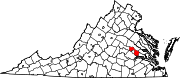 | |
|
Unincorporated communities | ||