From Wikipedia, the free encyclopedia
Provincial park in British Columbia, Canada
| Lowe Inlet Marine Provincial Park | |
|---|---|
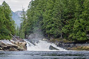
 Verney Falls at the head of Lowe Inlet | |
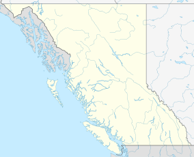
| Location | British Columbia, Canada |
| Nearest city | Prince Rupert, BC |
| Coordinates | 53°33′23″N 129°35′15″W / 53.5564°N 129.5875°W / 53.5564; -129.5875 |
| Area | 765 hectares (1,890 acres) |
| Established | 14 June 1994 |
| Governing body | BC Parks |
| Website | Official website |
Lowe Inlet Marine Provincial Park is a provincial park in British Columbia, Canada located on the Inside Passage of the North Coast, 118 km south of Prince Rupert and 75 km north of Butedale. [2] Established on 14 June 1994, the park now contains approximately 765 hectares (1,890 acres) (555 hectares (1,370 acres) of upland and 210 hectares (520 acres) of foreshore). [3]
Images
Wikimedia Commons has media related to
Lowe Inlet Marine Provincial Park.
-
Lowe Inlet
References
- ^ "Lowe Inlet Marine Park". Protected Planet. Retrieved 2020-09-15.
- ^ "Lowe Inlet Marine Provincial Park". BC Parks. Retrieved 3 August 2014.
- ^ "Lowe Inlet Marine Park". BC Geographical Names.
|
| This British Columbia protected areas related article is a stub. You can help Wikipedia by expanding it. |
| |||||||||||||||||||||||||||||||||||||||||||||||||||||||||||||||||||||||||
| |||||||||||||||||||||||||||||||||||||||||||||||||||||||||||||||||||||||||
| |||||||||||||||||||||||||||||||||||||||||||||||||||||||||||||||||||||||||
| |||||||||||||||||||||||||||||||||||||||||||||||||||||||||||||||||||||||||
| |||||||||||||||||||||||||||||||||||||||||||||||||||||||||||||||||||||||||
| |||||||||||||||||||||||||||||||||||||||||||||||||||||||||||||||||||||||||
| |||||||||||||||||||||||||||||||||||||||||||||||||||||||||||||||||||||||||
| |||||||||||||||||||||||||||||||||||||||||||||||||||||||||||||||||||||||||

