| Bellhouse Provincial Park | |
|---|---|
IUCN category II (
national park) | |
 Map of British Columbia | |
| Location | Cowichan Land District, British Columbia, Canada |
| Nearest city | Duncan, BC |
| Coordinates | 48°52′21″N 123°18′45″W / 48.87250°N 123.31250°W |
| Area | 2.5 ha. (0.02 km2) |
| Established | August 21, 1964 |
| Governing body | BC Parks |
| Website |
bcparks |
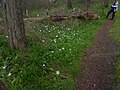
Bellhouse Provincial Park is a provincial park in the southern Gulf Islands of British Columbia, Canada. It is located in the Sturdies Bay area of southeastern Galiano Island. It is on land donated by Thorney Bellhouse in 1964, and is noted for its spring wildflowers, notably fawn lilies and chocolate lilies, as well as views of snow-capped mountains and abundant marine life.
Gallery
-
-

-
 Mount Baker
 -

-
 Spring Mushrooms
 -
 Sandstone formations
 -
 Armeria maritima
 -
 Claytonia perfoliata
 -
 Amelanchier alnifolia
 -
 Camas Meadow
 -
 Quamassia camash


External links
48°52′20″N 123°18′37″W / 48.87222°N 123.31028°W
|
| This British Columbia protected areas related article is a stub. You can help Wikipedia by expanding it. |