| Klewnuggit Inlet Marine Provincial Park | |
|---|---|
 Klewnuggit Inlet Marine Park | |
_location_map.svg) | |
| Location | British Columbia, Canada |
| Nearest city | Prince Rupert, BC |
| Coordinates | 53°41′09″N 129°42′06″W / 53.6858°N 129.7018°W |
| Area | 1,800 hectares (4,400 acres) |
| Established | 14 June 1993 |
| Governing body | BC Parks |
| Website | Official website |
Klewnuggit Inlet Marine Provincial Park is a provincial park in British Columbia, Canada, located on the east side of Grenville Channel, 100 kilometres (62 mi) southeast of Prince Rupert, in the Range 4 Coast Land District. [2]
The park was established on 14 June 1993, surrounds the inlet and Freda Lake, and covers 1,800 hectares (4,400 acres), including 1,508 hectares (3,730 acres) of upland and 292 hectares (720 acres) of foreshore. [3] [4]
Images
Wikimedia Commons has media related to
Klewnuggit Inlet Marine Provincial Park.
-
 Flock of Barrow's goldeneyes foraging
 -
 Curious Harbour Seals
 -
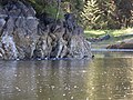
 Brodie Lake falls into the inlet
 -


References
- ^ "Klewnuggit Inlet Marine Park". Protected Planet. Retrieved 2020-09-15.
- ^ "Klewnuggit Inlet Marine Park". BC Geographical Names.
- ^ "Klewnuggit Inlet Marine Provincial Park". BC Parks. Retrieved 3 August 2014.
- ^ "Management Direction Statement" (PDF). BC Parks. March 2003. Archived from the original (PDF) on 3 January 2016. Retrieved 3 August 2014.
|
| This British Columbia protected areas related article is a stub. You can help Wikipedia by expanding it. |