
The following sortable table comprises the 477 mountain peaks of the United States with at least 3,000 m (9,843 ft) of topographic elevation and at least 500 m (1,640 ft) of topographic prominence. [1]
The summit of a mountain or hill may be measured in three principal ways:
- The topographic elevation of a summit measures the height of the summit above a geodetic sea level. [2] [3]
- The topographic prominence of a summit is a measure of how high the summit rises above its surroundings. [4] [3]
- The topographic isolation (or radius of dominance) of a summit measures how far the summit lies from its nearest point of equal elevation. [5]
In the United States, only Denali exceeds 6000 meters (19,685 feet) elevation. Four major summits exceed 5000 meters (16,404 feet), nine exceed 4500 meters (14,764 feet), 104 exceed 4000 meters (13,123 feet), 246 exceed 3500 meters (11,483 feet), and the following 477 major summits exceed 3000 meters (9843 feet) elevation.
Major 3000-meter summits
A total of 477 mountain summits in the United States meet both criteria for the definition of "major summit" used here: at least 3,000 metres (9,843 ft) of topographic elevation and at least 500 metres (1,640 ft) of topographic prominence. Of these 477 summits, 117 are located in Colorado, 67 in Alaska, 51 in California, 43 in Wyoming, 42 in Montana, 40 in Utah, 38 in Nevada, 36 in Idaho, 26 in New Mexico, five in Arizona, five in Oregon, four in Washington, and three in Hawaiʻi. Five of these summits are located on the international border between Alaska and the Yukon, and three are located on the international border between Alaska and British Columbia. The ten highest major summits of the United States are all located in Alaska.
The northernmost summit with at least 3000 metres elevation and 500 metres prominence is Hess Mountain in central Alaska; the southernmost is Mauna Loa on the Island of Hawaii; the westernmost is Haleakalā on the Island of Maui; and the easternmost is East Spanish Peak in south-central Colorado. In the contiguous United States (i.e. excluding Alaska and Hawaii), the northernmost, southernmost, westernmost, and easternmost major summits are Kintla Peak in Montana, Mount Graham in Arizona, Mount Shasta in California, and East Spanish Peak in Colorado, respectively.
Gallery
-
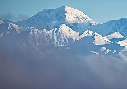
 1. Denali in Alaska is the highest summit of the United States and all of North America.
 -
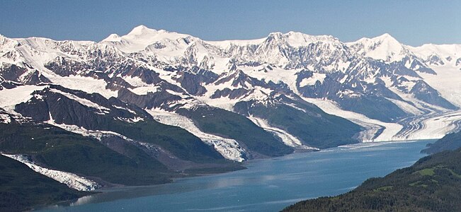
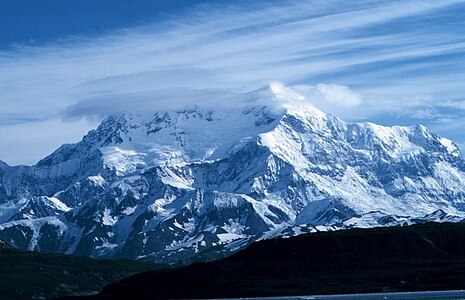 2. Mount Saint Elias is the second highest summit of both Canada and the United States.
 -
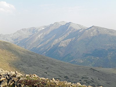
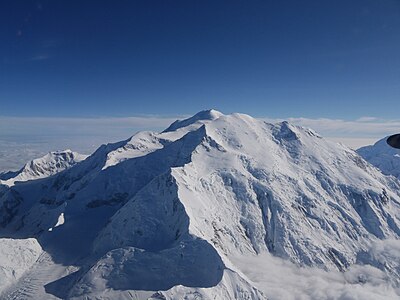 3. Mount Foraker is the second highest major summit of the Alaska Range.
 -
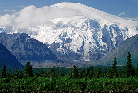
 4. Mount Bona in Alaska is the highest volcano in the United States.
 -
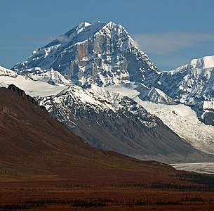
 5. Mount Blackburn in Alaska is the highest summit of the Wrangell Mountains.
 -
 6. Mount Sanford in Alaska is the third highest volcano in the United States.
 -
 7. Mount Fairweather lies on the Alaska-British Columbia international border.
 -
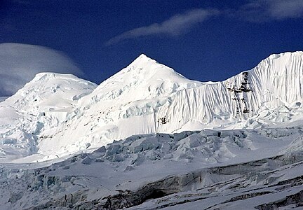
 10. Mount Hunter is the third highest major summit of the Alaska Range.
 -
 11. Mount Whitney highest summit of the Sierra Nevada and California.
 -
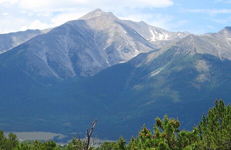
 14. Mount Elbert is the highest summit of Colorado and the Rocky Mountains.
 -
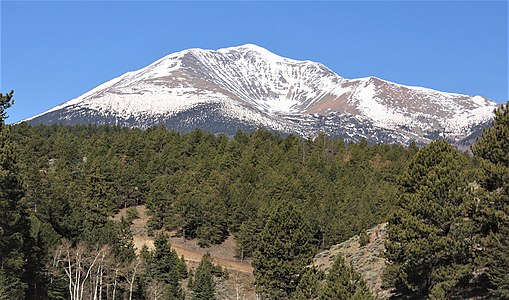
 15. Mount Massive is the second-highest summit of Colorado and the Rocky Mountains.
 -
 17. Mount Rainier is the highest summit of Washington and the Cascade Range.
 -
 18. Mount Williamson is the second-highest summit of the Sierra Nevada and the state of California.
 -
 19. Blanca Peak in Colorado is the highest summit of the Sangre de Cristo Mountains and is higher than any point in the United States east of its longitude.
 -
 20. La Plata Peak is the fifth-highest summit of Colorado and the Rocky Mountains.
 -
 21. Uncompahgre Peak is the highest summit of the San Juan Mountains and the sixth-highest in Colorado.
 -
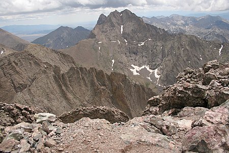 22. Crestone Peak
 -
 23. Mount Lincoln is the highest summit of Colorado's Mosquito Range and of the entire Missouri River drainage basin.
 -
 24. Castle Peak is the highest summit of Colorado's Elk Mountains.
 -
 25. Grays Peak in Colorado is the highest point on the Continental Divide in North America.
 -
 30. The summit of White Mountain Peak is the highest point in California's White Mountains and the third-highest point in the state of California.
 -
 32. Mount Princeton in Colorado's Sawatch Range
 -
 34. Mount Shasta in California is the highest summit of the southern Cascade Range.
 -
 38. Capitol Peak in Colorado's Elk Mountains
 -
 39. Pikes Peak in Colorado was the inspiration for America the Beautiful.
 -
 44. The summit of San Luis Peak is the highest point in Colorado's La Garita Mountains.
 -
 49. Mount Ouray
 -
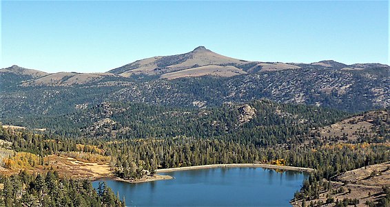
 50. Vermilion Peak
 -
 52. Regal Mountain is the 16th highest major summit in Alaska.
 -
 54. Mount Hayes is the highest summit of the eastern Alaska Range.
 -
 57. Gannett Peak is the highest summit of the Wind River Range and Wyoming.
 -
 59. Mauna Kea on the Island of Hawaiʻi is the tallest mountain on Earth as measured from base to summit.
 -
 60. Grand Teton in Wyoming is the highest summit of the Teton Range.
 -
 62. Mount Morgan
 -
 66. Mauna Loa on the Island of Hawaiʻi is the most voluminous mountain on Earth.
 -
 70. The summit of West Spanish Peak is the highest point in Las Animas County, Colorado.
 -
 76. Kings Peak is the highest summit of the Uinta Range and Utah.
 -
 81. Parry Peak in Colorado's Front Range
 -
 90. Henry Mountain in Gunnison County, Colorado
 -
 96. Conejos Peak is the highest summit of Conejos County in the state of Colorado.
 -
 97. Mount Marcus Baker is the highest summit of Alaska's Chugach Mountains and the eighth most prominent summit in the United States.
 -
 99. Wheeler Peak is the highest summit of New Mexico.
 -
 104. Red Slate Mountain in California's Sierra Nevada
 -
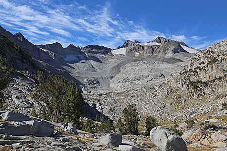 105. The summit of Mount Lyell is the highest point in Yosemite National Park.
 -
 111. Mount Moffit in the Alaska Range
 -
 118. Granite Peak is the highest summit of the Beartooth Range and Montana.
 -
 122. Mount Peale is the highest summit of Utah's La Sal Mountains.
 -
 127. Borah Peak is the highest summit of the Lost River Range and Idaho.
 -
 130. Mount Conness in California's Sierra Nevada
 -
 131. Humphreys Peak is the highest summit of the San Francisco Peaks and Arizona.
 -
 133. Gothic Mountain in Colorado's Elk Mountains
 -
 136. Mount Moran in Wyoming's Teton Range
 -
 142. Whetstone Mountain in Colorado's West Elk Mountains
 -
-
 157. The summit of Greenhorn Mountain is the highest point in Colorado's Wet Mountains.
 -
 159. Mount Deborah in the eastern Alaska Range
 -
 160. Mount Warren in Mono County, California
 -
 168. Mount Huntington in the central Alaska Range
 -
 171. Diamond Peak is the highest summit of Idaho's Lemhi Range.
 -
 177. Crested Butte
 -
 184. Ibapah Peak is the highest summit of Utah's Deep Creek Range.
 -
 185. Carbon Peak in Gunnison County, Colorado
 -
 193. The summit of Hyndman Peak is the highest point in Idaho's Pioneer Mountains.
 -
 196. Mount Drum in Alaska's Wrangell Mountains
 -
 206. Mount Nebo is the highest summit of Utah's Wasatch Range.
 -
 217. Castle Peak is the highest summit of Idaho's White Cloud Mountains.
 -
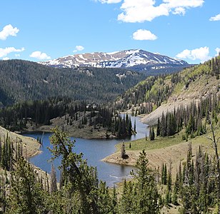
 226. Pilot Peak is near the northeast corner of Yellowstone National Park in Wyoming.
 -
 249. Tomichi Dome in Gunnison County, Colorado
 -
 260. Ruby Dome is the highest summit of Nevada's Ruby Mountains.
 -
 261. The summit of Eagle Peak is the highest point in Yellowstone National Park.
 -
 272. Hole in the Mountain Peak is the highest summit of Nevada's East Humboldt Range.
 -
 284. Mount Hood is the highest summit of Oregon.
 -
 308. Telescope Peak is the highest summit of California's Panamint Range and Death Valley National Park.
 -
 336. Mount Hoffmann in California's Yosemite National Park
 -
 349. The summit of Thompson Peak is the highest point in Idaho's Sawtooth Range.
 -
 358. Saddle Mountain in Wyoming's Yellowstone National Park
 -
 373. Glacier Peak is one of five major stratovolcanoes in the state of Washington.
 -
 376. Mount Jefferson is the second-highest summit in Oregon.
 -
 387. Round Top is the 16th most prominent summit in the state of California.
 -
 398. The Moose's Tooth in Alaska's Denali National Park
 -
 422. Redoubt Volcano is the highest summit of the Aleutian Range.
 -
 424. Mount Regan in Idaho's Sawtooth Range
 -
 430. The summit of Trapper Peak is the highest point in Montana's Bitterroot Mountains.
 -
 444. Hawkins Peak in Alpine County, California
 -
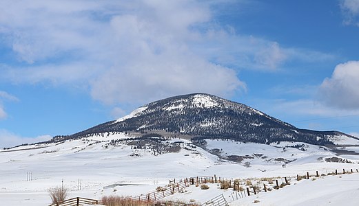
 454. Ute Peak on the Ute Mountain Ute Tribe Reservation in southwest Colorado
 -


.jpg)


.jpg)


.jpg)


_6.1_miles_north_of_the_southern_terminus_in_Clover_Valley,_Nevada-cropped.jpg)


.jpg)


See also
-
List of mountain peaks of North America
- List of mountain peaks of Greenland
- List of mountain peaks of Canada
- List of mountain peaks of the Rocky Mountains
-
List of mountain peaks of the United States
- List of the highest major summits of the United States
- List of the major 4000-meter summits of the United States
- List of the major 3000-meter summits of the United States
- List of United States fourteeners
- List of the most prominent summits of the United States
- List of the most isolated major summits of the United States
- List of extreme summits of the United States
- List of mountain peaks of Alaska
- List of mountain peaks of California
- List of mountain peaks of Colorado
- List of mountain peaks of Hawaiʻi
- List of mountain peaks of Montana
- List of mountain peaks of Nevada
- List of mountain peaks of Utah
- List of mountain peaks of Washington (state)
- List of mountain peaks of Wyoming
- List of the highest major summits of the United States
- List of mountain peaks of México
- List of mountain peaks of Central America
- List of mountain peaks of the Caribbean
- United States of America
- Physical geography
Notes
- ^ The summit of Denali is the highest point of the Alaska Range, the State of Alaska, the United States of America, and greater North America. Denali is the third most topographically prominent and third most topographically isolated summit on Earth after Mount Everest and Aconcagua.
- ^ Mount Saint Elias is the second-highest major summit of both Canada and the United States.
- ^ Mount Foraker is the westernmost 5000-meter (16,404-foot) summit of Alaska, the United States, and greater North America.
- ^ The summit of Mount Bona is the highest point of the northwest Saint Elias Mountains.
- ^ The summit of Mount Blackburn is the highest point of the Wrangell Mountains.
- ^ Mount Fairweather lies on the international border between Alaska and British Columbia. The peak is the highest point of the Canadian Province of British Columbia and the southernmost and easternmost summit of its elevation in both Canada and the United States.
- ^ The summit of Mount Whitney is the highest point of the Sierra Nevada, the State of California, and the contiguous United States.
- ^ Mount Whitney is the southernmost and easternmost summit of its elevation in the United States.
- ^ The summit of Mount Elbert is the highest point of the U.S. State of Colorado, the Rocky Mountains of North America, and the entire Mississippi River drainage basin.
- ^ Mount Massive is the second highest major summit of the Rocky Mountains.
- ^ The elevation of Mount Massive includes an adjustment of +2.087 m (6.85 ft) from NGVD 29 to NAVD 88.
- ^ The summit of Mount Harvard is the highest point of the Collegiate Peaks.
- ^ Mount Harvard is the southernmost and easternmost summit of its elevation in the Rocky Mountains.
- ^ The summit of Mount Rainier is the highest point of the Cascade Range and the U.S. State of Washington. Mount Rainier is the most prominent summit in the contiguous United States and the fourth most prominent in North America.
- ^ The elevation of Mount Rainier includes an adjustment of +1.914 m (6.28 ft) from NGVD 29 to NAVD 88.
- ^ The elevation of Mount Williamson includes an adjustment of +1.807 m (5.93 ft) from NGVD 29 to NAVD 88.
- ^ The summit of Blanca Peak is the highest point of the Sangre de Cristo Mountains and the entire Rio Grande drainage basin.
- ^ Blanca Peak is the southernmost ultra-prominent summit of the Rocky Mountains.
- ^ The elevation of Blanca Peak includes an adjustment of +1.755 m (5.76 ft) from NGVD 29 to NAVD 88.
- ^ The elevation of La Plata Peak includes an adjustment of +1.983 m (6.51 ft) from NGVD 29 to NAVD 88.
- ^ The summit of Uncompahgre Peak is the highest point of the San Juan Mountains and the entire Gulf of California drainage basin.
- ^ Uncompahgre Peak is the westernmost summit of its elevation in the Rocky Mountains.
- ^ The summit of Crestone Peak is the highest point of the Crestones.
- ^ The elevation of Crestone Peak includes an adjustment of +1.76 m (5.77 ft) from NGVD 29 to NAVD 88.
- ^ The summit of Mount Lincoln is the highest point of the Mosquito Range and the entire Missouri River drainage basin.
- ^ Mount Lincoln is the northernmost summit of its elevation in the Rocky Mountains.
- ^ The summit of Castle Peak is the highest point of the Elk Mountains.
- ^ The summit of Grays Peak is the highest point of the Front Range and the Continental Divide in North America.
- ^ Grays Peak is the northernmost summit of its elevation in the Rocky Mountains.
- ^ The summit of Mount Antero is the highest point of the southern Sawatch Range.
- ^ The summit elevation of Mount Blue Sky includes a vertical offset of +1.798 m (5.9 ft) from the station benchmark.
- ^ The summit of Longs Peak is the highest point of the northern Front Range.
- ^ Longs Peak is the northernmost 14,000-foot (4267-meter) summit of the Rocky Mountains.
- ^ The summit of Mount Wilson is the highest point of the San Miguel Mountains.
- ^ Mount Wilson is the westernmost summit of its elevation in the Rocky Mountains.
- ^ The elevation of Mount Wilson includes an adjustment of +1.899 m (6.23 ft) from NGVD 29 to NAVD 88.
- ^ The summit of White Mountain Peak is the highest point of the White Mountains.
- ^ The summit of North Palisade is the highest point of the Palisades.
- ^ The elevation of North Palisade includes an adjustment of +1.867 m (6.13 ft) from NGVD 29 to NAVD 88.
- ^ The summit of Mount Shasta is the highest point of the southern Cascade Range.
- ^ The summit of Mount Sneffels is the highest point of the Sneffels Range.
- ^ The elevation of Capitol Peak includes an adjustment of +1.991 m (6.53 ft) from NGVD 29 to NAVD 88.
- ^ Pikes Peak is the easternmost 14,000-foot (4267-meter) summit and ultra-prominent summit of the Rocky Mountains. Pikes Peak was the inspiration for the lyrics of America the Beautiful.
- ^ The summit of Windom Peak is the highest point of the Needle Mountains.
- ^ Mount Eolus may be higher than Windom Peak.
- ^ The elevation of Windom Peak includes an adjustment of +1.785 m (5.86 ft) from NGVD 29 to NAVD 88.
- ^ The summit of Culebra Peak is the highest point of the Culebra Range.
- ^ Culebra Peak is the southernmost 14,000-foot (4267-meter) summit of the Rocky Mountains.
- ^ The elevation of Culebra Peak includes an adjustment of +1.74 m (5.71 ft) from NGVD 29 to NAVD 88.
- ^ The summit of Mount of the Holy Cross is the highest point of the northern Sawatch Range.
- ^ The summit elevation of Mount of the Holy Cross includes a vertical offset of +0.61 m (2 ft) from the station benchmark.
- ^ The elevation of Mount Humphreys includes an adjustment of +1.842 m (6.04 ft) from NGVD 29 to NAVD 88.
- ^ The elevation of Mount Keith includes an adjustment of +1.795 m (5.89 ft) from NGVD 29 to NAVD 88.
- ^ The summit of Mount Ouray is the highest point of the far southern Sawatch Range.
- ^ The elevation of Vermilion Peak includes an adjustment of +1.827 m (5.99 ft) from NGVD 29 to NAVD 88.
- ^ The elevation of Mount Darwin includes an adjustment of +1.886 m (6.19 ft) from NGVD 29 to NAVD 88.
- ^ The summit of Mount Hayes is the highest point of the Hayes Range.
- ^ Mount Hayes is the northernmost 4000-meter (13,123-foot) summit of Alaska, the United States, and greater North America.
- ^ The summit of Gannett Peak is the highest point of the Wind River Range, the U.S. State of Wyoming, and the central Rocky Mountains.
- ^ Gannett Peak is the northernmost and westernmost summit of its elevation in the Rocky Mountains.
- ^ The summit of Mount Kaweah is the highest point of the Great Western Divide.
- ^ Mount Kaweah is the southernmost summit of its elevation in United States.
- ^ The elevation of Mount Kaweah includes an adjustment of +1.652 m (5.42 ft) from NGVD 29 to NAVD 88.
- ^ The summit of Mauna Kea is the highest point of the Island of Hawaiʻi, the U.S. State of Hawaiʻi, and all islands of the Pacific Ocean.
- ^ Mauna Kea is the tallest mountain on Earth as measured from base to summit. The shield volcano sits on the ocean floor at a depth of 5998 meters (19,678 feet) for a total height of 10,205.3 meters (33,482 feet).
- ^ The summit of Grand Teton is the highest point of the Teton Range.
- ^ Grand Teton is the northernmost and westernmost 4000-meter (13,123-foot) summit of the Rocky Mountains.
- ^ The elevation of Mount Gabb includes an adjustment of +1.958 m (6.42 ft) from NGVD 29 to NAVD 88.
- ^ The elevation of Bald Mountain includes an adjustment of +1.922 m (6.31 ft) from NGVD 29 to NAVD 88.
- ^ The elevation of Mount Oso includes an adjustment of +1.776 m (5.83 ft) from NGVD 29 to NAVD 88.
- ^ Mauna Loa is the southernmost and westernmost 4000-meter (13,123-foot) summit of Hawaiʻi and the United States.
- ^ The shield volcano Mauna Loa is the most voluminous mountain on Earth with an estimated volume of 74,000 km3 (17,800 cubic miles), or enough material to fill the Grand Canyon more than 18 times.
- ^ The elevation of Mount Tom includes an adjustment of +1.379 m (4.52 ft) from NGVD 29 to NAVD 88.
- ^ The elevation of Bard Peak includes an adjustment of +1.707 m (5.6 ft) from NGVD 29 to NAVD 88.
- ^ West Spanish Peak is the easternmost 4000-meter (13,123-foot) summit of the Rocky Mountains and the United States.
- ^ The elevation of West Spanish Peak includes an adjustment of +1.468 m (4.82 ft) from NGVD 29 to NAVD 88.
- ^ The summit of Mount Powell is the highest point of the Gore Range.
- ^ The elevation of Mount Powell includes an adjustment of +1.771 m (5.81 ft) from NGVD 29 to NAVD 88.
- ^ The summit of Hagues Peak is the highest point of the Mummy Range.
- ^ The elevation of Mount Dubois includes an adjustment of +1.879 m (6.16 ft) from NGVD 29 to NAVD 88.
- ^ The elevation of Tower Mountain includes an adjustment of +1.796 m (5.89 ft) from NGVD 29 to NAVD 88.
- ^ The elevation of Treasure Mountain includes an adjustment of +2.008 m (6.59 ft) from NGVD 29 to NAVD 88.
- ^ The summit of Kings Peak is the highest point of the Uinta Mountains, the U.S. State of Utah, and the western Rocky Mountains.
- ^ The elevation of Kings Peak includes an adjustment of +1.807 m (5.93 ft) from NGVD 29 to NAVD 88.
- ^ The summit of North Arapaho Peak is the highest point of the Indian Peaks.
- ^ The elevation of North Arapaho Peak includes an adjustment of +1.763 m (5.78 ft) from NGVD 29 to NAVD 88.
- ^ The elevation of Mount Pinchot includes an adjustment of +1.81 m (5.94 ft) from NGVD 29 to NAVD 88.
- ^ The elevation of Parry Peak includes an adjustment of +1.763 m (5.78 ft) from NGVD 29 to NAVD 88.
- ^ The summit of Bill Williams Peak is the highest point of the Williams Mountains.
- ^ The elevation of Bill Williams Peak includes an adjustment of +2.044 m (6.71 ft) from NGVD 29 to NAVD 88.
- ^ The elevation of Sultan Mountain includes an adjustment of +1.649 m (5.41 ft) from NGVD 29 to NAVD 88.
- ^ The elevation of Mount Herard includes an adjustment of +1.64 m (5.38 ft) from NGVD 29 to NAVD 88.
- ^ The elevation of West Buffalo Peak includes an adjustment of +1.834 m (6.02 ft) from NGVD 29 to NAVD 88.
- ^ The summit of Summit Peak is the highest point of the southern San Juan Mountains.
- ^ Dolores Peak may be higher than Middle Peak.
- ^ The elevation of Middle Peak includes an adjustment of +1.809 m (5.94 ft) from NGVD 29 to NAVD 88.
- ^ The elevation of Antora Peak includes an adjustment of +1.883 m (6.18 ft) from NGVD 29 to NAVD 88.
- ^ The elevation of Henry Mountain includes an adjustment of +2.037 m (6.68 ft) from NGVD 29 to NAVD 88.
- ^ The summit of Hesperus Mountain is the highest point of the La Plata Mountains.
- ^ The elevation of Hesperus Mountain includes an adjustment of +1.65 m (5.41 ft) from NGVD 29 to NAVD 88.
- ^ The elevation of Jacque Peak includes an adjustment of +1.866 m (6.12 ft) from NGVD 29 to NAVD 88.
- ^ The elevation of Bennett Peak includes an adjustment of +1.782 m (5.85 ft) from NGVD 29 to NAVD 88.
- ^ The summit of Wind River Peak is the highest point of the southern Wind River Range.
- ^ The summit of Mount Marcus Baker is the highest point of the Chugach Mountains.
- ^ The summit of Cloud Peak is the highest point of the Bighorn Mountains.
- ^ Cloud Peak is the northernmost 4000-meter (13,123-foot) summit of the Rocky Mountains.
- ^ The summit of Wheeler Peak is the highest point of the Taos Mountains and the U.S. State of New Mexico.
- ^ Wheeler Peak is the southernmost 4000-meter (13,123-foot) summit of the Rocky Mountains.
- ^ The summit of Francs Peak is the highest point of the Absaroka Range.
- ^ The summit of Twilight Peak is the highest point of the West Needle Mountains.
- ^ The elevation of Twilight Peak includes an adjustment of +1.537 m (5.04 ft) from NGVD 29 to NAVD 88.
- ^ The summit of Mount Ritter is the highest point of the Ritter Range.
- ^ The elevation of Mount Ritter includes an adjustment of +1.786 m (5.86 ft) from NGVD 29 to NAVD 88.
- ^ The elevation of Red Slate Mountain includes an adjustment of +1.893 m (6.21 ft) from NGVD 29 to NAVD 88.
- ^ The summit of Truchas Peak is the highest point of the Santa Fe Mountains.
- ^ Truchas Peak is the southernmost summit of its elevation in the Rocky Mountains.
- ^ The summit of Wheeler Peak is the highest point of the Snake Range.
- ^ The summit of West Elk Peak is the highest point of the West Elk Mountains.
- ^ The elevation of Mount Centennial includes an adjustment of +1.814 m (5.95 ft) from NGVD 29 to NAVD 88.
- ^ The summit of Clark Peak is the highest point of the Medicine Bow Mountains.
- ^ The summit of Mount Richthofen is the highest point of the Never Summer Mountains.
- ^ The elevation of Mount Richthofen includes an adjustment of +1.658 m (5.44 ft) from NGVD 29 to NAVD 88.
- ^ The summit of Lizard Head Peak is the highest point of the Cirque of the Towers.
- ^ The elevation of Lizard Head Peak includes an adjustment of +1.572 m (5.16 ft) from NGVD 29 to NAVD 88.
- ^ The summit of Granite Peak is the highest point of the Beartooth Mountains and the U.S. State of Montana.
- ^ The elevation of Venado Peak includes an adjustment of +1.65 m (5.41 ft) from NGVD 29 to NAVD 88.
- ^ The summit of Mount Peale is the highest point of the La Sal Mountains and the Colorado Plateau.
- ^ East Spanish Peak is the easternmost 3000-meter (9843-foot) summit of the Rocky Mountains and the entire United States.
- ^ The elevation of East Spanish Peak includes an adjustment of +1.372 m (4.5 ft) from NGVD 29 to NAVD 88.
- ^ The summit of Borah Peak is the highest point of the Lost River Range and the U.S. State of Idaho.
- ^ The summit of Mount Wood is the highest point of the Granite Range.
- ^ The elevation of Mount Wood includes an adjustment of +1.516 m (4.97 ft) from NGVD 29 to NAVD 88.
- ^ The summit of Humphreys Peak is the highest point of the San Francisco Peaks and the U.S. State of Arizona.
- ^ The elevation of Humphreys Peak includes an adjustment of +1.345 m (4.41 ft) from NGVD 29 to NAVD 88.
- ^ Santa Fe Baldy is the southernmost 3000-meter (9843-foot) summit of the Rocky Mountains.
- ^ The elevation of Gothic Mountain includes an adjustment of +1.936 m (6.35 ft) from NGVD 29 to NAVD 88.
- ^ The elevation of Needham Mountain includes an adjustment of +1.602 m (5.26 ft) from NGVD 29 to NAVD 88.
- ^ The elevation of Atlantic Peak includes an adjustment of +1.521 m (4.99 ft) from NGVD 29 to NAVD 88.
- ^ The elevation of Specimen Mountain includes an adjustment of +1.614 m (5.3 ft) from NGVD 29 to NAVD 88.
- ^ The summit of Baldy Mountain is the highest point of the Cimarron Range.
- ^ The summit of Knobby Crest is the highest point of the Kenosha Mountains.
- ^ The elevation of Knobby Crest includes an adjustment of +1.595 m (5.23 ft) from NGVD 29 to NAVD 88.
- ^ The summit of Bison Peak is the highest point of the Tarryall Mountains.
- ^ The elevation of Matchless Mountain includes an adjustment of +1.941 m (6.37 ft) from NGVD 29 to NAVD 88.
- ^ The summit of Flat Top Mountain is the highest point of the Flat Tops.
- ^ The summit of Greenhorn Mountain is the highest point of the Wet Mountains.
- ^ The elevation of Elliott Mountain includes an adjustment of +1.709 m (5.61 ft) from NGVD 29 to NAVD 88.
- ^ Mount Deborah is the northernmost summit of its elevation in Alaska, the United States, and greater North America.
- ^ The elevation of Twin Peaks includes an adjustment of +1.717 m (5.63 ft) from NGVD 29 to NAVD 88.
- ^ The summit of Parkview Mountain is the highest point of the Rabbit Ears Range.
- ^ The elevation of Cornwall Mountain includes an adjustment of +1.715 m (5.63 ft) from NGVD 29 to NAVD 88.
- ^ The summit of Trout Peak is the highest point of the central Absaroka Range.
- ^ The elevation of Leatherman Peak includes an adjustment of +1.61 m (5.28 ft) from NGVD 29 to NAVD 88.
- ^ The summit of Diamond Peak is the highest point of the Lemhi Range.
- ^ The summit of Mount Zirkel is the highest point of the Park Range.
- ^ The elevation of Mount Zirkel includes an adjustment of +1.632 m (5.35 ft) from NGVD 29 to NAVD 88.
- ^ The summit of Delano Peak is the highest point of the Tushar Mountains.
- ^ The elevation of Crested Butte includes an adjustment of +1.94 m (6.36 ft) from NGVD 29 to NAVD 88.
- ^ The summit of Olancha Peak is the highest point of the southern Sierra Nevada.
- ^ The elevation of Park Cone includes an adjustment of +1.873 m (6.15 ft) from NGVD 29 to NAVD 88.
- ^ The summit of Ibapah Peak is the highest point of the Deep Creek Range.
- ^ The elevation of Ibapah Peak includes an adjustment of +1.517 m (4.98 ft) from NGVD 29 to NAVD 88.
- ^ The elevation of Glover Peak includes an adjustment of +1.609 m (5.28 ft) from NGVD 29 to NAVD 88.
- ^ The summit of Medicine Bow Peak is the highest point of the Snowy Range.
- ^ The summit of Hyndman Peak is the highest point of the Pioneer Mountains.
- ^ The elevation of Mount Zwischen includes an adjustment of +1.481 m (4.86 ft) from NGVD 29 to NAVD 88.
- ^ The summit of Sierra Blanca Peak is the highest point of the Sacramento Mountains.
- ^ The elevation of Bald Mountain includes an adjustment of +1.59 m (5.22 ft) from NGVD 29 to NAVD 88.
- ^ The summit of Mount Jefferson is the highest point of the Toquima Range.
- ^ The elevation of Mount Jefferson includes an adjustment of +1.666 m (5.47 ft) from NGVD 29 to NAVD 88.
- ^ Hess Mountain is the northernmost 3000-meter (9843-foot) summit of Alaska and the United States.
- ^ The summit of Cerro Vista is the highest point of the southern Sangre de Cristo Range.
- ^ The summit of Mount Nebo is the highest point of the Wasatch Range.
- ^ The elevation of Mount Nebo includes an adjustment of +1.395 m (4.58 ft) from NGVD 29 to NAVD 88.
- ^ The summit of Charleston Peak is the highest point of the Spring Mountains.
- ^ The summit of North Schell Peak is the highest point of the Schell Creek Range.
- ^ The elevation of Huntsman Ridge includes an adjustment of +1.711 m (5.61 ft) from NGVD 29 to NAVD 88.
- ^ The elevation of South Mountain includes an adjustment of +1.437 m (4.71 ft) from NGVD 29 to NAVD 88.
- ^ The summit of Castle Peak is the highest point of the White Cloud Mountains.
- ^ The summit of Arc Dome is the highest point of the Toiyabe Range.
- ^ The elevation of Arc Dome includes an adjustment of +1.665 m (5.46 ft) from NGVD 29 to NAVD 88.
- ^ The summit of Mount Timpanogos is the highest point of the central Wasatch Range.
- ^ The summit of Doubletop Peak is the highest point of the Gros Ventre Range.
- ^ The elevation of Doubletop Peak includes an adjustment of +1.708 m (5.6 ft) from NGVD 29 to NAVD 88.
- ^ The summit of Ryan Peak is the highest point of the Boulder Mountains.
- ^ The summit of Waugh Mountain is the highest point of the South Park Hills.
- ^ The elevation of Waugh Mountain includes an adjustment of +1.702 m (5.58 ft) from NGVD 29 to NAVD 88.
- ^ The elevation of Coal Mountain includes an adjustment of +1.625 m (5.33 ft) from NGVD 29 to NAVD 88.
- ^ The summit of Mount Patterson is the highest point of the Sweetwater Range.
- ^ The elevation of Mount Patterson includes an adjustment of +1.734 m (5.69 ft) from NGVD 29 to NAVD 88.
- ^ Mount Russell is the westernmost summit of its elevation in Alaska and greater North America.
- ^ The elevation of Black Mountain includes an adjustment of +1.631 m (5.35 ft) from NGVD 29 to NAVD 88.
- ^ The summit of Fish Lake Hightop is the highest point of the Fish Lake Plateau.
- ^ The elevation of Glassford Peak includes an adjustment of +1.583 m (5.19 ft) from NGVD 29 to NAVD 88.
- ^ The summit elevation of San Joaquin Mountain includes a vertical offset of +0.61 m (2 ft) from the station benchmark.
- ^ The elevation of San Joaquin Mountain includes an adjustment of +1.7 m (5.58 ft) from NGVD 29 to NAVD 88.
- ^ The elevation of Puma Peak includes an adjustment of +1.513 m (4.96 ft) from NGVD 29 to NAVD 88.
- ^ The elevation of Mount Mestas includes an adjustment of +1.372 m (4.5 ft) from NGVD 29 to NAVD 88.
- ^ The elevation of Leavitt Peak includes an adjustment of +1.6 m (5.25 ft) from NGVD 29 to NAVD 88.
- ^ The summit of Chicoma Mountain is the highest point of the Jemez Mountains.
- ^ The elevation of Thirtynine Mile Mountain includes an adjustment of +1.584 m (5.2 ft) from NGVD 29 to NAVD 88.
- ^ The summit of Mount Ellen is the highest point of the Henry Mountains.
- ^ The elevation of Mount Ellen includes an adjustment of +1.486 m (4.88 ft) from NGVD 29 to NAVD 88.
- ^ The summit of Currant Mountain is the highest point of the White Pine Range.
- ^ The summit of San Gorgonio Mountain is the highest point of the San Bernardino Mountains.
- ^ The elevation of San Gorgonio Mountain includes an adjustment of +1.303 m (4.27 ft) from NGVD 29 to NAVD 88.
- ^ The elevation of Twin Peaks includes an adjustment of +1.463 m (4.8 ft) from NGVD 29 to NAVD 88.
- ^ The elevation of Tomichi Dome includes an adjustment of +1.693 m (5.55 ft) from NGVD 29 to NAVD 88.
- ^ The elevation of Sonora Peak includes an adjustment of +1.62 m (5.31 ft) from NGVD 29 to NAVD 88.
- ^ The summit of Blair Mountain is the highest point of the White River Plateau.
- ^ The elevation of Blair Mountain includes an adjustment of +1.565 m (5.13 ft) from NGVD 29 to NAVD 88.
- ^ The elevation of Twin Sisters Peaks includes an adjustment of +1.388 m (4.55 ft) from NGVD 29 to NAVD 88.
- ^ The summit of Wyoming Peak is the highest point of the Wyoming Range.
- ^ The elevation of Iron Mountain includes an adjustment of +1.436 m (4.71 ft) from NGVD 29 to NAVD 88.
- ^ The summit of Mount Torbert is the highest point of the Tordrillo Mountains.
- ^ Mount Torbert is the westernmost summit of its elevation in Alaska and greater North America.
- ^ The summit of Mount Baldy is the highest point of the White Mountains.
- ^ The summit of Scott Peak is the highest point of the Beaverhead Mountains.
- ^ The summit of Ruby Dome is the highest point of the Ruby Mountains.
- ^ The elevation of Ruby Dome includes an adjustment of +1.429 m (4.69 ft) from NGVD 29 to NAVD 88.
- ^ The elevation of Eagle Peak includes an adjustment of +1.42 m (4.66 ft) from NGVD 29 to NAVD 88.
- ^ The elevation of Toiyabe Dome includes an adjustment of +1.579 m (5.18 ft) from NGVD 29 to NAVD 88.
- ^ The summit of Abajo Peak is the highest point of the Abajo Mountains.
- ^ The elevation of Marcellina Mountain includes an adjustment of +1.658 m (5.44 ft) from NGVD 29 to NAVD 88.
- ^ The elevation of Bluebell Knoll includes an adjustment of +1.708 m (5.6 ft) from NGVD 29 to NAVD 88.
- ^ The summit of Crater Peak is the highest point of Grand Mesa.
- ^ The summit of Tumble Mountain is the highest point of the Lake Plateau.
- ^ The summit of Hilgard Peak is the highest point of the Madison Range.
- ^ The elevation of Hilgard Peak includes an adjustment of +1.49 m (4.89 ft) from NGVD 29 to NAVD 88.
- ^ The summit of Brian Head is the highest point of the Markagunt Plateau.
- ^ The elevation of Brian Head includes an adjustment of +1.556 m (5.1 ft) from NGVD 29 to NAVD 88.
- ^ The summit of Hole in the Mountain Peak is the highest point of the eastern Humboldt Range.
- ^ The elevation of Hole in the Mountain Peak includes an adjustment of +1.457 m (4.78 ft) from NGVD 29 to NAVD 88.
- ^ The summit of Mount Taylor is the highest point of the northern San Mateo Mountains.
- ^ The elevation of Castle Peak includes an adjustment of +1.575 m (5.17 ft) from NGVD 29 to NAVD 88.
- ^ The summit of Mount Grant is the highest point of the Wassuk Range.
- ^ The elevation of Mount Grant includes an adjustment of +1.456 m (4.78 ft) from NGVD 29 to NAVD 88.
- ^ The summit of Troy Peak is the highest point of the Grant Range.
- ^ The summit of South Tent Mountain is the highest point of the Wasatch Plateau.
- ^ The elevation of Mount Douglas includes an adjustment of +1.501 m (4.92 ft) from NGVD 29 to NAVD 88.
- ^ The summit of Shelly Mountain is the highest point of the White Knob Mountains.
- ^ The elevation of North Breccia Cliffs includes an adjustment of +1.529 m (5.02 ft) from NGVD 29 to NAVD 88.
- ^ The summit of Mount Hood is the highest point of the Oregon Cascades and the U.S. State of Oregon.
- ^ The summit of Monroe Peak is the highest point of the Sevier Plateau.
- ^ The elevation of Mount Cowen includes an adjustment of +1.469 m (4.82 ft) from NGVD 29 to NAVD 88.
- ^ The summit of Crazy Peak is the highest point of the Crazy Mountains.
- ^ The elevation of Crazy Peak includes an adjustment of +1.421 m (4.66 ft) from NGVD 29 to NAVD 88.
- ^ The elevation of Two Sisters includes an adjustment of +1.398 m (4.59 ft) from NGVD 29 to NAVD 88.
- ^ The elevation of Hardscrabble Mountain includes an adjustment of +1.612 m (5.29 ft) from NGVD 29 to NAVD 88.
- ^ The elevation of Lone Mountain includes an adjustment of +1.482 m (4.86 ft) from NGVD 29 to NAVD 88.
- ^ The summit of Tweedy Mountain is the highest point of the Pioneer Mountains.
- ^ The elevation of Tweedy Mountain includes an adjustment of +1.598 m (5.24 ft) from NGVD 29 to NAVD 88.
- ^ The elevation of Cochetopa Dome includes an adjustment of +1.804 m (5.92 ft) from NGVD 29 to NAVD 88.
- ^ The summit of Waucoba Mountain is the highest point of the Inyo Mountains.
- ^ The summit of Glass Mountain is the highest point of the Glass Mountain Ridge.
- ^ The elevation of Keynot Peak includes an adjustment of +1.347 m (4.42 ft) from NGVD 29 to NAVD 88.
- ^ The elevation of Aiken Peak includes an adjustment of +1.483 m (4.87 ft) from NGVD 29 to NAVD 88.
- ^ The elevation of South Lost River Range high point includes an adjustment of +1.466 m (4.81 ft) from NGVD 29 to NAVD 88.
- ^ The elevation of Provo Peak includes an adjustment of +1.31 m (4.3 ft) from NGVD 29 to NAVD 88.
- ^ The summit of Telescope Peak is the highest point of the Panamint Range.
- ^ The elevation of Mammoth Mountain includes an adjustment of +1.766 m (5.79 ft) from NGVD 29 to NAVD 88.
- ^ The summit of Deseret Peak is the highest point of the Stansbury Mountains.
- ^ The elevation of Laramie Mountains high point includes an adjustment of +1.415 m (4.64 ft) from NGVD 29 to NAVD 88.
- ^ The elevation of Gallatin Peak includes an adjustment of +1.52 m (4.99 ft) from NGVD 29 to NAVD 88.
- ^ The summit of Electric Peak is the highest point of the Gallatin Range.
- ^ The summit elevation of Highland Peak includes a vertical offset of +0.61 m (2 ft) from the station benchmark.
- ^ The summit of Ward Mountain is the highest point of the Egan Range.
- ^ The elevation of Rendezvous Peak includes an adjustment of +1.469 m (4.82 ft) from NGVD 29 to NAVD 88.
- ^ The elevation of Shoshone Mountain includes an adjustment of +1.521 m (4.99 ft) from NGVD 29 to NAVD 88.
- ^ The summit of Mount Fitzpatrick is the highest point of the Salt River Range.
- ^ The elevation of Mount Fitzpatrick includes an adjustment of +1.483 m (4.87 ft) from NGVD 29 to NAVD 88.
- ^ The summit of Whitewater Baldy is the highest point of the Mogollon Mountains.
- ^ The elevation of Whitewater Baldy includes an adjustment of +1.273 m (4.18 ft) from NGVD 29 to NAVD 88.
- ^ The summit of Table Mountain is the highest point of the Monitor Range.
- ^ The summit of Freel Peak is the highest point of the Carson Range.
- ^ The summit of Sand Mountain North is the highest point of the Elkhead Mountains.
- ^ The elevation of Sand Mountain North includes an adjustment of +1.502 m (4.93 ft) from NGVD 29 to NAVD 88.
- ^ The elevation of Sphinx Mountain includes an adjustment of +1.495 m (4.9 ft) from NGVD 29 to NAVD 88.
- ^ The elevation of Black Mountain includes an adjustment of +1.537 m (5.04 ft) from NGVD 29 to NAVD 88.
- ^ The elevation of Sleepy Cat Peak includes an adjustment of +1.471 m (4.83 ft) from NGVD 29 to NAVD 88.
- ^ The summit of Matterhorn is the highest point of the Jarbidge Mountains.
- ^ The elevation of Matterhorn includes an adjustment of +1.429 m (4.69 ft) from NGVD 29 to NAVD 88.
- ^ The summit of San Jacinto Peak is the highest point of the San Jacinto Mountains.
- ^ The summit of West Goat Peak is the highest point of the Anaconda Range.
- ^ The elevation of West Goat Peak includes an adjustment of +1.52 m (4.99 ft) from NGVD 29 to NAVD 88.
- ^ The summit of South Baldy is the highest point of the Magdalena Mountains.
- ^ The summit of Mount Baker is the highest point of the northern Cascade Range.
- ^ The elevation of Mount Baker includes an adjustment of +1.43 m (4.69 ft) from NGVD 29 to NAVD 88.
- ^ The elevation of Mount McDougal includes an adjustment of +1.499 m (4.92 ft) from NGVD 29 to NAVD 88.
- ^ The summit of Mount Rose is the highest point of the Carson Range.
- ^ The summit of Thompson Peak is the highest point of the Sawtooth Range.
- ^ The elevation of Rocky Peak includes an adjustment of +1.423 m (4.67 ft) from NGVD 29 to NAVD 88.
- ^ The summit of Mount Miller is the highest point of Barkley Ridge.
- ^ The elevation of Mount Hillers includes an adjustment of +1.364 m (4.48 ft) from NGVD 29 to NAVD 88.
- ^ The summit of Mount Graham is the highest point of the Pinaleño Mountains.
- ^ The summit of Pilot Peak is the highest point of the Pilot Range.
- ^ The elevation of Cutoff Mountain includes an adjustment of +1.31 m (4.3 ft) from NGVD 29 to NAVD 88.
- ^ The summit of Sandia Crest is the highest point of the Sandia Mountains.
- ^ The elevation of Sandia Crest includes an adjustment of +1.101 m (3.61 ft) from NGVD 29 to NAVD 88.
- ^ The elevation of Sage Peak includes an adjustment of +1.438 m (4.72 ft) from NGVD 29 to NAVD 88.
- ^ The elevation of Mount Evans includes an adjustment of +1.543 m (5.06 ft) from NGVD 29 to NAVD 88.
- ^ The summit of Diamond Peak is the highest point of the Diamond Mountains.
- ^ The summit of Homer Youngs Peak is the highest point of the West Big Hole Mountains.
- ^ The elevation of Homer Youngs Peak includes an adjustment of +1.483 m (4.87 ft) from NGVD 29 to NAVD 88.
- ^ The summit of Flat Top Mountain is the highest point of the Oquirrh Mountains.
- ^ The elevation of Flat Top Mountain includes an adjustment of +1.329 m (4.36 ft) from NGVD 29 to NAVD 88.
- ^ The elevation of San Pedro Peaks high point includes an adjustment of +1.306 m (4.28 ft) from NGVD 29 to NAVD 88.
- ^ The summit of South Sheep Mountain is the highest point of the Lionshead Mountains.
- ^ The elevation of South Sheep Mountain includes an adjustment of +1.431 m (4.69 ft) from NGVD 29 to NAVD 88.
- ^ The summit of Hollowtop Mountain is the highest point of the Tobacco Root Mountains.
- ^ The elevation of Hollowtop Mountain includes an adjustment of +1.486 m (4.88 ft) from NGVD 29 to NAVD 88.
- ^ The summit of Sunset Peak is the highest point of the Snowcrest Range.
- ^ The elevation of Sunset Peak includes an adjustment of +1.553 m (5.1 ft) from NGVD 29 to NAVD 88.
- ^ The elevation of Hogback Mountain includes an adjustment of +1.514 m (4.97 ft) from NGVD 29 to NAVD 88.
- ^ The elevation of The Thunderer includes an adjustment of +1.26 m (4.13 ft) from NGVD 29 to NAVD 88.
- ^ The summit of Black Butte is the highest point of the Gravelly Range.
- ^ The summit elevation of Black Butte includes a vertical offset of +1 m (3.3 ft) from the station benchmark.
- ^ The elevation of Glacier Peak includes an adjustment of +1.492 m (4.9 ft) from NGVD 29 to NAVD 88.
- ^ The summit of Cherry Creek Benchmark is the highest point of the Cherry Creek Range.
- ^ The summit of Mount Steller is the highest point of Waxell Ridge.
- ^ The elevation of Mount Jefferson includes an adjustment of +1.388 m (4.55 ft) from NGVD 29 to NAVD 88.
- ^ The summit of Mount Cleveland is the highest point of the Lewis Range.
- ^ The summit of White Mountain West is the highest point of the Salmon River Mountains.
- ^ The elevation of White Mountain West includes an adjustment of +1.567 m (5.14 ft) from NGVD 29 to NAVD 88.
- ^ The elevation of Barronette Peak includes an adjustment of +1.274 m (4.18 ft) from NGVD 29 to NAVD 88.
- ^ The summit of Bromaghin Peak South is the highest point of the Smoky Mountains.
- ^ The elevation of Bromaghin Peak South includes an adjustment of +1.525 m (5 ft) from NGVD 29 to NAVD 88.
- ^ The elevation of Sliderock Mountain includes an adjustment of +1.49 m (4.89 ft) from NGVD 29 to NAVD 88.
- ^ The summit of McAfee Peak is the highest point of the Independence Mountains.
- ^ The summit elevation of McAfee Peak includes a vertical offset of +0.03 m (0.1 ft) from the station benchmark.
- ^ The summit of Round Top is the highest point of Eldorado National Forest and the Mokelumne Wilderness.
- ^ The summit of Signal Peak is the highest point of the Pine Valley Mountains.
- ^ The elevation of Signal Peak includes an adjustment of +1.249 m (4.1 ft) from NGVD 29 to NAVD 88.
- ^ The summit of Mount Kimball is the highest point of the Delta Range.
- ^ The summit of Cache Peak is the highest point of the Albion Range.
- ^ The summit of Strawberry Peak is the highest point of the Roan Cliffs.
- ^ The summit of West Blue Mountain is the highest point of the San Mateo Mountains.
- ^ The elevation of West Blue Mountain includes an adjustment of +1.112 m (3.65 ft) from NGVD 29 to NAVD 88.
- ^ The elevation of Mount Chisholm includes an adjustment of +1.532 m (5.03 ft) from NGVD 29 to NAVD 88.
- ^ The summit of North Shoshone Peak is the highest point of the Shoshone Mountains.
- ^ The summit of Mount Sheridan is the highest point of the Red Mountains.
- ^ The elevation of Fan Mountain includes an adjustment of +1.42 m (4.66 ft) from NGVD 29 to NAVD 88.
- ^ The summit of Spruce Mountain is the highest point of the Pequop Mountains.
- ^ The elevation of Columbus Mountain includes an adjustment of +1.378 m (4.52 ft) from NGVD 29 to NAVD 88.
- ^ The summit of Morey Peak is the highest point of the Hot Creek Range.
- ^ The elevation of Alegres Mountain includes an adjustment of +1.078 m (3.54 ft) from NGVD 29 to NAVD 88.
- ^ The summit of Potato Peak is the highest point of the Bodie Mountains.
- ^ The summit elevation of Vienna Benchmark includes a vertical offset of +0.914 m (3 ft) from the station benchmark.
- ^ The summit of Table Mountain is the highest point of the Highland Mountains.
- ^ The elevation of Table Mountain includes an adjustment of +1.467 m (4.81 ft) from NGVD 29 to NAVD 88.
- ^ The summit of Mine Camp Peak is the highest point of the Pavant Range.
- ^ The elevation of Mine Camp Peak includes an adjustment of +1.418 m (4.65 ft) from NGVD 29 to NAVD 88.
- ^ The summit of Mount Jefferson is the highest point of the Centennial Mountains.
- ^ Mount Jefferson lies on the Continental Divide between Idaho and Montana.
- ^ The elevation of Capitan Mountains high point includes an adjustment of +0.963 m (3.16 ft) from NGVD 29 to NAVD 88.
- ^ The summit of Redoubt Volcano is the highest point of the Chigmit Mountains.
- ^ Redoubt Volcano is the westernmost summit of its elevation in Alaska and greater North America.
- ^ The elevation of Mount Regan includes an adjustment of +1.587 m (5.21 ft) from NGVD 29 to NAVD 88.
- ^ The elevation of Quinn Canyon Range high point includes an adjustment of +1.292 m (4.24 ft) from NGVD 29 to NAVD 88.
- ^ The summit of Mount Powell is the highest point of the Flint Creek Range.
- ^ The summit of McKnight Mountain is the highest point of the Black Range.
- ^ The elevation of McKnight Mountain includes an adjustment of +1.193 m (3.91 ft) from NGVD 29 to NAVD 88.
- ^ The summit of Trapper Peak is the highest point of the central Bitterroot Range.
- ^ The elevation of Trapper Peak includes an adjustment of +1.367 m (4.48 ft) from NGVD 29 to NAVD 88.
- ^ The summit of Kintla Peak is the highest point of the Livingston Range.
- ^ The elevation of Kintla Peak includes an adjustment of +1.413 m (4.64 ft) from NGVD 29 to NAVD 88.
- ^ The summit of Manzano Peak is the highest point of the Manzano Mountains.
- ^ The elevation of Ute Mountain includes an adjustment of +1.288 m (4.23 ft) from NGVD 29 to NAVD 88.
- ^ The summit of Smoky Dome is the highest point of the Soldier Mountains.
- ^ The summit of Mount McGuire is the highest point of the Bighorn Crags.
- ^ The summit of Ferris Mountain is the highest point of the Ferris Mountains.
- ^ The summit of Mount San Antonio is the highest point of the San Gabriel Mountains.
- ^ The elevation of Mount San Antonio includes an adjustment of +1.214 m (3.98 ft) from NGVD 29 to NAVD 88.
- ^ The elevation of Mount Jackson includes an adjustment of +1.425 m (4.68 ft) from NGVD 29 to NAVD 88.
- ^ The elevation of Becky Peak includes an adjustment of +1.306 m (4.28 ft) from NGVD 29 to NAVD 88.
- ^ The summit of Haleakalā is the highest point of the Island of Maui and the westernmost 3000 meter (9842.5-foot) summit of the United States.
- ^ The elevation of Mount Siyeh includes an adjustment of +1.435 m (4.71 ft) from NGVD 29 to NAVD 88.
- ^ Iliamna Volcano is the westernmost 3000-meter (9843-foot) summit of Alaska and greater North America.
- ^ The elevation of Mount Merritt includes an adjustment of +1.372 m (4.5 ft) from NGVD 29 to NAVD 88.
- ^ The summit of Salt Benchmark is the highest point of the San Pitch Mountains.
- ^ The elevation of Shay Mountain includes an adjustment of +1.249 m (4.1 ft) from NGVD 29 to NAVD 88.
- ^ The elevation of El Capitan includes an adjustment of +1.251 m (4.1 ft) from NGVD 29 to NAVD 88.
- ^ The summit of Ute Peak is the highest point of Ute Mountain.
- ^ The summit of Naomi Peak is the highest point of the Bear River Mountains.
- ^ The elevation of Peak 9980 includes an adjustment of +1.369 m (4.49 ft) from NGVD 29 to NAVD 88.
- ^ The summit of Desatoya Peak is the highest point of the Desatoya Mountains.
- ^ The summit of Mount Augusta is the highest point of the Clan Alpine Mountains.
- ^ The summit of Meade Peak is the highest point of the Preuss Range.
- ^ The elevation of Horse Mountain includes an adjustment of +1.461 m (4.79 ft) from NGVD 29 to NAVD 88.
- ^ The summit of Bull Mountain is the highest point of the Raft River Mountains.
- ^ The elevation of Bull Mountain includes an adjustment of +1.343 m (4.41 ft) from NGVD 29 to NAVD 88.
- ^ The summit of Hayford Peak is the highest point of the Sheep Range.
- ^ The elevation of Baldy Mountain includes an adjustment of +1.436 m (4.71 ft) from NGVD 29 to NAVD 88.
- ^ The elevation of Rainbow Peak includes an adjustment of +1.362 m (4.47 ft) from NGVD 29 to NAVD 88.
- ^ The summit of Eagle Peak is the highest point of the Warner Mountains.
- ^ The elevation of Dry Mountain includes an adjustment of +1.222 m (4.01 ft) from NGVD 29 to NAVD 88.
- ^ Taylor Mountain lies on the Continental Divide between Idaho and Montana.
- ^ The summit of Sacajawea Peak is the highest point of the Wallowa Mountains and the Columbia Plateau.
- ^ The elevation of Sacajawea Peak includes an adjustment of +1.56 m (5.12 ft) from NGVD 29 to NAVD 88.
References
- ^ This article defines a significant summit as a summit with at least 100 m (328.1 ft) of topographic prominence, and a major summit as a summit with at least 500 m (1,640 ft) of topographic prominence. All summits in this article have at least 500 meters of topographic prominence. An ultra-prominent summit is a summit with at least 1,500 m (4,921 ft) of topographic prominence.
- ^ All elevations in the 48 states of the contiguous United States include an elevation adjustment from the National Geodetic Vertical Datum of 1929 ( NGVD 29) to the North American Vertical Datum of 1988 ( NAVD 88). For further information, please see this United States National Geodetic Survey note.
- ^ a b If the elevation or prominence of a summit is calculated as a range of values, the arithmetic mean is shown.
- ^ The topographic prominence of a summit is the topographic elevation difference between the summit and its highest or key col to a higher summit. The summit may be near its key col or quite far away. The key col for Denali in Alaska is the Isthmus of Rivas in Nicaragua, 7642 kilometers (4749 miles) away.
- ^ The topographic isolation of a summit is the great-circle distance to its nearest point of equal elevation.
- ^ "MT BLACKBURN". Datasheet for NGS Station UV4136. U.S. National Geodetic Survey. Retrieved 4 May 2016.
- ^ "WHITNEY". Datasheet for NGS Station GT1811. U.S. National Geodetic Survey. Retrieved 4 May 2016.
- ^ "BOUNDARY POINT 180". Datasheet for NGS Station UV3032. U.S. National Geodetic Survey. Retrieved 4 May 2016.
- ^ "MOUNT ELBERT". Datasheet for NGS Station KL0637. U.S. National Geodetic Survey. Retrieved 4 May 2016.
- ^ "MOUNT MASSIVE CAIRN". Datasheet for NGS Station KL0640. U.S. National Geodetic Survey. Retrieved 4 May 2016.
- ^ "HARVARD". Datasheet for NGS Station JL0879. U.S. National Geodetic Survey. Retrieved 4 May 2016.
- ^ "UNCOMPAHGRE". Datasheet for NGS Station JL0798. U.S. National Geodetic Survey. Retrieved 4 May 2016.
- ^ "MT LINCOLN". Datasheet for NGS Station KL0627. U.S. National Geodetic Survey. Retrieved 4 May 2016.
- ^ "CASTLE PK". Datasheet for NGS Station KL0659. U.S. National Geodetic Survey. Retrieved 4 May 2016.
- ^ "GRAYS PEAK". Datasheet for NGS Station KK2036. U.S. National Geodetic Survey. Retrieved 4 May 2016.
- ^ "MT ANTERO". Datasheet for NGS Station JL0883. U.S. National Geodetic Survey. Retrieved 4 May 2016.
- ^ "EVANS". Datasheet for NGS Station KK2030. U.S. National Geodetic Survey. Retrieved 4 May 2016.
- ^ "LONGS PEAK". Datasheet for NGS Station LL1346. U.S. National Geodetic Survey. Retrieved 4 May 2016.
- ^ "WHITE MOUNTAIN PEAK". Datasheet for NGS Station HR2559. U.S. National Geodetic Survey. Retrieved 4 May 2016.
- ^ "NORTH PALISADE". Datasheet for NGS Station HR2629. U.S. National Geodetic Survey. Retrieved 4 May 2016.
- ^ "PRINCETON". Datasheet for NGS Station JL0886. U.S. National Geodetic Survey. Retrieved 4 May 2016.
- ^ "YALE". Datasheet for NGS Station JL0889. U.S. National Geodetic Survey. Retrieved 4 May 2016.
- ^ "MT SHASTA". Datasheet for NGS Station MX1016. U.S. National Geodetic Survey. Retrieved 4 May 2016.
- ^ "MAROON PEAK". Datasheet for NGS Station KL0805. U.S. National Geodetic Survey. Retrieved 4 May 2016.
- ^ "SNEFFLES". Datasheet for NGS Station JL0826. U.S. National Geodetic Survey. Retrieved 4 May 2016.
- ^ "CAPITOL PK". Datasheet for NGS Station KL0688. U.S. National Geodetic Survey. Retrieved 4 May 2016.
- ^ "PIKES PEAK". Datasheet for NGS Station JK1242. U.S. National Geodetic Survey. Retrieved 4 May 2016.
- ^ "HANDIES". Datasheet for NGS Station HL0635. U.S. National Geodetic Survey. Retrieved 4 May 2016.
- ^ "SAN LUIS PEAK CAIRN". Datasheet for NGS Station HL0570. U.S. National Geodetic Survey. Retrieved 4 May 2016.
- ^ "MT HOLY CROSS ET". Datasheet for NGS Station KL0649. U.S. National Geodetic Survey. Retrieved 4 May 2016.
- ^ "GRIZZLY". Datasheet for NGS Station KL0800. U.S. National Geodetic Survey. Retrieved 4 May 2016.
- ^ "MT HUMPHREYS". Datasheet for NGS Station HR2626. U.S. National Geodetic Survey. Retrieved 4 May 2016.
- ^ "MT KEITH". Datasheet for NGS Station GT1807. U.S. National Geodetic Survey. Retrieved 4 May 2016.
- ^ "MOUNT OURAY RESET". Datasheet for NGS Station JL0672. U.S. National Geodetic Survey. Retrieved 4 May 2016.
- ^ "REGAL MOUNTAIN". Datasheet for NGS Station UV4133. U.S. National Geodetic Survey. Retrieved 4 May 2016.
- ^ "MT DARWIN". Datasheet for NGS Station HR2631. U.S. National Geodetic Survey. Retrieved 4 May 2016.
- ^ "SILVERHEELS ET". Datasheet for NGS Station KL0629. U.S. National Geodetic Survey. Retrieved 4 May 2016.
- ^ "PYRAMID". Datasheet for NGS Station HL0589. U.S. National Geodetic Survey. Retrieved 4 May 2016.
- ^ "GANNETT PEAK CAIRN". Datasheet for NGS Station OW0356. U.S. National Geodetic Survey. Retrieved 4 May 2016.
- ^ "SUMMIT". Datasheet for NGS Station TU2314. U.S. National Geodetic Survey. Retrieved 4 May 2016.
- ^ "GRAND TETON". Datasheet for NGS Station OX0838. U.S. National Geodetic Survey. Retrieved 4 May 2016.
- ^ "MORGAN". Datasheet for NGS Station HR2627. U.S. National Geodetic Survey. Retrieved 4 May 2016.
- ^ "MT JACKSON ET". Datasheet for NGS Station KL0650. U.S. National Geodetic Survey. Retrieved 4 May 2016.
- ^ "MT TOM LOOKOUT TOWER". Datasheet for NGS Station HR2770. U.S. National Geodetic Survey. Retrieved 4 May 2016.
- ^ "HAGUE RM". Datasheet for NGS Station LL1350. U.S. National Geodetic Survey. Retrieved 4 May 2016.
- ^ "NORTH ARAPAHOE PEAK CAIRN". Datasheet for NGS Station LL1357. U.S. National Geodetic Survey. Retrieved 4 May 2016.
- ^ "BUFFALO WEST PEAK CAIRN". Datasheet for NGS Station JL0653. U.S. National Geodetic Survey. Retrieved 4 May 2016.
- ^ "SUMMIT". Datasheet for NGS Station HL0503. U.S. National Geodetic Survey. Retrieved 4 May 2016.
- ^ "WIND". Datasheet for NGS Station NS0274. U.S. National Geodetic Survey. Retrieved 4 May 2016.
- ^ "CONEJOS". Datasheet for NGS Station HL0502. U.S. National Geodetic Survey. Retrieved 4 May 2016.
- ^ "CLOUD PEAK". Datasheet for NGS Station PW0524. U.S. National Geodetic Survey. Retrieved 4 May 2016.
- ^ "WHEELER". Datasheet for NGS Station GM0779. U.S. National Geodetic Survey. Retrieved 4 May 2016.
- ^ "FRANCS PK 2". Datasheet for NGS Station OW0325. U.S. National Geodetic Survey. Retrieved 4 May 2016.
- ^ "S RIVER". Datasheet for NGS Station HL0558. U.S. National Geodetic Survey. Retrieved 4 May 2016.
- ^ "RED SLATE MOUNTAIN". Datasheet for NGS Station HR2690. U.S. National Geodetic Survey. Retrieved 4 May 2016.
- ^ "LYELL 2". Datasheet for NGS Station HR2884. U.S. National Geodetic Survey. Retrieved 4 May 2016.
- ^ "TWIN". Datasheet for NGS Station JK1305. U.S. National Geodetic Survey. Retrieved 4 May 2016.
- ^ "TRUCHAS". Datasheet for NGS Station FN0666. U.S. National Geodetic Survey. Retrieved 4 May 2016.
- ^ "WHEELER PEAK". Datasheet for NGS Station JP0339. U.S. National Geodetic Survey. Retrieved 4 May 2016.
- ^ "MOUNT DANA". Datasheet for NGS Station HR2738. U.S. National Geodetic Survey. Retrieved 4 May 2016.
- ^ "WEST ELK D". Datasheet for NGS Station JL0755. U.S. National Geodetic Survey. Retrieved 4 May 2016.
- ^ "CLARK". Datasheet for NGS Station LL1388. U.S. National Geodetic Survey. Retrieved 4 May 2016.
- ^ "GRANITE PEAK". Datasheet for NGS Station QW0616. U.S. National Geodetic Survey. Retrieved 4 May 2016.
- ^ "CHAIR D". Datasheet for NGS Station KL0696. U.S. National Geodetic Survey. Retrieved 4 May 2016.
- ^ "MOUNT PEALE". Datasheet for NGS Station JM0496. U.S. National Geodetic Survey. Retrieved 4 May 2016.
- ^ "GUNNISON D". Datasheet for NGS Station JL0762. U.S. National Geodetic Survey. Retrieved 4 May 2016.
- ^ "GOLD". Datasheet for NGS Station GM0854. U.S. National Geodetic Survey. Retrieved 3 September 2022.
- ^ "Gold Hill". Geographic Names Information System. United States Geological Survey, United States Department of the Interior.
- ^ "EAST SPANISH PEAK CAIRN". Datasheet for NGS Station HK0488. U.S. National Geodetic Survey. Retrieved 4 May 2016.
- ^ "BEAUTY RESET". Datasheet for NGS Station PZ0770. U.S. National Geodetic Survey. Retrieved 4 May 2016.
- ^ "MOUNT CONNESS". Datasheet for NGS Station HR2743. U.S. National Geodetic Survey. Retrieved 4 May 2016.
- ^ "SANTA FE BALDY". Datasheet for NGS Station FN0726. U.S. National Geodetic Survey. Retrieved 4 May 2016.
- ^ "PLATEAU". Datasheet for NGS Station QW0613. U.S. National Geodetic Survey. Retrieved 4 May 2016.
- ^ "LONE CONE". Datasheet for NGS Station HM0489. U.S. National Geodetic Survey. Retrieved 4 May 2016.
- ^ "MT MORAN ET". Datasheet for NGS Station OX0854. U.S. National Geodetic Survey. Retrieved 4 May 2016.
- ^ "CUERVO". Datasheet for NGS Station GM0770. U.S. National Geodetic Survey. Retrieved 4 May 2016.
- ^ "GRAHAM". Datasheet for NGS Station HL0620. U.S. National Geodetic Survey. Retrieved 4 May 2016.
- ^ "WHETSTONE MTN CAIRN". Datasheet for NGS Station JL0732. U.S. National Geodetic Survey. Retrieved 4 May 2016.
- ^ "BALDY MTN". Datasheet for NGS Station GM0775. U.S. National Geodetic Survey. Retrieved 4 May 2016.
- ^ "EAST BECKWITH". Datasheet for NGS Station JL0741. U.S. National Geodetic Survey. Retrieved 4 May 2016.
- ^ "BISON". Datasheet for NGS Station KK1966. U.S. National Geodetic Survey. Retrieved 4 May 2016.
- ^ "ANTHRACITE". Datasheet for NGS Station JL0739. U.S. National Geodetic Survey. Retrieved 4 May 2016.
- ^ "FLATTOP". Datasheet for NGS Station LM0694. U.S. National Geodetic Survey. Retrieved 4 May 2016.
- ^ "MT NYSTROM". Datasheet for NGS Station NS0271. U.S. National Geodetic Survey. Retrieved 4 May 2016.
- ^ "GREENHORN MTN". Datasheet for NGS Station HK0512. U.S. National Geodetic Survey. Retrieved 4 May 2016.
- ^ "CARTER". Datasheet for NGS Station PX0432. U.S. National Geodetic Survey. Retrieved 4 May 2016.
- ^ "MOUNT WAAS RESET". Datasheet for NGS Station JM0478. U.S. National Geodetic Survey. Retrieved 3 September 2022.
- ^ "Mount Waas". Geographic Names Information System. United States Geological Survey, United States Department of the Interior.
- ^ "PARKVIEW MOUNTAIN". Datasheet for NGS Station LM0574. U.S. National Geodetic Survey. Retrieved 4 May 2016.
- ^ "MOUNT ADAMS". Datasheet for NGS Station SB1004. U.S. National Geodetic Survey. Retrieved 4 May 2016.
- ^ "TROUT". Datasheet for NGS Station PX0457. U.S. National Geodetic Survey. Retrieved 4 May 2016.
- ^ "Leatherman Peak". Geographic Names Information System. United States Geological Survey, United States Department of the Interior.
- ^ "DIAMOND RESET". Datasheet for NGS Station PZ0750. U.S. National Geodetic Survey. Retrieved 4 May 2016.
- ^ "DELANO PEAK M 5". Datasheet for NGS Station JO0502. U.S. National Geodetic Survey. Retrieved 4 May 2016.
- ^ "YOUNTS". Datasheet for NGS Station OW0379. U.S. National Geodetic Survey. Retrieved 4 May 2016.
- ^ "SAWTOOTH". Datasheet for NGS Station JL0697. U.S. National Geodetic Survey. Retrieved 4 May 2016.
- ^ "OLANCHA". Datasheet for NGS Station GT1820. U.S. National Geodetic Survey. Retrieved 4 May 2016.
- ^ "Fortress Mountain". Geographic Names Information System. United States Geological Survey, United States Department of the Interior.
- ^ "CARBON". Datasheet for NGS Station JL0738. U.S. National Geodetic Survey. Retrieved 4 May 2016.
- ^ "MT MORIAH". Datasheet for NGS Station KP0314. U.S. National Geodetic Survey. Retrieved 4 May 2016.
- ^ "MT GUERO". Datasheet for NGS Station JL0894. U.S. National Geodetic Survey. Retrieved 4 May 2016.
- ^ "RUEDI". Datasheet for NGS Station KL0811. U.S. National Geodetic Survey. Retrieved 4 May 2016.
- ^ "CHALK". Datasheet for NGS Station HL0510. U.S. National Geodetic Survey. Retrieved 4 May 2016.
- ^ "MEDICINE BOW". Datasheet for NGS Station MP0546. U.S. National Geodetic Survey. Retrieved 4 May 2016.
- ^ "HYNDMAN". Datasheet for NGS Station OZ0915. U.S. National Geodetic Survey. Retrieved 3 September 2022.
- ^ "Hyndman Peak". Geographic Names Information System. United States Geological Survey, United States Department of the Interior.
- ^ "LITTLE CONE". Datasheet for NGS Station HM0486. U.S. National Geodetic Survey. Retrieved 4 May 2016.
- ^ "MCCALEB". Datasheet for NGS Station PZ0768. U.S. National Geodetic Survey. Retrieved 3 September 2022.
- ^ "SIERRA BLANCA". Datasheet for NGS Station DR1010. U.S. National Geodetic Survey. Retrieved 4 May 2016.
- ^ "BALD MTN CAIRN". Datasheet for NGS Station LO1135. U.S. National Geodetic Survey. Retrieved 3 September 2022.
- ^ "Bald Mountain". Geographic Names Information System. United States Geological Survey, United States Department of the Interior.
- ^ "MT BROOKS". Datasheet for NGS Station TT6450. U.S. National Geodetic Survey. Retrieved 4 May 2016.
- ^ "CERRO". Datasheet for NGS Station GM0798. U.S. National Geodetic Survey. Retrieved 4 May 2016.
- ^ "CHARLESTON". Datasheet for NGS Station GR1965. U.S. National Geodetic Survey. Retrieved 4 May 2016.
- ^ "NORTH SHELL". Datasheet for NGS Station KP0332. U.S. National Geodetic Survey. Retrieved 4 May 2016.
- ^ "BUFFALO". Datasheet for NGS Station LM0590. U.S. National Geodetic Survey. Retrieved 4 May 2016.
- ^ "South Mountain". Geographic Names Information System. United States Geological Survey, United States Department of the Interior.
- ^ "CASTLE". Datasheet for NGS Station QA0732. U.S. National Geodetic Survey. Retrieved 4 May 2016.
- ^ "TIMPANOGOS". Datasheet for NGS Station LO0769. U.S. National Geodetic Survey. Retrieved 4 May 2016.
- ^ "Doubletop Peak". Geographic Names Information System. United States Geological Survey, United States Department of the Interior.
- ^ "CLEAR". Datasheet for NGS Station GM0792. U.S. National Geodetic Survey. Retrieved 3 September 2022.
- ^ "Mount Phillips". Geographic Names Information System. United States Geological Survey, United States Department of the Interior.
- ^ "RYAN". Datasheet for NGS Station OZ0926. U.S. National Geodetic Survey. Retrieved 3 September 2022.
- ^ "Ryan Peak". Geographic Names Information System. United States Geological Survey, United States Department of the Interior.
- ^ "FISH LAKE". Datasheet for NGS Station JN0377. U.S. National Geodetic Survey. Retrieved 3 September 2022.
- ^ "WILLIAMS". Datasheet for NGS Station KL0783. U.S. National Geodetic Survey. Retrieved 4 May 2016.
- ^ "BELL MTN". Datasheet for NGS Station PZ0753. U.S. National Geodetic Survey. Retrieved 3 September 2022.
- ^ "Bell Mountain". Geographic Names Information System. United States Geological Survey, United States Department of the Interior.
- ^ "Glassford Peak". Geographic Names Information System. United States Geological Survey, United States Department of the Interior.
- ^ "SAN JOAQUIN". Datasheet for NGS Station HR2890. U.S. National Geodetic Survey. Retrieved 1 September 2022.
- ^ "San Joaquin Mountain". Geographic Names Information System. United States Geological Survey, United States Department of the Interior.
- ^ "MOUNT MARVINE". Datasheet for NGS Station JN0380. U.S. National Geodetic Survey. Retrieved 3 September 2022.
- ^ "Mount Marvine". Geographic Names Information System. United States Geological Survey, United States Department of the Interior.
- ^ "LEAVITT". Datasheet for NGS Station JR1124. U.S. National Geodetic Survey. Retrieved 1 September 2022.
- ^ "Leavitt Peak". Geographic Names Information System. United States Geological Survey, United States Department of the Interior.
- ^ "LANGLEY". Datasheet for NGS Station GN0677. U.S. National Geodetic Survey. Retrieved 4 May 2016.
- ^ "CURRANT MT". Datasheet for NGS Station JP0700. U.S. National Geodetic Survey. Retrieved 4 May 2016.
- ^ "SMILEY RESET". Datasheet for NGS Station OY0991. U.S. National Geodetic Survey. Retrieved 3 September 2022.
- ^ "Smiley Mountain". Geographic Names Information System. United States Geological Survey, United States Department of the Interior.
- ^ "Twin Peaks". Geographic Names Information System. United States Geological Survey, United States Department of the Interior.
- ^ "KERN". Datasheet for NGS Station GT1831. U.S. National Geodetic Survey. Retrieved 1 September 2022.
- ^ "Kern Peak". Geographic Names Information System. United States Geological Survey, United States Department of the Interior.
- ^ "BUNKER HILL". Datasheet for NGS Station KQ0445. U.S. National Geodetic Survey. Retrieved 2 September 2022.
- ^ "Sonora Peak". Geographic Names Information System. United States Geological Survey, United States Department of the Interior.
- ^ "ELK". Datasheet for NGS Station LM0582. U.S. National Geodetic Survey. Retrieved 4 May 2016.
- ^ "WYOMING PEAK". Datasheet for NGS Station NT0655. U.S. National Geodetic Survey. Retrieved 4 May 2016.
- ^ "PENNELL". Datasheet for NGS Station HN1004. U.S. National Geodetic Survey. Retrieved 3 September 2022.
- ^ "BALDY". Datasheet for NGS Station DT0788. U.S. National Geodetic Survey. Retrieved 4 May 2016.
- ^ "SCOTT PK". Datasheet for NGS Station PZ0705. U.S. National Geodetic Survey. Retrieved 3 September 2022.
- ^ "RUBY DOME CAIRN". Datasheet for NGS Station LQ0693. U.S. National Geodetic Survey. Retrieved 4 May 2016.
- ^ "Eagle Peak". Geographic Names Information System. United States Geological Survey, United States Department of the Interior.
- ^ "Toiyabe Dome". Geographic Names Information System. United States Geological Survey, United States Department of the Interior.
- ^ "ABAJO PEAK". Datasheet for NGS Station HM0536. U.S. National Geodetic Survey. Retrieved 4 May 2016.
- ^ "BIG RESET". Datasheet for NGS Station PZ0764. U.S. National Geodetic Survey. Retrieved 3 September 2022.
- ^ "CIRCLEVILLE". Datasheet for NGS Station JO0499. U.S. National Geodetic Survey. Retrieved 3 September 2022.
- ^ "CRATER PK". Datasheet for NGS Station KL0706. U.S. National Geodetic Survey. Retrieved 4 May 2016.
- ^ "TUMBLE". Datasheet for NGS Station QX0680. U.S. National Geodetic Survey. Retrieved 3 September 2022.
- ^ "TAYLOR". Datasheet for NGS Station FO1614. U.S. National Geodetic Survey. Retrieved 4 May 2016.
- ^ "Mount Grant". Geographic Names Information System. United States Geological Survey, United States Department of the Interior.
- ^ "WHITE PINE RESET". Datasheet for NGS Station JP0387. U.S. National Geodetic Survey. Retrieved 4 May 2016.
- ^ "THOUSAND LAKE MTN". Datasheet for NGS Station JN0361. U.S. National Geodetic Survey. Retrieved 3 September 2022.
- ^ "SOUTH TENT". Datasheet for NGS Station KN0397. U.S. National Geodetic Survey. Retrieved 4 May 2016.
- ^ "Mount Douglas". Geographic Names Information System. United States Geological Survey, United States Department of the Interior.
- ^ "SHELLY RESET". Datasheet for NGS Station OY0978. U.S. National Geodetic Survey. Retrieved 3 September 2022.
- ^ "11252 REDONDO". Datasheet for NGS Station FO1482. U.S. National Geodetic Survey. Retrieved 3 September 2022.
- ^ "MOUNT HOOD HIGHEST POINT". Datasheet for NGS Station RC2244. U.S. National Geodetic Survey. Retrieved 4 May 2016.
- ^ "Prospectors Mountain". Geographic Names Information System. United States Geological Survey, United States Department of the Interior.
- ^ "MONROE PEAK 13". Datasheet for NGS Station JO0474. U.S. National Geodetic Survey. Retrieved 3 September 2022.
- ^ "MONROE 2". Datasheet for NGS Station JO0472. U.S. National Geodetic Survey. Retrieved 3 September 2022.
- ^ "Mount Cowen". Geographic Names Information System. United States Geological Survey, United States Department of the Interior.
- ^ "Two Sisters". Geographic Names Information System. United States Geological Survey, United States Department of the Interior.
- ^ "Lone Mountain". Geographic Names Information System. United States Geological Survey, United States Department of the Interior.
- ^ "ELK MTN". Datasheet for NGS Station MP0585. U.S. National Geodetic Survey. Retrieved 2 September 2022.
- ^ "TWEEDY MTN SOUTH PEAK". Datasheet for NGS Station QY0549. U.S. National Geodetic Survey. Retrieved 4 May 2016.
- ^ "DICKEY". Datasheet for NGS Station PZ0776. U.S. National Geodetic Survey. Retrieved 3 September 2022.
- ^ "WAUCOBA". Datasheet for NGS Station HR2612. U.S. National Geodetic Survey. Retrieved 4 May 2016.
- ^ "GLASS MOUNTAIN". Datasheet for NGS Station HR2673. U.S. National Geodetic Survey. Retrieved 4 May 2016.
- ^ "NORTH MAM". Datasheet for NGS Station KL0716. U.S. National Geodetic Survey. Retrieved 4 May 2016.
- ^ "Provo Peak". Geographic Names Information System. United States Geological Survey, United States Department of the Interior.
- ^ "MT DUTTON". Datasheet for NGS Station JO0491. U.S. National Geodetic Survey. Retrieved 3 September 2022.
- ^ "TELESCOPE". Datasheet for NGS Station GS0799. U.S. National Geodetic Survey. Retrieved 4 May 2016.
- ^ "Gallatin Peak". Geographic Names Information System. United States Geological Survey, United States Department of the Interior.
- ^ "BRIDGER RESET". Datasheet for NGS Station AJ1667. U.S. National Geodetic Survey. Retrieved 2 September 2022.
- ^ "ELECTRIC RM 2". Datasheet for NGS Station QX0707. U.S. National Geodetic Survey. Retrieved 3 September 2022.
- ^ "MOUNT GRAFTON". Datasheet for NGS Station JP0380. U.S. National Geodetic Survey. Retrieved 3 September 2022.
- ^ "LEM". Datasheet for NGS Station PZ0796. U.S. National Geodetic Survey. Retrieved 3 September 2022.
- ^ "GARFIELD". Datasheet for NGS Station PZ0710. U.S. National Geodetic Survey. Retrieved 3 September 2022.
- ^ "HIGHLAND PEAK CAIRN". Datasheet for NGS Station JR1318. U.S. National Geodetic Survey. Retrieved 1 September 2022.
- ^ "WARD SMALL CAIRN 2". Datasheet for NGS Station KP0471. U.S. National Geodetic Survey. Retrieved 3 September 2022.
- ^ "PAPOOSE". Datasheet for NGS Station PX0467. U.S. National Geodetic Survey. Retrieved 2 September 2022.
- ^ "EMIGRANT". Datasheet for NGS Station QX0697. U.S. National Geodetic Survey. Retrieved 3 September 2022.
- ^ "BALD MTN". Datasheet for NGS Station KN0447. U.S. National Geodetic Survey. Retrieved 3 September 2022.
- ^ "SHEEP MTN". Datasheet for NGS Station QA0704. U.S. National Geodetic Survey. Retrieved 3 September 2022.
- ^ "SAN ANTONE". Datasheet for NGS Station GN0422. U.S. National Geodetic Survey. Retrieved 3 September 2022.
- ^ "Shoshone Mountain". Geographic Names Information System. United States Geological Survey, United States Department of the Interior.
- ^ "Mount Fitzpatrick". Geographic Names Information System. United States Geological Survey, United States Department of the Interior.
- ^ "Whitewater Baldy". Geographic Names Information System. United States Geological Survey, United States Department of the Interior.
- ^ "DANVILLE". Datasheet for NGS Station JQ0582. U.S. National Geodetic Survey. Retrieved 2 September 2022.
- ^ "FREEL PEAK". Datasheet for NGS Station JR1221. U.S. National Geodetic Survey. Retrieved 4 May 2016.
- ^ "ESCUDILLA". Datasheet for NGS Station DT0715. U.S. National Geodetic Survey. Retrieved 3 September 2022.
- ^ "Sphinx Mountain". Geographic Names Information System. United States Geological Survey, United States Department of the Interior.
- ^ "HOBACK PEAK RESET". Datasheet for NGS Station OX0799. U.S. National Geodetic Survey. Retrieved 2 September 2022.
- ^ "MT HOFFMANN". Datasheet for NGS Station HR2847. U.S. National Geodetic Survey. Retrieved 1 September 2022.
- ^ "Mount Hoffmann". Geographic Names Information System. United States Geological Survey, United States Department of the Interior.
- ^ "PEARL PEAK". Datasheet for NGS Station LQ0715. U.S. National Geodetic Survey. Retrieved 2 September 2022.
- ^ "SPRUCE MTN". Datasheet for NGS Station KL0703. U.S. National Geodetic Survey. Retrieved 4 May 2016.
- ^ "SAN JACINTO". Datasheet for NGS Station DX5119. U.S. National Geodetic Survey. Retrieved 4 May 2016.
- ^ "SADDLE". Datasheet for NGS Station OY0924. U.S. National Geodetic Survey. Retrieved 3 September 2022.
- ^ "PICURIS". Datasheet for NGS Station GM0819. U.S. National Geodetic Survey. Retrieved 3 September 2022.
- ^ "SOUTH". Datasheet for NGS Station DS1463. U.S. National Geodetic Survey. Retrieved 4 May 2016.
- ^ "Mount McDougal". Geographic Names Information System. United States Geological Survey, United States Department of the Interior.
- ^ "MOUNT ROSE RESET". Datasheet for NGS Station KR1728. U.S. National Geodetic Survey. Retrieved 2 September 2022.
- ^ "GOAT". Datasheet for NGS Station QA0805. U.S. National Geodetic Survey. Retrieved 4 May 2016.
- ^ "Rocky Peak". Geographic Names Information System. United States Geological Survey, United States Department of the Interior.
- ^ "Mount Hillers". Geographic Names Information System. United States Geological Survey, United States Department of the Interior.
- ^ "GRAHAM". Datasheet for NGS Station CY1235. U.S. National Geodetic Survey. Retrieved 4 May 2016.
- ^ "PILOT PEAK". Datasheet for NGS Station MT0738. U.S. National Geodetic Survey. Retrieved 4 May 2016.
- ^ "Cutoff Mountain". Geographic Names Information System. United States Geological Survey, United States Department of the Interior.
- ^ "LOAFER". Datasheet for NGS Station KN0422. U.S. National Geodetic Survey. Retrieved 3 September 2022.
- ^ "SADDLE". Datasheet for NGS Station PX0465. U.S. National Geodetic Survey. Retrieved 2 September 2022.
- ^ "Sage Peak". Geographic Names Information System. United States Geological Survey, United States Department of the Interior.
- ^ "Mount Evans". Geographic Names Information System. United States Geological Survey, United States Department of the Interior.
- ^ "DIAMOND PEAK". Datasheet for NGS Station KP0435. U.S. National Geodetic Survey. Retrieved 3 September 2022.
- ^ "Hogback Mountain". Geographic Names Information System. United States Geological Survey, United States Department of the Interior.
- ^ "The Thunderer". Geographic Names Information System. United States Geological Survey, United States Department of the Interior.
- ^ "BLACK BUTTE RESET". Datasheet for NGS Station PY1200. U.S. National Geodetic Survey. Retrieved 3 September 2022.
- ^ "SHEEP MTN". Datasheet for NGS Station QX0701. U.S. National Geodetic Survey. Retrieved 3 September 2022.
- ^ "GLACIER PEAK". Datasheet for NGS Station TQ0506. U.S. National Geodetic Survey. Retrieved 4 May 2016.
- ^ "CHERRY CREEK". Datasheet for NGS Station KP0369. U.S. National Geodetic Survey. Retrieved 2 September 2022.
- ^ "MOUNT JEFFERSON". Datasheet for NGS Station QD1739. U.S. National Geodetic Survey. Retrieved 4 May 2016.
- ^ "CLEVELAND". Datasheet for NGS Station TM1009. U.S. National Geodetic Survey. Retrieved 4 May 2016.
- ^ "BROKEN BACK 2". Datasheet for NGS Station KQ0513. U.S. National Geodetic Survey. Retrieved 3 September 2022.
- ^ "LASSEN". Datasheet for NGS Station LT0688. U.S. National Geodetic Survey. Retrieved 4 May 2016.
- ^ "Barronette Peak". Geographic Names Information System. United States Geological Survey, United States Department of the Interior.
- ^ "Bromaghin Peak South". Geographic Names Information System. United States Geological Survey, United States Department of the Interior.
- ^ "Sliderock Mountain". Geographic Names Information System. United States Geological Survey, United States Department of the Interior.
- ^ "JACKS". Datasheet for NGS Station MT0876. U.S. National Geodetic Survey. Retrieved 3 September 2022.
- ^ "GREEN". Datasheet for NGS Station KK1978. U.S. National Geodetic Survey. Retrieved 4 May 2016.
- ^ "KENDRICK". Datasheet for NGS Station FQ0560. U.S. National Geodetic Survey. Retrieved 3 September 2022.
- ^ "ROUND TOP RESET". Datasheet for NGS Station JS3905. U.S. National Geodetic Survey. Retrieved 1 September 2022.
- ^ "Signal Peak". Geographic Names Information System. United States Geological Survey, United States Department of the Interior.
- ^ "SOUTH SISTER". Datasheet for NGS Station QD1872. U.S. National Geodetic Survey. Retrieved 4 May 2016.
- ^ "CACHE". Datasheet for NGS Station NU1721. U.S. National Geodetic Survey. Retrieved 4 May 2016.
- ^ "STRAWBERRY WEST". Datasheet for NGS Station LO1097. U.S. National Geodetic Survey. Retrieved 3 September 2022.
- ^ "West Blue Mountain". Geographic Names Information System. United States Geological Survey, United States Department of the Interior.
- ^ "Mount Chisholm". Geographic Names Information System. United States Geological Survey, United States Department of the Interior.
- ^ "THE GENERAL RESET". Datasheet for NGS Station QA0744. U.S. National Geodetic Survey. Retrieved 3 September 2022.
- ^ "Mount Leidy". Geographic Names Information System. United States Geological Survey, United States Department of the Interior.
- ^ "10319". Datasheet for NGS Station LQ0716. U.S. National Geodetic Survey. Retrieved 3 September 2022.
- ^ "NORTH SHOSHONE". Datasheet for NGS Station KQ0454. U.S. National Geodetic Survey. Retrieved 3 September 2022.
- ^ "North Shoshone Peak". Geographic Names Information System. United States Geological Survey, United States Department of the Interior.
- ^ "RAM RESET". Datasheet for NGS Station QA0717. U.S. National Geodetic Survey. Retrieved 3 September 2022.
- ^ "SHERIDAN". Datasheet for NGS Station PY1238. U.S. National Geodetic Survey. Retrieved 2 September 2022.
- ^ "Fan Mountain". Geographic Names Information System. United States Geological Survey, United States Department of the Interior.
- ^ "LARAMIE PEAK". Datasheet for NGS Station NQ0621. U.S. National Geodetic Survey. Retrieved 4 May 2016.
- ^ "WINDY". Datasheet for NGS Station PX0455. U.S. National Geodetic Survey. Retrieved 2 September 2022.
- ^ "SPRUCE MTN". Datasheet for NGS Station LQ0670. U.S. National Geodetic Survey. Retrieved 3 September 2022.
- ^ "MOREY". Datasheet for NGS Station JQ0561. U.S. National Geodetic Survey. Retrieved 3 September 2022.
- ^ "WASHBURN". Datasheet for NGS Station PY1215. U.S. National Geodetic Survey. Retrieved 2 September 2022.
- ^ "Mount Washburn". Geographic Names Information System. United States Geological Survey, United States Department of the Interior.
- ^ "Alegres Mountain". Geographic Names Information System. United States Geological Survey, United States Department of the Interior.
- ^ "VIENNA". Datasheet for NGS Station OZ0978. U.S. National Geodetic Survey. Retrieved 3 September 2022.
- ^ "TABLE MTN". Datasheet for NGS Station QY0501. U.S. National Geodetic Survey. Retrieved 4 May 2016.
- ^ "Mine Camp Peak". Geographic Names Information System. United States Geological Survey, United States Department of the Interior.
- ^ "TWO OCEAN". Datasheet for NGS Station PY1224. U.S. National Geodetic Survey. Retrieved 2 September 2022.
- ^ "Two Ocean Mountain". Geographic Names Information System. United States Geological Survey, United States Department of the Interior.
- ^ "HANCOCK". Datasheet for NGS Station PY1231. U.S. National Geodetic Survey. Retrieved 2 September 2022.
- ^ "SAWTELLE". Datasheet for NGS Station PY1196. U.S. National Geodetic Survey. Retrieved 3 September 2022.
- ^ "SPANISH FORK PEAK". Datasheet for NGS Station LO0779. U.S. National Geodetic Survey. Retrieved 3 September 2022.
- ^ "MOUNT CALLAHAN". Datasheet for NGS Station KQ0544. U.S. National Geodetic Survey. Retrieved 3 September 2022.
- ^ "BRUIN". Datasheet for NGS Station KN0464. U.S. National Geodetic Survey. Retrieved 3 September 2022.
- ^ "POWELL ET". Datasheet for NGS Station RX1032. U.S. National Geodetic Survey. Retrieved 3 September 2022.
- ^ "McKnight Mountain". Geographic Names Information System. United States Geological Survey, United States Department of the Interior.
- ^ "STIMSON". Datasheet for NGS Station TM0942. U.S. National Geodetic Survey. Retrieved 4 May 2016.
- ^ "ROBERTS CREEK". Datasheet for NGS Station AH8054. U.S. National Geodetic Survey. Retrieved 3 September 2022.
- ^ "MT WITHINGTON". Datasheet for NGS Station DS1373. U.S. National Geodetic Survey. Retrieved 3 September 2022.
- ^ "MANZANO". Datasheet for NGS Station EQ0698. U.S. National Geodetic Survey. Retrieved 3 September 2022.
- ^ "Manzano Peak". Geographic Names Information System. United States Geological Survey, United States Department of the Interior.
- ^ "Ute Mountain". Geographic Names Information System. United States Geological Survey, United States Department of the Interior.
- ^ "SMOKY". Datasheet for NGS Station OZ0878. U.S. National Geodetic Survey. Retrieved 3 September 2022.
- ^ "Smoky Dome". Geographic Names Information System. United States Geological Survey, United States Department of the Interior.
- ^ "MOUNT MCGUIRE". Datasheet for NGS Station QZ0600. U.S. National Geodetic Survey. Retrieved 3 September 2022.
- ^ "FERRIS". Datasheet for NGS Station NR0432. U.S. National Geodetic Survey. Retrieved 4 May 2016.
- ^ "Mount Jackson". Geographic Names Information System. United States Geological Survey, United States Department of the Interior.
- ^ "Becky Peak". Geographic Names Information System. United States Geological Survey, United States Department of the Interior.
- ^ "Mount Siyeh". Geographic Names Information System. United States Geological Survey, United States Department of the Interior.
- ^ "Mount Merritt". Geographic Names Information System. United States Geological Survey, United States Department of the Interior.
- ^ "SALT". Datasheet for NGS Station KN0432. U.S. National Geodetic Survey. Retrieved 3 September 2022.
- ^ "Shay Mountain". Geographic Names Information System. United States Geological Survey, United States Department of the Interior.
- ^ "El Capitan". Geographic Names Information System. United States Geological Survey, United States Department of the Interior.
- ^ "PYRAMID". Datasheet for NGS Station JS3933. U.S. National Geodetic Survey. Retrieved 1 September 2022.
- ^ "Pyramid Peak". Geographic Names Information System. United States Geological Survey, United States Department of the Interior.
- ^ "UTE". Datasheet for NGS Station HM0511. U.S. National Geodetic Survey. Retrieved 4 May 2016.
- ^ "NAOMI". Datasheet for NGS Station MR0721. U.S. National Geodetic Survey. Retrieved 4 May 2016.
- ^ "TWIN". Datasheet for NGS Station KQ0479. U.S. National Geodetic Survey. Retrieved 3 September 2022.
- ^ "Desatoya Peak". Geographic Names Information System. United States Geological Survey, United States Department of the Interior.
- ^ "INDIAN". Datasheet for NGS Station OX0812. U.S. National Geodetic Survey. Retrieved 2 September 2022.
- ^ "GRANT". Datasheet for NGS Station KQ0486. U.S. National Geodetic Survey. Retrieved 3 September 2022.
- ^ "PREUSS". Datasheet for NGS Station NT0536. U.S. National Geodetic Survey. Retrieved 3 September 2022.
- ^ "LOAF". Datasheet for NGS Station EV4031. U.S. National Geodetic Survey. Retrieved 1 September 2022.
- ^ "GOAT MOUNTAIN". Datasheet for NGS Station PZ0737. U.S. National Geodetic Survey. Retrieved 3 September 2022.
- ^ "PINYON". Datasheet for NGS Station QA0767. U.S. National Geodetic Survey. Retrieved 3 September 2022.
- ^ "DUNN". Datasheet for NGS Station MS0765. U.S. National Geodetic Survey. Retrieved 3 September 2022.
- ^ "HAYFORD". Datasheet for NGS Station GR1917. U.S. National Geodetic Survey. Retrieved 4 May 2016.
- ^ "Baldy Mountain". Geographic Names Information System. United States Geological Survey, United States Department of the Interior.
- ^ "Rainbow Peak". Geographic Names Information System. United States Geological Survey, United States Department of the Interior.
- ^ "EAGLE PEAK CAIRN 1931". Datasheet for NGS Station MW0748. U.S. National Geodetic Survey. Retrieved 4 May 2016.
- ^ "SLEEPING DEER". Datasheet for NGS Station QA0754. U.S. National Geodetic Survey. Retrieved 3 September 2022.
- ^ "Dry Mountain". Geographic Names Information System. United States Geological Survey, United States Department of the Interior.
- ^ "GLO POST 10". Datasheet for NGS Station PY1198. U.S. National Geodetic Survey. Retrieved 3 September 2022.
External links
 Definitions from Wiktionary
 Media from Commons
 News from Wikinews
 Quotations from Wikiquote
 Texts from Wikisource
 Textbooks from Wikibooks
 Resources from Wikiversity