| Mount Crosson | |
|---|---|
 | |
| Highest point | |
| Elevation | 12,352 ft (3,765 m) [1] |
| Prominence | 1,600 ft (490 m) [2] |
| Coordinates | 63°00′30″N 151°16′21″W / 63.00833°N 151.27250°W [3] |
| Geography | |
| Location | Denali Borough, Alaska, United States |
| Parent range | Alaska Range |
| Topo map | USGS Mount McKinley A-3 |
| Climbing | |
| Easiest route | Southeast ridge |
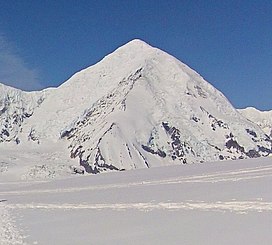
Mount Crosson is a 12,352-foot (3,765 m) mountain in the Alaska Range, in Denali National Park and Preserve. Mount Crosson lies to the northeast of Mount Foraker, overlooking Kahiltna Glacier. The mountain was named in 1949 by mountaineer Bradford Washburn for bush pilot Joseph Crosson. [2] [3]
See also
References
- ^ "Mount Crosson". Peakbagger.com. Retrieved 2013-04-12.
- ^ a b "Mount Crosson". Bivouac.com. Retrieved 2013-04-12.
- ^ a b "Mount Crosson". Geographic Names Information System. United States Geological Survey, United States Department of the Interior. Retrieved 2013-04-12.
