South Purmela, Texas | |
|---|---|
 South Purmela  South Purmela | |
| Coordinates: 31°28′12″N 97°58′20″W / 31.47000°N 97.97222°W | |
| Country | United States |
| State | Texas |
| County | Coryell |
| Elevation | 1,076 ft (328 m) |
| Time zone | UTC-6 ( Central (CST)) |
| • Summer ( DST) | UTC-5 (CDT) |
| Area code | 254 |
| GNIS feature ID | 1368751 [1] |
South Purmela is an unincorporated community in Coryell County, in the U.S. state of Texas. [1] According to the Handbook of Texas, only three people lived there in 2000. It is located within the Killeen-Temple-Fort Hood metropolitan area.
History
Little is known about the community except that a Methodist church, several businesses, and several scattered houses were extant in the 1980s. Only three people lived there in 2000. [2]
Geography
South Purmela is located at the intersection of U.S. Route 84 and Farm to Market Roads 183 and 932, 13 mi (21 km) northwest of Gatesville and 2 mi (3.2 km) south of Purmela in northwestern Coryell County. [2]
Education
Today, the community is served by the Evant Independent School District.
References
- ^ a b U.S. Geological Survey Geographic Names Information System: South Purmela, Texas
- ^ a b Smyrl, Vivian Elizabeth. "South Purmela, TX". tshaonline.org. Retrieved July 13, 2023.
Municipalities and communities of
Coryell County, Texas, United States | ||
|---|---|---|
| Cities | 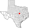 | |
| Towns | ||
| CDPs | ||
|
Other communities | ||
| Footnotes | ‡This populated place also has portions in an adjacent county or counties | |