King, Texas | |
|---|---|
 King  King | |
| Coordinates: 31°22′47″N 97°54′53″W / 31.37972°N 97.91472°W | |
| Country | United States |
| State | Texas |
| County | Coryell |
| Elevation | 846 ft (258 m) |
| Time zone | UTC-6 ( Central (CST)) |
| • Summer ( DST) | UTC-5 (CDT) |
| Area code | 254 |
| GNIS feature ID | 1380030 [1] |
King is an unincorporated community in Coryell County, in the U.S. state of Texas. [1] According to the Handbook of Texas, the community had a population of 25 in 2000. It is located within the Killeen-Temple-Fort Hood metropolitan area.
History
The community was originally known as Stringtown because the houses in the area were arranged in a straight line along the creek. A Baptist church was established in 1875. A post office was established in 1882 and remained in operation until September 1953. John W. Seay served as postmaster. Mail was then sent from Gatesville. Its name was changed to King for store owner Henry King. In the mid-1880s, King had 80 residents served by a gristmill, a cotton gin, and three churches. Farmers in the community shipped cotton, corn, and oats. Its population zenith was 100 in the 1890s, but that number declined by three-quarters in the early 1940s. King had a business, a church, and a cemetery in the 1980s. The population remained at 25 through 2000. [2]
Geography
King is located on Farm to Market Road 1783 on Cowhouse Creek, 12 mi (19 km) southwest of Gatesville in west-central Coryell County. [2]
Education
King had its own school in the mid-1880s. [2] Today, the community is served by the Gatesville Independent School District.
References
- ^ a b U.S. Geological Survey Geographic Names Information System: King, Texas
- ^ a b c Smyrl, Vivian Elizabeth. "King, TX". tshaonline.org. Retrieved July 12, 2023.
Municipalities and communities of
Coryell County, Texas, United States | ||
|---|---|---|
| Cities | 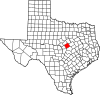 | |
| Towns | ||
| CDPs | ||
|
Other communities | ||
| Footnotes | ‡This populated place also has portions in an adjacent county or counties | |