Ireland, Texas | |
|---|---|
 Ireland  Ireland | |
| Coordinates: 31°34′1″N 97°57′55″W / 31.56694°N 97.96528°W | |
| Country | United States |
| State | Texas |
| County | Coryell |
| Elevation | 1,063 ft (324 m) |
| Time zone | UTC-6 ( Central (CST)) |
| • Summer ( DST) | UTC-5 (CDT) |
| Area code | 254 |
| GNIS feature ID | 1360025 [1] |
Ireland is an unincorporated community in Coryell County, in the U.S. state of Texas. [1] According to the Handbook of Texas, the community had a population of 60 in 2000. It is located within the Killeen-Temple-Fort Hood metropolitan area.
History
Ireland was originally known as Hamco for its location on the Hamilton-Coryell County line. The Stephenville North and South Texas Railway built a track through the community and it was renamed Ireland for John Ireland, who served as the 18th governor of Texas. A post office was established in 1911 and remained in operation until 1970. It then received its mail from Gatesville. Its population zenith was 400 in the 1920s with three general stores, three churches, a bank, and many other businesses. The community declined when the railroad was abandoned. The population plummeted to 40 in the late 1940s then went up to 60 from 1990 through 2000. [2]
Geography
Ireland is located on Farm to Market Road 932, 16 mi (26 km) northwest of Gatesville in northwestern Coryell County. [2]
Education
Today, the community is served by the Jonesboro Independent School District.
References
- ^ a b U.S. Geological Survey Geographic Names Information System: Ireland, Texas
- ^ a b Scott, Zelma. "Ireland, TX". tshaonline.org. Retrieved July 12, 2023.
Municipalities and communities of
Coryell County, Texas, United States | ||
|---|---|---|
| Cities | 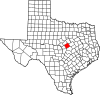 | |
| Towns | ||
| CDPs | ||
|
Other communities | ||
| Footnotes | ‡This populated place also has portions in an adjacent county or counties | |