Pearl, Texas | |
|---|---|
 Pearl  Pearl | |
| Coordinates: 31°24′37″N 97°2′6″W / 31.41028°N 97.03500°W | |
| Country | United States |
| State | Texas |
| County | Coryell |
| Elevation | 1,221 ft (372 m) |
| Time zone | UTC-6 ( Central (CST)) |
| • Summer ( DST) | UTC-5 (CDT) |
| Area code | 254 |
| GNIS feature ID | 1380335 [1] |
Pearl is an unincorporated community in Coryell County, in the U.S. state of Texas. [1] According to the Handbook of Texas, the community had a population of 125 in 2000. It is located within the Killeen-Temple-Fort Hood metropolitan area.
History
Wayback was the original name of Pearl. In honor of Swayback Mountain, which lies close to the hamlet, a petition was made asking for the opening of a post office with the name Swayback. In 1884, the post office was given the name "Wayback" due to a typing error. The community was renamed Pearl after Pearl Davenport, a local store owner's son, on March 28, 1890, after which the post office continued to operate under that name. In 1871, G. Dallas Edmondson and his brothers, J. Polk and Sam, were among the first settlers. Three Pearl doctors, Drs. H. Davenport, Taylor, and Ralph Bailey, engaged in a "price war" for patients' services in the early 1900s. A baby might therefore be born at that time for just $2.50. Dr. B. F. King, who relocated to the town in 1920 and died in 1947, was the final rural physician. The Methodist church was founded in Pearl in 1854, followed by the Church of Christ in 1878, the Baptist church in 1889, the United Baptist Church of Jesus Christ in 1896, and the Nazarene church in the first decade of the twentieth century. All of Pearl's congregations held ten-day revival meetings in July and August up until the mid-1920s. Some of the churches rented tents, and people packed food, utensils, and mattresses into their carts. The biggest social occasion of the year was these revivals. Pearl once possessed a gristmill, a flour mill, and a steam-powered cotton gin. The "Price System" telephones arrived in Pearl in 1908. People were required to purchase their own telephone boxes, wire, posts, string, and lines, as well as to maintain them. There were forty cents in the average monthly bill. There are still gatherings, quilting bees, and parties held at the Pearl Community Center. In 1892, Pearl had 125 residents. From the 1920s to the 1940s, that number dropped to 75, and from 1943 to the 1970s, it was 220. From 1970 to 2000, 125 people were living there. [2]
Pearl hosts a Bluegrass festival at its community center every second Sunday in September. [3]
Geography
Pearl is located 22 mi (35 km) west of Gatesville, 60 mi (97 km) west of Waco, and 30 mi (48 km) northeast of Lampasas in northwestern Coryell County. [3]
Education
Ellen Reily donated a plot of land for a school called Cowhouse School in May 1875. Its name changed to Sweet Home School in the 1890s. Voters approved a $4,000 bond to construct a new school on July 21, 1917. The Pearl School was a brick structure with four rooms. It joined the Evant Independent School District in 1958. [2]
References
- ^ a b U.S. Geological Survey Geographic Names Information System: Pearl, Texas
- ^ a b Freeman, Violet. "Pearl, TX (Coryell County)". tshaonline.org. Retrieved July 13, 2023.
- ^ a b "Pearl, Texas". Texas Escapes. Retrieved July 13, 2023.
Municipalities and communities of
Coryell County, Texas, United States | ||
|---|---|---|
| Cities | 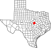 | |
| Towns | ||
| CDPs | ||
|
Other communities | ||
| Footnotes | ‡This populated place also has portions in an adjacent county or counties | |