Native name: Toprak Adası | |
|---|---|
| Geography | |
| Coordinates | 37°16′58″N 27°21′59″E / 37.28278°N 27.36639°E |
| Administration | |
| İl (province) | Muğla Province |
| İlçe | Milas |
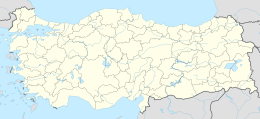
Toprak Island ( Turkish: Toprak Adası, literally "Soil Island") is an Aegean island of Turkey. (It is sometimes called Vardalkapı Island) It is uninhabited. At 37°16′58″N 27°21′59″E / 37.28278°N 27.36639°E it is administratively a part of Milas ilçe (district) of Muğla Province. [1] Its area is about 1 square kilometre (0.39 sq mi). Its distance from the mainland ( Anatolia) is about 4.5 kilometres (2.8 mi).
