 Aerial view of Suluada | |
| Geography | |
|---|---|
| Location | Mediterranean Sea |
| Coordinates | 36°14′19″N 30°28′18″E / 36.23861°N 30.47167°E |
| Area | 01 km2 (0.39 sq mi) |
| Administration | |
| İl (province) | Antalya Province |
| İlçe | Kumluca |
Suluada is a Mediterranean island of Turkey. The name Suluada is a composite word meaning "watery island" referring to fresh water sources of the island. In the antiquity the island was called "Krambusa". [1]

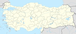
The uninhabited island is situated in the westernmost end of Gulf of Antalya about 7 kilometres (4.3 mi) to the Cape Gelidonya. Administratively, it is a part of Kumluca ilçe (district) of Antalya Province at 36°14′19″N 30°28′18″E / 36.23861°N 30.47167°E [2] The island is long and narrow where the 1,200 metres (3,900 ft)-long dimension points to northwest.
Daily excursions to Suluada from Antalya coast are being organized everyday between March and November. Island is also known as Turkish Maldives. [3]
References
- ^ Fulantalya page (in Turkish)
- ^ Map page
- ^ "Antalya Suluada Tour". Book From Locals. 4 January 2022. Retrieved 8 December 2022.
