Native name: Sıçan Adası | |
|---|---|
| Geography | |
| Location | Mediterranean Sea |
| Coordinates | 36°48′09″N 30°55′22″E / 36.80250°N 30.92278°E |
| Administration | |
| İl (province) | Antalya Province |
| İlçe | Kaş |
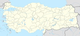
Sıçan Island ( Turkish: Sıçan Adası, also called fare Adası, literally "Mouse Island") is a Mediterranean island in Turkey. It is administratively a part of Konyaaltı ilçe (district) of Antalya Province at 36°48′09″N 30°55′22″E / 36.80250°N 30.92278°E. [1]
At the past it was one of the Xenagorou islands ( Ancient Greek: Ξεναγόρου νῆσοι). [2] [3]
The uninhabited island is a small circular island with an area of about 0.15 square kilometres (0.058 sq mi). It is situated to the south of East of Topçam Beach. The shortest distance to the main land ( Anatolia) is about 1.5 kilometres (0.93 mi). Yılan Island, another island is to the south west of Sıçan Island. The island is ideal for underwater sports even for the beginners. [4]
