| This is a Wikipedia
user page. This is not an encyclopedia article or the talk page for an encyclopedia article. If you find this page on any site other than Wikipedia, you are viewing a mirror site. Be aware that the page may be outdated and that the user in whose space this page is located may have no personal affiliation with any site other than Wikipedia. The original page is located at https://en.wikipedia.org/wiki/User:AlexiusHoratius/Images. |
Welcome to the images page of AlexiusHoratius. This page contains the photographs I have taken, maps I have made, and maps and photographs I have uploaded.
Maps Information
-
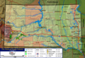 Map of South Dakota's terrain and primary geographic features.
 -
 Map of South Dakota's terrain and primary geographic features.
 -
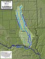
 Course and watershed of the Mississippi River.
 -
 Map of the Sioux Falls metropolitan area.
 -
 General map of Sioux Falls.
 -
 Route of Jacques Cartier's first voyage.
 -
 Route of Jacques Cartier's second voyage.
 -
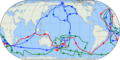 Map showing all three of James Cook's voyages. First voyage is shown in red, second in green, third in blue. The route of Cook's crew following his death is shown as a blue dashed line.
 -
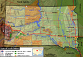
 Course and watershed of the Vermillion River.
 -
 Course and watershed of the White River.
 -
 Map of the Belle Fourche River.
 -
 Map of the Bad River.
 -
 Course and drainage basin of the Big Sioux River.
 -
 Course and drainage basin of the James River.
 -
 Course and drainage basin of the Cheyenne River.
 -
 Ecclesiastical Province of Saint Paul and Minneapolis (Catholic).
 -
 Ecclesiastical Province of Milwaukee (Catholic).
 -
 Ecclesiastical Province of Philadelphia (Catholic).
 -
 Ecclesiastical Province of Chicago (Catholic).
 -
 Ecclesiastical Province of Detroit (Catholic).
 -
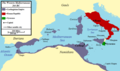 Map of the western Mediterranean Sea in 264 BC, focusing on the states involved in the First Punic War.
 -
 North America colonial changes after the French and Indian War, also shows boundary changes within British North America outside of the thirteen colonies between 1763 and 1783.
 -
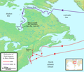 Map the two North American voyages of Henry Hudson in the early 17th century.


Maine Information
Bethel
-

-
 Gould Academy
 -

-
-
-

-
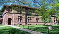
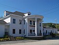
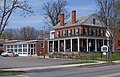
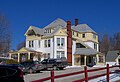
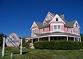
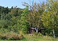
 Victoria Inn B&B


Augusta
-

-

-

-
-

-
 Kennebec River
 -
-
-


Farmington


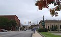
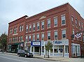
Portland
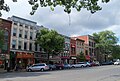
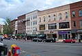
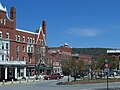
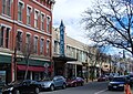
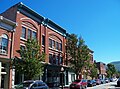
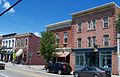
Downtown
-
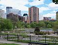
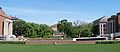
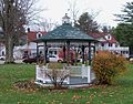
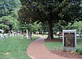
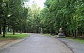
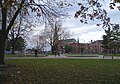 Lincoln Park
 -
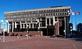
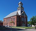
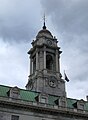 City Hall
 -
 City Hall
 -

-
-
-
-
-

-

-

-

-
-

-
-
-

-

-

-

-

-

-

-

-
-
-

-
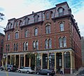
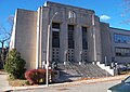
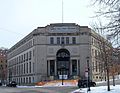
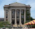
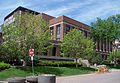
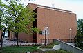
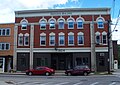
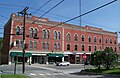
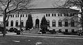
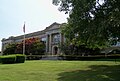
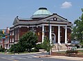
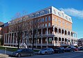
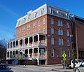
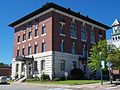
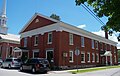
 Cumberland County Courthouse
 -
 Cumberland County Courthouse
 -
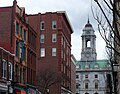
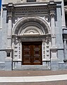
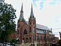
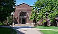
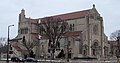
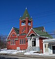
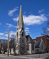
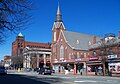
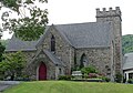
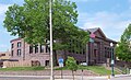
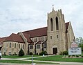
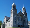
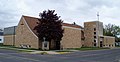
 Cathedral of the Immaculate Conception (Catholic)
 -
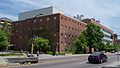
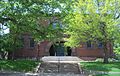
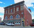
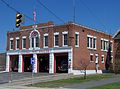
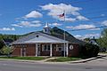
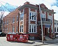
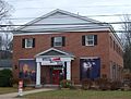
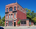
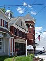
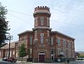
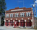
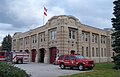 Fire Station
 -
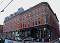
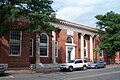
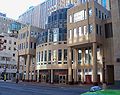
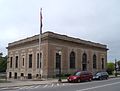
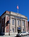
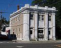
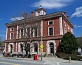
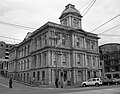 Custom House


West End
-
-
-

-
-
-

-

-
-
-
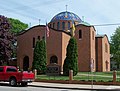
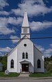
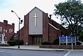
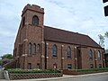
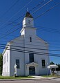
 St. Louis Catholic Church
 -
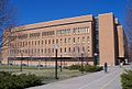
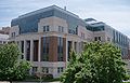
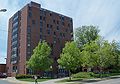
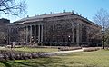
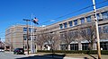
 Maine Medical Center


Rumford


Other Maine
-
 Androscoggin River
 -
 Androscoggin River


Massachusetts Information
Amherst


University of Massachusetts


Boston
-

-
 Trinity Church
 -
 Temple Bnai Moshe in Brighton
 -
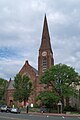
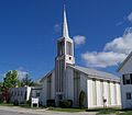
 St. Stephan Catholic Church
 -
 Grave of Samuel Adams
 -
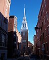 Old North Church
 -
 Alley in Boston's North End neighborhood
 -
 Massachusetts State House
 -
 Massachusetts State House
 -
 Massachusetts flag in front of the state house
 -
 King's Chapel Burying Ground
 -
 Hanover Street
 -
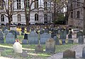
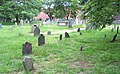
 Granary Burying Ground
 -
 Granary Burying Ground
 -
 Family plot of Benjamin Franklin in the Granary Burying Ground
 -

-
-
-
 Copp's Hill Burying Ground
 -
 Boston Public Library
 -
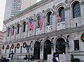 Boston Public Library
 -
 Courtyard in the Boston Public Library
 -
 Grave for victims of the Boston Massacre
 -
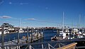 Boston Harbor
 -
 Boston Common
 -
 Boston Common
 -
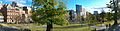 Boston Common
 -
 Boston Common
 -
-
 Frog Pond
 -
 Fort Independence
 -

-
-

-


Fort Warren


Greenfield


Holyoke


Northampton
-

-

-
-
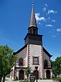
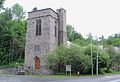
 Catholic church
 -

-

-
-
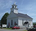
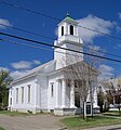
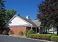
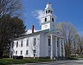
 Unitarian church
 -

-

-
-
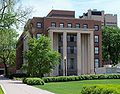
 Hampshire County Courthouse
 -
-
 Post office
 -


Pittsfield


Salem
-
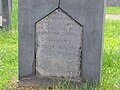 Grave of a Mayflower Pilgrim
 -
-

-
 Old town hall
 -
-

-
-
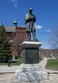
 Nathaniel Hawthorne statue
 -
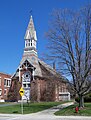
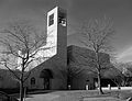
 Church of the Immaculate Conception
 -
-

-

-

-
-
-
-
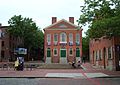
 Custom House
 -
 Custom House
 -
 Friendship of Salem


Springfield


Other Massachusetts
-
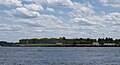
 Hull from Ft. Warren
 -
 Boston Light from Ft. Warren


Minnesota Information
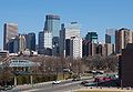
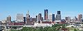
Minneapolis
Minneapolis skyscrapers
-
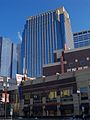
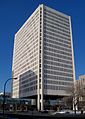
 The Wells Fargo Center at night.
 -
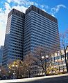
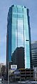
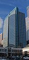
 US Bancorp Center
 -

-
-

-

-

-
-
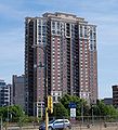
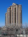
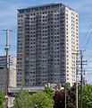 Skyscape building - condos, I think.
 -
-

-
 Accenture Tower
 -
 Grant Park building (condos, I think).
 -
-

-
 IVY Hotel + Residences
 -
 US Bank Plaza I and II
 -

-

-

-
 Fifth Street Towers. Looking at the back of the buildings, good photos facing the front seemed impossible.
 -

-
-

-
 North entrance of the Wells Fargo Center in Minneapolis.
 -

-

-
 Marquette Place Apartments
 -


Loring Park
-
-
 Pedestrian bridge in Loring Park.
 -

-

-
 Loring Park
 -
 Loring Park
 -
 Loring Park
 -
 Loring Park
 -
 110 Grant
 -
 Jerusalem's Restaurant
 -
 Loring Park Office Building


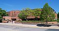
University of Minnesota (Minneapolis campus)
-
 Entrance sign at the northwest corner of East Bank
 -
 Northrop Mall
 -
-
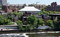
 Northern Pacific Bridge Number 9 over the Mississippi River.
 -
 Walter Library
 -
 Remains of the 35W Bridge
 -

-
 Vincent Hall
 -
 Pedestrian bridge
 -
 Music Education Building
 -
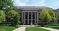
 Wilson Library
 -
 Wilson Library
 -
 Kolthoff Hall
 -
 Johnston Hall
 -
 Hasselmo Hall
 -
 Shevlin Hall
 -
 Shevlin Hall
 -
 Willey Hall
 -
 Morrill Hall
 -
 Tate Lab of Physics
 -
 Science Teaching and Student Services Building (under construction)
 -
 Plaque at the former site of Old Main
 -
 Carlson School of Management
 -
 Fraser Hall
 -
 East side of Jones Hall
 -
 West side of Jones Hall
 -
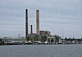
 Heating plant along the Mississippi River
 -
 Shepherd Laboratories
 -
 Burton Hall - Not a great photo, but whatever.
 -
 Heller Hall
 -
 Heller Hall
 -
 Inscription on the front of Northrop Auditorium
 -
 Transportation and Safety Building
 -
 Lind Hall
 -
 Ford Hall
 -
 Folwell Hall
 -
 Nolte Center
 -
 Rarig Center
 -
 Murphy Hall
 -
 Institute of Child Development
 -
 Civil Engineering Building
 -
 West entrance of the Civil Engineering Building
 -
 Comstock Hall
 -
 Sanford Hall
 -
 Norris Hall
 -
 Appleby Hall
 -
 Blegen Hall
 -
 Molecular & Cellular Biology Building
 -
 Amundson Hall
 -
 Back side of the Education Sciences building
 -
 717 Delaware Building
 -
 Wilkins Hall
 -
 Middlebrook Hall
 -
 Elliott Hall
 -
 Centennial Hall
 -
 Southern end of Ferguson Hall
 -
 Northern end of Ferguson Hall
 -
 Anderson Hall
 -
 Pattee Hall
 -
 Peik Hall
 -
 Social Sciences Tower
 -
 Social Sciences Tower
 -
 Elmer L. Andersen Library
 -
 Smith Hall


Other Minneapolis
-
 Downtown Minneapolis from across Lake Calhoun
 -
 Minneapolis skyline and Lake of the Isles (October)
 -
 Minneapolis skyline and Lake of the Isles (May)
 -
 Downtown looking north
 -
 I-35W and downtown. Basically the same photo as before, but cropped a bit for the I-35W article.
 -

-
 St. Maron's Maronite Catholic church in Northeast
 -
 St. Constantine's Ukrainian Catholic church in Northeast
 -
 Downtown Minneapolis from the Walker Art Center, looking across Loring Park.
 -
 Downtown Minneapolis from the East Bank of the University of Minnesota.
 -
 Cool stuff on the top of the Pillsbury "A" Mill.
 -
 Street in Dinkytown near the U of M campus
 -
 Cowles Conservatory in the Minneapolis Sculpture Garden.
 -
 Pedestrian bridge between Loring Park and the Minneapolis Sculpture Garden.
 -
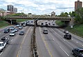
 Interstates 35W and 94 alongside each other near downtown
 -
 Kramarczuk's in Northeast.
 -
 Surdyk's in Northeast.
 -
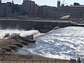 St. Anthony Falls. Not a great photo, but taken during a time of higher-than-usual water; compare with this.
 -
 Interstate 94 near downtown.
 -
 St. Anne - St. Joseph Hien Catholic Church
 -
 Semple Mansion
 -
 Continental Hotel
 -
 Hosmer branch library
 -
 Purity Bakery Building
 -
 Short Line Bridge
 -
 Temple Israel (synagogue)


Saint Paul
-
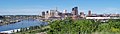 Downtown St. Paul. The Mississippi River can be seen to the left, and the Minnesota State Capitol is at the far right.
 -
 Downtown St. Paul
 -

-
 Minnesota State Capitol looking southwest.
 -
 Cathedral of Saint Paul
 -
 Cathedral of Saint Paul
 -
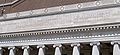
 Close-up of the dome of the Cathedral of Saint Paul.
 -
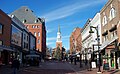
 Downtown
 -

-
 Governor's Residence
 -
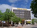
 Wells Fargo building in downtown
 -
 Civil War memorial
 -
 Mississippi River near downtown. Minor flooding.
 -
 Mississippi River near downtown. Minor flooding.
 -

-

-
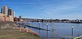
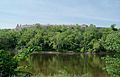
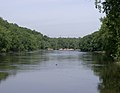 Mississippi River between St. Paul and Minneapolis
 -
 St. Thomas Aquinas Chapel on the campus of the University of St. Thomas
 -
 St. Paul's On-The-Hill Church
 -
 St. Paul's On-The-Hill Church
 -
 St. Thomas More Catholic Church
 -
 St. Thomas More Catholic Church
 -
 Close-up of entrance of St. Thomas More Catholic Church


_5.jpg)


University of Minnesota (St. Paul campus)
-
 McNeal Hall
 -
 Biological Sciences building
 -
 Beef Cattle Barn
 -
 Agronomy Seed House
 -
 St. Paul Student Center
 -
 Vocational and Technical Center
 -
 Snyder Hall


Other Minnesota
-
 Flag of Minnesota under the US flag
 -
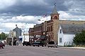
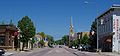
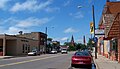
 Downtown Faribault, Minnesota
 -
 Downtown Faribault
 -
 Fort Snelling above the Mississippi River
 -
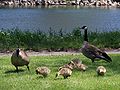 Family of Canada geese in Northfield
 -

-
-

-

-

-

-
-

-
-
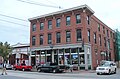
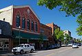
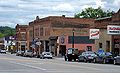
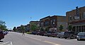
 Water Street in Jordan, Minnesota
 -

-

-

-
 Rice County Courthouse in Faribault, Minnesota
 -
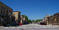
 Downtown Owatonna, Minnesota
 -
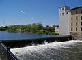 Small waterfall and mill in Northfield
 -

-

-

-
-

-
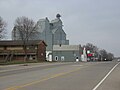
 Grain elevator in Claremont
 -

-

-
-

-

-

-
-
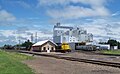 Trains and grain elevator in Rush City
 -
-

-

-
-

-

-
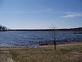
 Pigeon Lake
 -
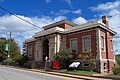
 Carnegie library in Hutchinson, Minnesota
 -

-
-

-
 Grant House in Rush City
 -

-

-
-
-
-
 Old Creamery in Cokato
 -

-

-

-
 Jackson County Courthouse
 -

-


New Hampshire Information
Androscoggin River
Mostly taken in either Berlin or Gorham


Bath
-
-

-
 Library and post office
 -
-
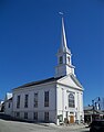
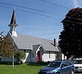
 Congregational Church


Berlin
-
-
-
-
 St. Anne Catholic Church in foreground
 -
 United Church of Christ
 -
 St. Anne Catholic Church
 -
 Holy Resurrection Orthodox Church
 -
-
 St. Paul Lutheran Church
 -

-
 St. Joseph Catholic Church
 -
 St. Barnabas Episcopal Church
 -
-
 Train depot
 -

-
-
 Library
 -
-

-
 City Hall
 -
-

-

-
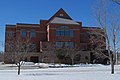
 White Mountains Community College
 -
 Dead River
 -
 Dead River
 -
 Fire Station
 -
-

-
Grand Trunk Depot
-
East Station


Bethlehem
-

-

-
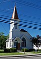
 Methodist Church
 -

-
-
 Public Library
 -
 Post Office
 -
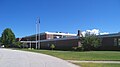
 Elementary school


Charlestown
-
 Anglican Church of the Good Shepherd
 -

-
 Post office
 -
-
 St. Luke's Episcopal Church
 -
-
 St. Catherine Catholic Church
 -
 South Parish Unitarian Church
 -
 Public Library


Claremont
-
-

-
 City Hall
 -
 City Hall
 -
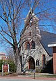
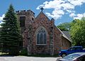
 Trinity Episcopal Church
 -
-

-
-
 Fire Station
 -

-

-
 Methodist Church
 -
-
-
-
-


Colebrook
-
-
 Town Hall
 -

-
-

-

-

-


Concord
-
 New Hampshire Historical Society
 -
-

-

-
-

-
-
 State Legislative Building
 -
 Sacred Heart Catholic Church
 -
-
-

-
 St. Paul's Episcopal Church


State House


Dover
-

-

-
 St. Mary Academy
 -
 St. Joseph Catholic Church
 -
 Congregational Church
 -

-

-
-
 Public Library
 -


Franklin
-
 United Methodist Church
 -
 St. Paul Catholic Church
 -
 Baptist Church
 -

-
 City Hall


Gorham
-

-

-

-
 Holy Family Catholic Church
 -
-
 Town Hall
 -
-

-
-
-
-

-
 Old train depot
 -

-
 Gorham Common
 -
 Congregational Church
 -

-
 Evans Cemetery
 -

-

-
-


Groveton
-
 Post office
 -
 High school
 -
 Library
 -

-
-

-

-

-


Haverhill
-
 Town Hall
 -
 Methodist Church
 -
 Public Library
 -
 Grafton County Courthouse


Keene
-

-
 Cheshire County Courthouse
 -
 Central Fire Station
 -

-

-

-
 St. Bernard's Catholic Church
 -

-

-
 Colonial Theater
 -

-
 United Church of Christ
 -

-
 United Methodist Church
 -
-


Lancaster
-
 Coös County Courthouse
 -

-
 Catholic Church
 -
 Congregational/UCC Church
 -
 Post Office
 -
 Old Courthouse
 -
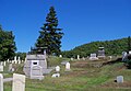
 Cemetery
 -
 Church of Christ Scientist
 -
 Methodist Church
 -
 Episcopal Church
 -
 Weeks Memorial Library
 -
-
-

-
-
-


Lebanon
-

-
 First Baptist Church
 -

-
 Post office
 -
 Library
 -
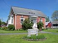
 Colburn Park


Lisbon
-
 Public Library
 -
 Town Hall
 -
 Ammonoosuc River
 -
-
-
-


Littleton
-
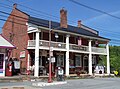
 Thayer's Inn
 -
 Catholic Church
 -
 Public Library
 -
 Movie theater
 -
 Littleton Motel
 -

-
 Courthouse and Post Office
 -
 Community Center
 -
 Congregational Church
 -
 Methodist Church
 -
 Ammonoosuc River
 -
 Episcopal Church
 -
-

-

-


Manchester
-
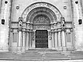
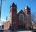
 Cathedral of St. Joseph
 -
 Cathedral of St. Joseph
 -
-

-
 Grace Episcopal Church
 -
 First Congregational Church
 -
 First Baptist Church
 -
 Carpenter Library
 -
 St. Anne Catholic Church
 -

-

-

-
-
-

-
-

-
-
 City Hall
 -


Nashua
-

-
-

-

-
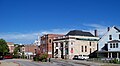
 Courthouse
 -
 Post office
 -
-
-
 City Hall
 -
 Nashua River
 -

-
 Civil War memorial
 -

-
 Hunt Memorial Library
 -

-
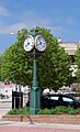
 Clocktower Place
 -
-

-

-


North Conway
-
 First Baptist Church
 -
 Christ Episcopal Church
 -
-
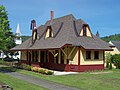
 Train depot
 -

-
-
 Library
 -
 Eastern Slope Inn
 -
 Eastern Slope Inn
 -
 Weather Discovery Center


North Stratford
-
-
 Sacred Heart Catholic Church
 -
-
 Post office
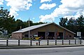
 -
 Fire station
 -
 Train depot
 -
 Town hall


Pittsburg


Portsmouth


.jpg)
.jpg)
.jpg)
.jpg)
.jpg)
.jpg)
.jpg)


.jpg)
.jpg)


Rochester
-
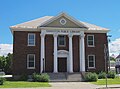
 Public Library
 -
 Courthouse
 -
 Methodist Church
 -
-

-
-
-
-

-
 Congregational Church
 -

-

-


Stark


Stewartstown


Sugar Hill
-
 Post office
 -

-

-
 Town Hall
 -
 Meetinghouse


Whitefield
-
 Catholic Church
 -
 Bed and Breakfast
 -
 Foster Square
 -
 Public Library
 -
 Methodist Church
 -
 Old town hall


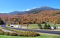
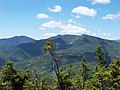
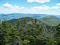
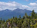
White Mountains
-
-
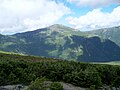
-
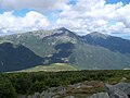
-

-
-

-
-
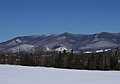
 Mt. Washington
 -

-

-

-
-

-
-

-

-
-

-

-

-

-

-


Other New Hampshire
-
-

-
 Cemetery in Errol
 -
 St. Pius Catholic Church in Errol
 -
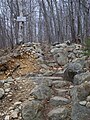 Sign on the Mahoosuc Trail
 -
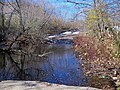
 Rattle River
 -
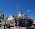
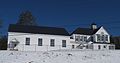 Town Hall for Carroll and Twin Mountain
 -
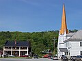
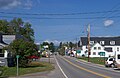
 Downtown Tilton
 -
 Downtown Tilton
 -
 Downtown Tilton
 -
 Congregational Church in Tilton
 -
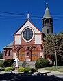
 St. Agnes Catholic Church in Jefferson
 -
 Rest stop on Interstate 93
 -
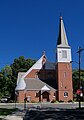
 First United Methodist Church in Milan
 -
 Hillcrest Cemetery in Milan
 -
 Errol
Errol -
 Errol General Store
 -
 Congregational Church in Errol
 -
 St. Joseph Catholic Church (Woodsville)
 -
 St. Luke Episcopal Church (Woodsville)
 -
 Library (Woodsville)
 -
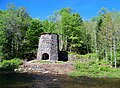 Iron Furnace (Franconia)


New York State Information
Beacon
-
 Baptist Church
 -
 Fire Station
 -
 Post Office
 -
 Catholic Church
 -
-
-


Cornwall-on-Hudson
-
 St. Thomas of Canterbury Catholic Church
 -
 Village Hall
 -

-

-
-
 Fire Station
 -
 St. Thomas of Canterbury School
 -
 St. Thomas of Canterbury School


Fishkill
-
 Van Wyck Hall
 -
 First Reformed Church
 -
 Fire Station
 -
-


Fort Montgomery
-
 Visitors' Center
 -
-
-

-

-
-
-

-
-


Goshen
-
 First Methodist Church
 -
 St. James Episcopal Church
 -
 First Presbyterian Church
 -
-

-


Highland Falls
-
 Post Office
 -
 Highlands Town Hall
 -
 Public Library
 -
 United Methodist Church
 -
 Sacred Heart Catholic Church
 -
 Church of the Holy Innocents Episcopal Church


Kingston
-

-
-
 Kingston City Library
 -
 City Hall
 -
 Kingston High School


Middletown
-
-
 Masonic Temple
 -
 United Presbyterian Church
 -


Monroe
-
-
-
 Town Hall
 -
 Village Hall
 -
-


Newburgh


New York City
-
 Foley Square
 -
 NY State Supreme Court Building
 -

-

-
 The Lake in Central Park


Poughkeepsie
-
-

-
-
-

-
-
-

-
 Dutchess County Courthouse
 -

-

-
-
-

-
-


Woodbury
-
 Town Hall
 -

-
 St. Patrick's Catholic Church
 -
 Fire Station


Other New York State
-
 United Methodist Church (Cornwall)
 -
 Public Library (Cornwall)


North Carolina Information
Charlotte
-
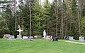
 Settlers' Cemetery
 -
 First Presbyterian Church
 -

-
 First United Methodist Church
 -
 Vue Condominiums


Other North Carolina
-
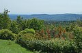
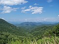 Scenic view of mountains in Cherokee County.
 -
 Providence Presbyterian Church in either Charlotte or Matthews
 -

-

-
 Large hotel in Concord
 -
 Old courthouse in Concord
 -
 Maxwell Chambers house (built in 1820) in Salisbury
 -
 Bell tower in Salisbury.
 -

-

-
 Rowan County Courthouse in Salisbury
 -
 Rowan Museum (old courthouse) in Salisbury
 -

-
 Research center in Kannapolis
 -

-
 First Presbyterian Church in Albemarle
 -


.jpg)


South Dakota Information
Brookings
-
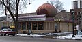
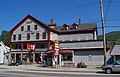
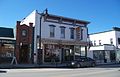
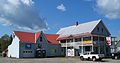
 Nick's Hamburger Shop
 -

-

-
-


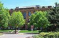
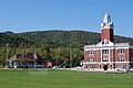
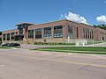
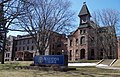
South Dakota State University


Sioux Falls
-
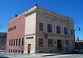
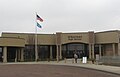
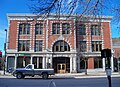
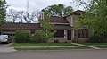
 City Hall
 -
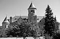
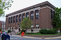
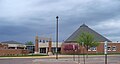
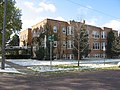
 O'Gorman High School
 -

-

-
-

-

-

-

-

-
-
-

-
-

-

-
-
-

-

-

-

-
-

-
-

-
-
-
-
-
-
-

-
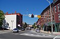
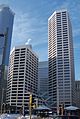
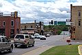
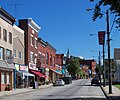
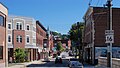
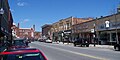
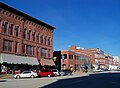
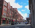
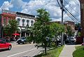
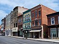
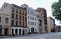
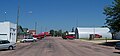
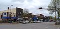
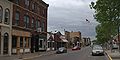
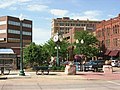 Downtown Sioux Falls. Looking north up Phillips Avenue.
 -
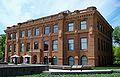
 Old Minnehaha County Courthouse and Museum
 -
 Old Minnehaha County Courthouse
 -
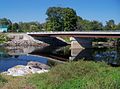
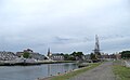
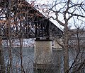
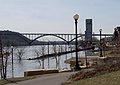
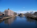
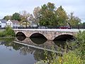
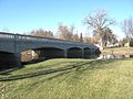
 8th Street Bridge over the Big Sioux River in Sioux Falls
 -
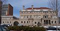
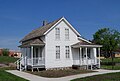
 Home of Richard F. Pettigrew in Sioux Falls; now a museum
 -
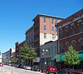
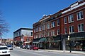
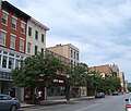
 Downtown Sioux Falls looking west
 -
 Downtown Sioux Falls bus terminal
 -
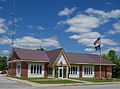
 Sioux Falls City Hall
 -
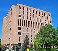
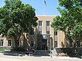
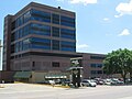
 Federal Building and courthouse in Sioux Falls
 -
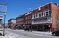
 Downtown Sioux Falls looking south from Falls Park
 -
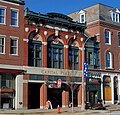
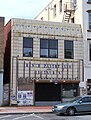
 Orpheum Theatre in Sioux Falls
 -
 New (or newer) Minnehaha County Courthouse in Sioux Falls
 -
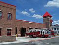
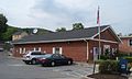
 Central Fire Station in Sioux Falls
 -
 Carpenter Hotel in Sioux Falls
 -
 Original Carnegie Library in Sioux Falls
 -
 Pettigrew & Tate Building in Sioux Falls
 -
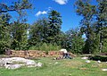
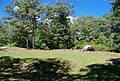
 Indian burial mound in Sherman Park
 -
 Indian burial mounds in Sherman Park
 -
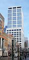
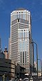
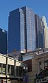
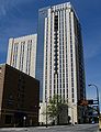
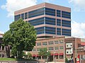 Qwest Tower in Sioux Falls
 -
 Qwest Tower in Sioux Falls
 -
 Qwest Tower in Sioux Falls
 -
 Marion E. Bowen house in Sioux Falls
 -
 Rock Island Depot in Sioux Falls (now a store)
 -
 Cannon in Lyon Park in Sioux Falls
 -
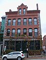
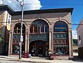
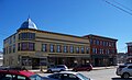
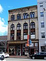
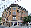
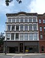
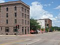
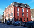
 Phillips Block in Sioux Falls
 -
 Edward Coughran house in Sioux Falls
 -
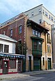
 Security Bank Building in Sioux Falls. (I believe this is the one that John Dillinger robbed.)
 -
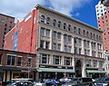
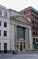
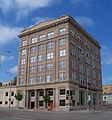
 Sioux Falls National Bank Building
 -
 Grand Lodge and Library etc. in Sioux Falls
 -
 Morrells meat packing plant in Sioux Falls
 -
 Cherry Rock Bridge in Sioux Falls
 -
 Yankton Trail Bridge in Sioux Falls
 -
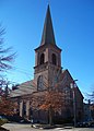
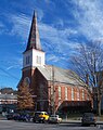
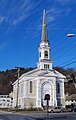
 First Congregational Church in Sioux Falls
 -
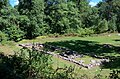
 Japanese gardens in Terrace Park in Sioux Falls
 -
 Administration Building at Augustana College in Sioux Falls
 -
 Sioux Falls Police Station
 -
 Johnson-Shriver Building in Sioux Falls.
 -
 Old hydropower plant in Falls Park, Sioux Falls
 -
 Some old warehouses in Sioux Falls
 -
 Parmley-Pankow House in Sioux Falls
 -
 Falls of the Big Sioux River
 -
 Falls of the Big Sioux River
 -
 Kuehn Warehouse in Sioux Falls
 -
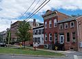
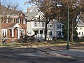
 Houses in the Sioux Falls Historic District aka the Cathedral Historic District.
 -
 Dr. Steven's house (?) in Sioux Falls
 -
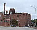
 L & A Baking Company in Sioux Falls
 -
 Miller Funeral Home in Sioux Falls
 -
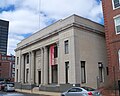
 US Courthouse and Federal Building in Sioux Falls
 -
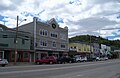
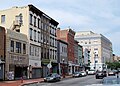
 Downtown Sioux Falls from the northwest
 -
 E.J. and Alice Daniels House in Sioux Falls
 -
 Berdhal-Rolvaag house in Sioux Falls.
 -
 Farley-Loetscher Company Building I in Sioux Falls
 -
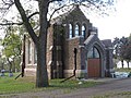 Josephine Martin Glidden Memorial Chapel in Sioux Falls
 -
 Glidden-Martin Hall in Sioux Falls
 -
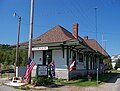
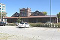 Illinois Central depot in Sioux Falls
 -
 LaSalle Apartments in Sioux Falls
 -
 Kirkeby-Over Stadium in Sioux Falls
 -
 Charles A. Thomas house in Sioux Falls
 -
 Plumbing Supply Company building in Sioux Falls
 -
 Presentation Children's Home in Sioux Falls
 -
 Randolph Block in Sioux Falls
 -
 Rock Island depot in Sioux Falls
 -

-
 South Dakota State Penitentiary in Sioux Falls
 -
 South Dakota State Penitentiary in Sioux Falls
 -
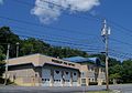
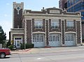
 South Side Fire Station No. 3 in Sioux Falls
 -
-

-
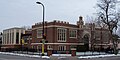
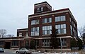
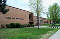
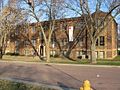
 Roosevelt High School in Sioux Falls
 -
 Washington High School in Sioux Falls
 -
 Lincoln High School in Sioux Falls
 -

-

-
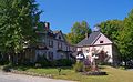
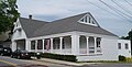
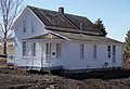
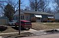
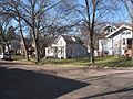
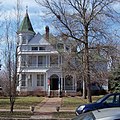
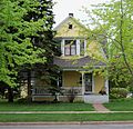
 House in Sioux Falls
 -
 Harrison DeLong house in Sioux Falls
 -
 House in Sioux Falls
 -
 Apartment building in Sioux Falls
 -
 Hayes Historical District in Sioux Falls
 -
 Entrance to the Great Plains Zoo in Sioux Falls
 -
 Jorden Hall on the campus of the University of Sioux Falls
 -
 Homes in the McKennan Historical District in Sioux Falls
 -
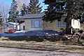
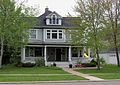
 House in Sioux Falls
 -
 Building at the S. Dakota School for the Deaf in Sioux Falls
 -
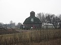 Round barn near Sioux Falls
 -
 Homes in the Sherman Historical District in Sioux Falls
 -
 Williams Piano Company house in Sioux Falls
 -
 Orlan A. Hayward house in Sioux Falls
 -
 Laura M. Welch house in Sioux Falls
 -
 Grant J. Reynolds house in Sioux Falls
 -
 Old Main and East Hall at Augustana College in Sioux Falls
 -
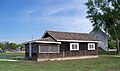
Rock Island RR depot


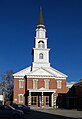
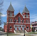
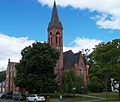
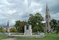
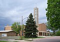
St. Joseph Cathedral


USS South Dakota Battleship Memorial
Memorial in Sioux Falls to USS South Dakota, a battleship in WWII.
-
 General memorial photo
 -
 Rear breach of a 16-inch gun
 -
 One of the screws, I believe it's a replica
 -
 Section of the original deck
 -
 Looking toward the front of the monument. The concrete wall thing is an outline of the hull.
 -
 Range-finding radar, I think. A major innovation in its day.
 -
 16-inch gun
 -
 Another general memorial photo.
 -
 Original mast from the ship.


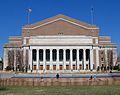
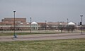
Washington Pavilion


Other South Dakota
-
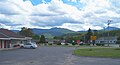
 Rest stop on I-29 south of Brookings
 -
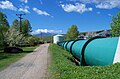
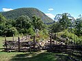
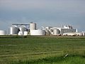 Ethanol plant in Turner County, South Dakota
 -
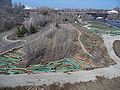
 Bridge at Palisades State Park
 -
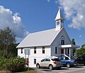
 Church in Dell Rapids
 -
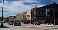
 Historic District homes in Dell Rapids
 -
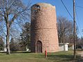 Old water tower in Dell Rapids
 -
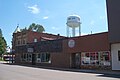
 Downtown Dell Rapids, SD
 -
 Bridge near Garretson, SD
 -
 Old bathhouse in Dell Rapids, SD
 -
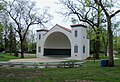
 Amphitheater in Dell Rapids, SD
 -
 Bridge in Dell Rapids over the Big Sioux River
 -
 Baltic, South Dakota
 -
 Corson, South Dakota
 -
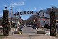
 Dell Rapids, South Dakota
 -
 Site of former town of East Sioux Falls, South Dakota
 -
 Rowena, South Dakota
 -
 Garretson, South Dakota
 -
 Building in Garretson, SD
 -
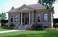
 Carnegie Library in Dell Rapids, SD
 -
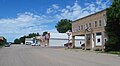
 One of Sherman, South Dakota's fancier buildings
 -

-
 Worthing, South Dakota
 -
 Vermillion River
 -
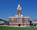
 Turner County Courthouse
 -
-
 Parker, South Dakota
 -
 Lincoln County Courthouse
 -
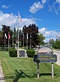
 State flag
 -

-

-

-

-
-

-


Vermont Information
Burlington
-
 First United Methodist Church
 -
 First Congregational Church
 -
 Church Street
 -
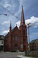
 Cathedral of the Immaculate Conception
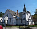
 -
 Cathedral Church of St. Paul
 -
 Ridin' High Skate Shop
 -
 Unitarian Church


University of Vermont
-

-

-
-
 Morrill Hall
 -

-

-

-
 Royall Tyler Theatre
 -
 Old Mill
 -
 Williams Hall
 -
-
 Billings Library
 -
 Ira Allen Chapel bell tower
 -
 Ira Allen Chapel
 -
 Ira Allen Chapel
 -
 John Dewey Hall


Canaan


Island Pond
-
 First Congregational Church
 -
-

-

-

-

-


Montpelier
-
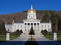 Vermont State House
 -
 Vermont History Museum
 -
 Vermont History Museum
 -
 Courthouse
 -
 Courthouse
 -
-
 State Street
 -
-
 North Branch of the Winooski River
 -
 Kellogg-Hubbard Library
 -
 Trinity United Methodist Church
 -
 First Baptist Church
 -
 Unitarian Church


Newport
-
 St. Mary Catholic Church
 -
 Goodrich Memorial Library
 -

-
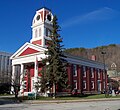
 Orleans County Courthouse
 -
 Orleans County Courthouse
 -
 Newport Baptist Church
 -


St. Johnsbury


Swanton
-
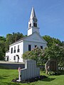
 First Congregational Church
 -
 Town Hall
 -
 Holy Trinity Episcopal Church
 -

-
 Public Library
 -
 United Methodist Church
 -
 Post Office


Windsor
-

-

-
-

-

-
 Fire Station
 -
 Old South Church


Woodstock
-

-
 Town Hall
 -
 St. James Episcopal Church
 -
 Public Library
 -
 Windsor County Courthouse


Other Vermont
-
 Trailhead
 -
 Overlook near Marlboro
 -
 Overlook near Marlboro
 -
 Municipal Offices (Alburgh)
 -
 Historical Society Museum (Alburgh)
 -
 St. Amadeus Catholic Church (Alburgh)
 -
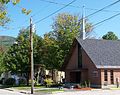
 All Saints Catholic Church (Richford)


Wisconsin Information
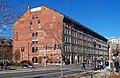
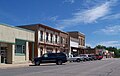
Hudson
-
-
 St. Croix River in Hudson
 -
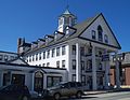
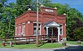
 St. Croix County Courthouse in Hudson
 -
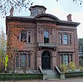
 Samuel C. Johnson house in Hudson
 -
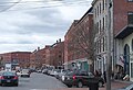
 Street in downtown Hudson
 -
 William H. Phipps house in Hudson
 -
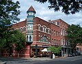
 Opera Hall Block in Hudson
 -
 William Dwelley house in Hudson
 -
 Lewis-Williams house in Hudson.
 -
 Herman L. Humphrey house in Hudson
 -
 August Johnson house in Hudson.
 -
 Frederick L. Darling house in Hudson
 -
 House in the 6th Street Historic District in Hudson
 -
 Samuel T. Merritt house in Hudson
 -
 Old Public Library in Hudson


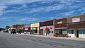
New Richmond
-
 Buildings in downtown New Richmond
 -
 Dr. Frank W. Epley Office
 -
 Erick J. Thompson House
 -
 Ezra Glover, Jr. House
 -
 First English Lutheran Church
 -
 Joseph Mielke House
 -
 Marcus Sears Bell Farm
 -
 North Side Historic District
 -
 New Richmond News Building
 -
 Soo Line Depot
 -
 William H. Kell House
 -
 William J. Bernd House on Second Street
 -
 William J. Bernd House on Arch Avenue


_1.jpg)
_1.jpg)
Other Wisconsin
-

-
 Daniel Smith House in Prescott.
 -
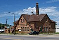
 Glen Park Municipal Swimming Pool in River Falls.
 -
 Roscius S. and Lydia R. Freeman House in River Falls.
 -
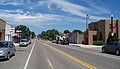
 Downtown River Falls
 -
 Downtown River Falls
 -
 H. S. Miller Bank in Prescott.
 -
 Rest stop near Millston


Other US Information
-

-

-

-
 Side entrance of Chickamauga Battlefield visitors center (in Georgia)
 -
 Battleline Road at Chickamauga Battlefield. (in Georgia)
 -
 Rest stop on Interstate 90 in Pennsylvania


Uploaded images made by other people Information
Note - I found the below maps and photographs on the internet. In other words, I did not make these maps nor did I take the photographs. All of these were either made by some arm of the United States Government or were published before 1923, and therefore are in the public domain. I have also uploaded several non-free images for limited use. For the relief maps of states, I have only uploaded a few, although the full set is available from the USGS. If you would like to upload another state, the source can be found by clicking on one of the maps.
-
 A relief map of South Dakota by the USGS.
 -
 A relief map of Massachusetts by the USGS.
 -
 A relief map of Wyoming by the USGS.
 -
 A relief map of New York state by the USGS.
 -
 A relief map of Pennsylvania by the USGS.
 -
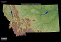 A relief map of Montana by the USGS.
 -
 A pronghorn in Wind Cave National Park. Photo by the National Park Service.
 -
 Black Hills. Photo by Beth Steinhauer, Black Hills National Forest.
 -
 Sylvan Lake in the Black Hills. Photo by a Black Hills National Forest employee.
 -
 Sylvan Lake and Harney Peak (to the left) in the Black Hills. Photo by a Black Hills National Forest employee.
 -
 Petroglyphs in the Black Hills. By Gary Chancey, USFS.
 -
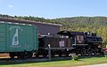
 Rodeo in Deadwood, South Dakota. By Gary Chancey, USFS.
 -
 George S. Mickelson Trail in the Black Hills. By Gary Chancey, USFS.
 -
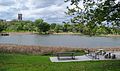
 Missouri River between Yankton, South Dakota and Gavins Point Dam. Photo by Galen Jons.
 -
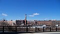
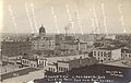
 1907 panorama of Sioux Falls. Photo by Frederick J. Bandholtz.
 -
 Downtown Aberdeen, South Dakota in 1910. Photo by N. A. Brothers.
 -
 1902 panorama of Spearfish, South Dakota. Photo by Clinton DeForest Curtis.
 -
 1883 bird's eye view of Watertown, South Dakota. By J.J. Stoner.
 -
 1883 illustration of Frederick, South Dakota. By C.F. Campau.
 -
 1883 illustration of Aberdeen, South Dakota. By F. H. Hagerty and H.M. Marple.
 -
 1883 illustration of Clark, South Dakota. By J.J. Stoner.
 -
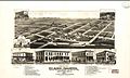
1883 illustration of Flandreau, South Dakota. By J.J. Stoner.
-
 Photo of Horse Thief Lake by Beth Steinhauer, Black Hills National Forest.
 -
 1867 bird's eye illustration of Green Bay, Wisconsin. By A. Ruger.
 -
 1871 bird's eye illustration of Little Rock, Arkansas. Artist unknown.
 -
 1887 bird's eye illustration of Montgomery, Alabama. By H.C. Davidson
 -
 1869 bird's eye illustration of Topeka, Kansas. By A. Ruger.


