Roxbury, Wisconsin | |
|---|---|
 Entering Roxbury on County Highway Y | |
 Roxbury  Roxbury | |
| Coordinates: 43°14′58″N 89°40′31″W / 43.24944°N 89.67528°W | |
| Country | |
| State | |
| County | Dane County |
| Town | Roxbury |
| Elevation | 264 m (866 ft) |
| Time zone | UTC-6 ( Central (CST)) |
| • Summer ( DST) | UTC-5 (CDT) |
| Area code | 608 |
| GNIS feature ID | 1572693 [1] |
Roxbury is an unincorporated community located in the town of Roxbury, Dane County, Wisconsin, United States. [1]
Gallery
-
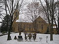 St. Norbert's Church
 -
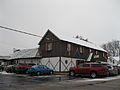
 Roxbury Tavern
 -
 Dorf Haus


Notes

|
| This article about a location in Dane County, Wisconsin is a stub. You can help Wikipedia by expanding it. |