Pleasant Valley Township | |
|---|---|
 Location in Finney County | |
| Coordinates: 38°10′38″N 100°46′28″W / 38.17722°N 100.77444°W | |
| Country | United States |
| State | Kansas |
| County | Finney |
| Area | |
| • Total | 143.26 sq mi (371.05 km2) |
| • Land | 143.26 sq mi (371.05 km2) |
| • Water | 0 sq mi (0 km2) 0% |
| Elevation | 2,917 ft (889 m) |
| Population (
2000) | |
| • Total | 139 |
| • Density | 1/sq mi (0.4/km2) |
| GNIS feature ID | 0485250 |
Pleasant Valley Township is a township in Finney County, Kansas, USA. As of the 2000 census, its population was 139.
Geography
Pleasant Valley Township covers an area of 143.26 square miles (371.0 km2) and contains no incorporated settlements.
Transportation
Pleasant Valley Township contains one airport or landing strip, Air-Ag Airport.
References
External links
Municipalities and communities of
Finney County, Kansas, United States | ||
|---|---|---|
| Cities | 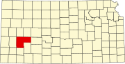 | |
|
Unincorporated communities | ||
| Ghost towns | ||
| Townships | ||
| Footnotes | †This community is designated a
Census-Designated Place (CDP) by the
United States Census Bureau. | |
|
| This article about a location in Finney County, Kansas is a stub. You can help Wikipedia by expanding it. |