Friend, Kansas | |
|---|---|
 | |
 Friend  Friend | |
| Coordinates: 38°15′36″N 100°54′42″W / 38.26000°N 100.91167°W [1] | |
| Country | United States |
| State | Kansas |
| County | Finney |
| Elevation | 2,914 ft (888 m) |
| Time zone | UTC-6 ( CST) |
| • Summer ( DST) | UTC-5 (CDT) |
| Area code | 620 |
| FIPS code | 20-24800 |
| GNIS ID | 471533 [1] |
Friend is an unincorporated community in Terry Township, Finney County, Kansas, United States. [1] It is located next to U.S. Route 83 and the North Line of the Garden City Western Railway, south to the county line of Scott County.
History
Originally the town was named McCue [1] after Basil M. McCue of Hastings, Nebraska who was the organizer of the Garden City Gulf & Northern Railroad. The Santa Fe Railroad changed the name to Friend when it took over the railway line between Garden City and Scott City.
The post office in Friend closed in 1992. [2]
Education
The community is served by Garden City USD 457 public school district.
References
- ^ a b c d e U.S. Geological Survey Geographic Names Information System: Friend, Kansas
- ^ "Kansas Post Offices, 1828-1961 (archived)". Kansas Historical Society. Archived from the original on October 9, 2013. Retrieved June 10, 2014.
Further reading
External links
- Historical Directory of Kansas Towns (M)
- Basil M. McCue at A Standard History of Kansas and Kansans
- Finney County maps: Current, Historic, KDOT
Municipalities and communities of
Finney County, Kansas, United States | ||
|---|---|---|
| Cities | 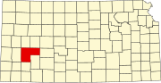 | |
|
Unincorporated communities | ||
| Ghost towns | ||
| Townships | ||
| Footnotes | †This community is designated a
Census-Designated Place (CDP) by the
United States Census Bureau. | |
|
| This article about a location in Finney County, Kansas is a stub. You can help Wikipedia by expanding it. |