Maxdale, Texas | |
|---|---|
 Maxdale  Maxdale | |
| Coordinates: 30°59′24″N 97°50′08″W / 30.99000°N 97.83556°W | |
| Country | United States |
| State | Texas |
| County | Bell |
| Elevation | 745 ft (227 m) |
| Time zone | UTC-6 ( Central (CST)) |
| • Summer ( DST) | UTC-5 (CDT) |
| Area code | 254 |
| GNIS feature ID | 1380156 [1] |
Maxdale is an unincorporated community in Bell County, in the U.S. state of Texas. [1] According to the Handbook of Texas, only four people lived in the community in 2000. It is located within the Killeen-Temple-Fort Hood metropolitan area.
History
The area in what is now known as Maxdale today was settled sometime before 1883. A post office was established at Maxdale that year and remained in operation until 1926. Twenty people were living in Maxdale in 1884, with the community having two churches and a cotton gin. A general store opened in 1914 and its population zenith was reported as 50 in 1925. There were three businesses and two churches in 1948. The population declined to 15 residents by 1968. Most of its homes were abandoned, but the Maxdale Community Center was located one mile east of where the community originally stood. Only four people lived there from 1988 through 2000. [2]
Geography
Maxdale is located on the Lampasas River, 8 mi (13 km) southwest of Killeen in southwestern Bell County, [2] on Farm to Market Road 2670. [3]
Education
Maxdale had its own school in 1884. [2] Today, the community is served by the Killeen Independent School District.
References
- ^ a b U.S. Geological Survey Geographic Names Information System: Maxdale, Texas
- ^ a b c Odintz, Mark. "Maxdale, TX". tshaonline.org. Retrieved July 14, 2022.
- ^ "Maxdale, Texas". Texas Escapes Online Magazine. Retrieved July 14, 2022.
Municipalities and communities of
Bell County, Texas, United States | ||
|---|---|---|
| Cities | 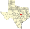 | |
| Towns | ||
| Village | ||
| CDPs | ||
|
Other communities | ||
| Ghost town | ||
| Footnotes | ‡This populated place also has portions in an adjacent county or counties | |
 | This article about a location in Bell County, Texas is a stub. You can help Wikipedia by expanding it. |