Leedale, Texas | |
|---|---|
 Leedale  Leedale | |
| Coordinates: 30°59′12″N 97°11′53″W / 30.98667°N 97.19806°W | |
| Country | United States |
| State | Texas |
| County | Bell |
| Elevation | 466 ft (142 m) |
| Time zone | UTC-6 ( Central (CST)) |
| • Summer ( DST) | UTC-5 (CDT) |
| Area code | 254 |
| GNIS feature ID | 1380073 [1] |
Leedale is an unincorporated community in Bell County, in the U.S. state of Texas. [1] According to the Handbook of Texas, the community had a population of 16 in 2000. It is located within the Killeen-Temple-Fort Hood metropolitan area.
History
Leedale was reported to have first been recognized in the early 1900s by the name of Gindale. It reported one business and 25 residents in 1946. There was a store, a gas station, and a cotton gin in the community in 1948, and the population went down to 20 in several scattered homes in 1964 until it absorbed Gindale. Its population was 16 from 1990 through 2000. [2]
Geography
Leedale is located on Farm to Market Road 437 on the Whatley Branch of South Elm Creek, 16 mi (26 km) east of Belton in southeastern Bell County. [2]
Education
Leedale was described as a school community in the early 1900s. [2] Today, the community is served by the Rogers Independent School District.
References
- ^ a b U.S. Geological Survey Geographic Names Information System: Leedale, Texas
- ^ a b c Odintz, Mark. "Leedale, TX". tshaonline.org. Retrieved July 14, 2022.
Municipalities and communities of
Bell County, Texas, United States | ||
|---|---|---|
| Cities | 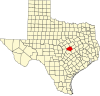 | |
| Towns | ||
| Village | ||
| CDPs | ||
|
Other communities | ||
| Ghost town | ||
| Footnotes | ‡This populated place also has portions in an adjacent county or counties | |
 | This article about a location in Bell County, Texas is a stub. You can help Wikipedia by expanding it. |