Lupton, Alabama | |
|---|---|
 Lupton  Lupton | |
| Coordinates: 33°56′10″N 87°23′50″W / 33.93611°N 87.39722°W | |
| Country | United States |
| State | Alabama |
| County | Walker |
| Elevation | 548 ft (167 m) |
| Time zone | UTC-6 ( Central (CST)) |
| • Summer ( DST) | UTC-5 (CDT) |
| Area code(s) | 205, 659 |
| GNIS feature ID | 162324 [1] |
Lupton is an unincorporated community in Walker County, Alabama, United States. Lupton is located along Alabama State Route 5, 11 miles (18 km) northwest of Jasper.
History
Lupton is home to Lupton School, an elementary/ middle school that is part of the Walker County Board of Education. [2]
Notes
- ^ "Lupton". Geographic Names Information System. United States Geological Survey, United States Department of the Interior.
- ^ "Lupton Jr. High School". Walker County Board of Education. Retrieved November 30, 2015.
Municipalities and communities of
Walker County, Alabama, United States | ||
|---|---|---|
| Cities | 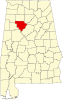 | |
| Towns | ||
|
Unincorporated communities | ||
| Footnotes | ‡This populated place also has portions in an adjacent county or counties | |
|
| This Walker County, Alabama state location article is a stub. You can help Wikipedia by expanding it. |