Corona, Alabama | |
|---|---|
 Corona  Corona | |
| Coordinates: 33°42′30″N 87°28′10″W / 33.70833°N 87.46944°W | |
| Country | United States |
| State | Alabama |
| County | Walker |
| Elevation | 325 ft (99 m) |
| Time zone | UTC-6 ( Central (CST)) |
| • Summer ( DST) | UTC-5 (CDT) |
| Area code(s) | 205, 659 |
| GNIS feature ID | 116660 [1] |
Corona is an unincorporated community in Walker County, Alabama, United States. Corona is located on Alabama State Route 18, 4.6 miles (7.4 km) west of Oakman.
History
Corona was founded in the 1880s after the Corona Coal Company opened mines here. [2] The first coal shipped from Walker County by rail came from the Corona mines. [3] A post office operated under the name Corona from 1884 to 1957. [4]
Notes
- ^ "Corona". Geographic Names Information System. United States Geological Survey, United States Department of the Interior.
- ^ Foscue, Virginia (1989). Place Names in Alabama. Tuscaloosa: The University of Alabama Press. p. 40. ISBN 0-8173-0410-X.
- ^ Armes, Ethel (1972). The Story of Coal and Iron in Alabama. Birmingham: The Book-Keepers Press. p. 502.
- ^ "Walker County". Jim Forte Postal History. Archived from the original on July 3, 2015. Retrieved November 30, 2015.
Municipalities and communities of
Walker County, Alabama, United States | ||
|---|---|---|
| Cities | 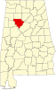 | |
| Towns | ||
|
Unincorporated communities | ||
| Footnotes | ‡This populated place also has portions in an adjacent county or counties | |
|
| This Walker County, Alabama state location article is a stub. You can help Wikipedia by expanding it. |