This article has multiple issues. Please help
improve it or discuss these issues on the
talk page. (
Learn how and when to remove these template messages)
|

Fuente el Saz de Jarama | |
|---|---|
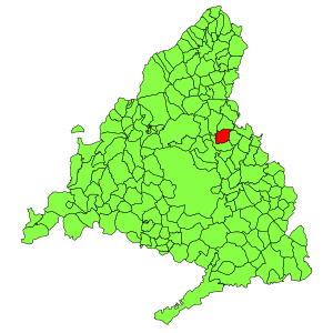
 Municipal location within the Community of Madrid. | |
| Coordinates: 40°38′10″N 3°30′40″W / 40.63611°N 3.51111°W | |
| Country | |
| Autonomous community | Community of Madrid |
| Population (2018)
[1] | |
| • Total | 6,541 |
| Time zone | UTC+1 ( CET) |
| • Summer ( DST) | UTC+2 ( CEST) |
Fuente el Saz de Jarama is a municipality of the autonomous community of Madrid in central Spain. It belongs to the comarca of Cuenca del Medio Jarama. [2]
Bus lines
- Line 184: Madrid ( Plaza de Castilla) - El Casar (Interbús)
- Line 197: Madrid (Plaza de Castilla) - Torrelaguna ( ALSA) [3]
- Line 254: Valdeolmos/Fuente el Saz - Alcalá de Henares (ALSA)
References
- ^ Municipal Register of Spain 2018. National Statistics Institute.
- ^ "Inicio". www.ayuntamientofuentelsaz.com. Retrieved 2024-01-20.
- ^ "How to get to Fuente El Saz De Jarama by Bus?". moovitapp.com. 2024-01-08. Retrieved 2024-01-20.
Wikimedia Commons has media related to
Fuente el Saz de Jarama.

