Florin | |||||||||||
|---|---|---|---|---|---|---|---|---|---|---|---|
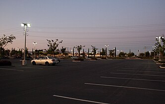
 Florin station parking lot, with a Sacramento RT train in the background | |||||||||||
| General information | |||||||||||
| Location | Florin Road at Indian Lane Sacramento, California United States | ||||||||||
| Coordinates | 38°29′52.18″N 121°28′17.64″W / 38.4978278°N 121.4715667°W | ||||||||||
| Owned by | Sacramento Regional Transit District | ||||||||||
| Platforms | 1 side platform, 1 island platform | ||||||||||
| Tracks | 2 | ||||||||||
| Connections | |||||||||||
| Construction | |||||||||||
| Structure type | At-grade | ||||||||||
| Parking | 1,076 spaces | ||||||||||
| Accessible | Yes | ||||||||||
| History | |||||||||||
| Opened | September 26, 2003 [2] | ||||||||||
| Services | |||||||||||
| |||||||||||
| Location | |||||||||||
|
| |||||||||||
Florin station is a side platformed Sacramento RT light rail station in Sacramento, California, United States. The station was opened on September 26, 2003, and is operated by the Sacramento Regional Transit District. It is served by the Blue Line. The station is located north of Florin Road at Indian Lane, and serves the surrounding residential and commercial areas along Florin Road, the Department of Human Assistance, and Luther Burbank High School.
On March 7, 2024, the decades-old Florin Certified Farmers' Market moved to the southernmost parking lot of Florin Station from its previous location near the vacant Florin Sears. [3] The market operates every Thursday morning, from 8:00 AM to 12:00 PM.
Platforms and tracks
| Freight track | ← UP Sacramento Subdivision; No passenger service → |
| Northbound | ← Blue Line toward Watt/I-80 ( 47th Avenue) |
| Island platform, doors open on the left | |
| Southbound | Blue Line toward Cosumnes River College ( Meadowview) → |
| Side platform, doors open on the right | |
| Plaza | Buses, park and ride lot, ticket machines |
Gallery
-
 The Florin Station parking lot
 -
 Florin Station sign


References
- ^ "SacRT System Map" (PDF) (Map). Sacramento Regional Transit District. August 29, 2021. Retrieved July 16, 2022.
- ^ Bizjak, Tony (September 27, 2003). "New vista for light rail – 1st new line in 16 years opens to fanfare". The Sacramento Bee. p. A1.
- ^ Staff, A. O. L. (2024-03-08). "Longtime Sacramento-area farmers market moves — and changes operators. What we know". www.aol.com. Retrieved 2024-03-11.
|
| This tram-, streetcar-, or light rail-related article is a stub. You can help Wikipedia by expanding it. |
|
| This California train station-related article is a stub. You can help Wikipedia by expanding it. |