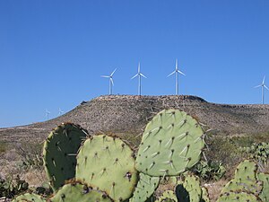
| Desert Sky Wind Farm | |
|---|---|
 Part of the Farm off of Interstate 10 | |
|
| |
| Country | United States |
| Location | Pecos County, near Iraan, Texas |
| Coordinates | 30°54′57″N 102°6′29″W / 30.91583°N 102.10806°W |
| Status | Operational |
| Owner(s) | American Electric Power (AEP) |
| Wind farm | |
| Type | |
| Power generation | |
| Nameplate capacity | 160.5 MW |
The Desert Sky Wind Farm is a 160.5 megawatt ( MW) wind power station near the far West Texas town of Iraan, in Pecos County. The wind farm consists of 107 GE wind turbines, each rated at 1.5 megawatts spread over a 15-square-mile (39 km2) area. American Electric Power (AEP) owns the facility and CPS Energy of San Antonio purchases all power produced under long-term agreements with AEP. [1]