Clarkdale Historic District | |
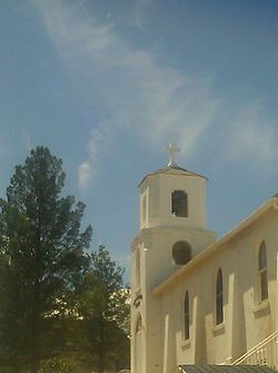
 St. Cecilia's Rectory | |
| Location | Roughly along Main St., roughly bounded by Verde R. including industrial smelter site., Clarkdale, Arizona |
|---|---|
| Coordinates | 34°46′27″N 112°3′31″W / 34.77417°N 112.05861°W |
| Architectural style | Mission/ Spanish Revival, Classical Revival, Bungalow/Craftsman |
| NRHP reference No. | 97001586 [1] |
| Added to NRHP | January 8, 1998 |
Clarkdale Historic District in Clarkdale, Arizona is a historic district that was listed on the National Register of Historic Places in 1998. [1]
Clarkdale was built as a company town for the United Verde Copper Company, owned by William A. Clark, which located a smelter in Clarkdale. [2]

Historic district contributing properties include:
- Clark Mansion
- Clarkdale Public Works Building
- Clark Memorial Clubhouse, also separately NRHP-listed
- Broadway Bridge, also separately NRHP-listed
See also

References
- ^ a b "National Register Information System". National Register of Historic Places. National Park Service. March 13, 2009.
- ^ Tommie Bain; Karl Klassen; Edward E. King; Dorothy King (June 20, 1996). "National Register of Historic Places Registration: Clarkdale Historic District". National Park Service. Retrieved December 5, 2016. with 30 photos
External links
Wikimedia Commons has media related to
St. Cecilia Catholic Church (Clarkdale, Arizona).


