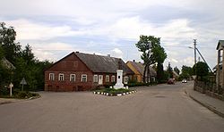
Betygala | |
|---|---|
Town | |
 Monument for
Vytautas in the center of Betygala | |
| Coordinates: 55°21′40″N 23°22′0″E / 55.36111°N 23.36667°E | |
| Country | |
| Ethnographic region | Samogitia |
| County |
|
| Municipality | Raseiniai district municipality |
| Eldership | Betygala eldership |
| Capital of | Betygala eldership |
| Population (2011) | |
| • Total | 488 |
| Time zone | UTC+2 ( EET) |
| • Summer ( DST) | UTC+3 ( EEST) |
Betygala is a small town in Kaunas County in central Lithuania. As of 2011 it had a population of 488. [1] In the 13th and 14th centuries the town had a noted Samogitan fortress, attacked by the Teutonic Knights numerous time. [2] One of the first churches in Lithuania was built in the town. Mikalojus Daukša was the parish pastor from 1592 to 1603. [2]
References
Wikimedia Commons has media related to
Betygala.
- ^ "2011 census". Statistikos Departamentas (Lithuania). Retrieved August 16, 2017.
- ^ a b Simas Sužiedėlis, ed. (1970–1978). "Betygala". Encyclopedia Lituanica. Vol. I. Boston, Massachusetts: Juozas Kapočius. pp. 338–339. LCCN 74-114275.


