You can help expand this article with text translated from
the corresponding article in Lithuanian. (June 2009) Click [show] for important translation instructions.
|
Kačerginė | |
|---|---|
Town | |
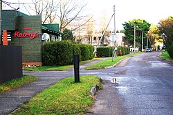
 Main street | |
| Coordinates: 54°56′0″N 23°43′10″E / 54.93333°N 23.71944°E | |
| Country | |
| Ethnographic region | Aukštaitija |
| County |
|
| Population (2015) | |
| • Total | 790 |
| Time zone | UTC+2 ( EET) |
| • Summer ( DST) | UTC+3 ( EEST) |
Kačerginė is a small town 16 km (9.9 mi) west of Kaunas. The town of Kačerginė is located in Kaunas County, central Lithuania. Kačerginė was officially proclaimed a health resort in 1933. [1] The only in Lithuania motor racing circuit Nemuno Žiedas was opened in 1960. As of 2015 it had a population of 790.
References
- ^ http://www.kacergine.lt/?lan=en Archived 2012-03-17 at the Wayback Machine Kačerginė. The history of Kačerginė
External links
- Website of Kačerginė Archived 2012-03-17 at the Wayback Machine


