Rukla | |
|---|---|
Town | |
 | |
 Coat of arms | |
 Rukla Location in Lithuania  Rukla Rukla (Lithuania) | |
| Coordinates: 55°03′10″N 24°22′40″E / 55.05278°N 24.37778°E | |
| Country | |
| Ethnographic region | Aukštaitija |
| County |
|
| Municipality | Jonava district municipality |
| Eldership | Rukla Eldership |
| Population (2021) | |
| • Total | 1,987 |
| Time zone | UTC+2 ( EET) |
| • Summer ( DST) | UTC+3 ( EEST) |
Rukla is a small town in Kaunas County in central Lithuania. In 2011 it had a population of 2,098. [1] Administrative centre of Rukla Eldership.
The national Refugees Reception Center hosts all refugees coming to the country. [2]
Military base
Five different units of the Lithuanian Armed Forces are based in Rukla. Military facilities include the Gaižiūnai military training ground (12,500 ha) and Jonava Air Base. Since 2017, Rukla hosts the NATO Enhanced Forward Presence.
Demographics
|
| |||||||||||||||||||||
| Source: 1902, 1923, 1959 & 1970, 1979, 1989, 2001, 2011 | ||||||||||||||||||||||
Gallery
-
 US M1 Abrams tank in the Gaižiūnai military training ground
 -
 M113 garrison monument of Iron Wolf brigade in Rukla, Lithuania
 -
 Refugees Reception Center
 -
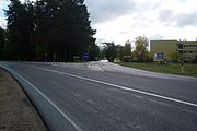 Road to Rukla


See also
References
- ^ "Kauno apskritis | Kaunas county". 2022-11-25. Archived from the original on 2022-11-25. Retrieved 2022-12-19.
- ^ "General information about Centre". Retrieved 17 August 2021.

| Towns | | |
|---|---|---|
| Villages | ||
|
| This Jonava district municipality, Kaunas County, Lithuania location article is a stub. You can help Wikipedia by expanding it. |