From Wikipedia, the free encyclopedia
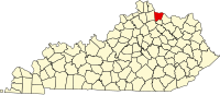
Location of Bracken County in Kentucky
This is a list of the National Register of Historic Places listings in Bracken County, Kentucky .
This is intended to be a complete list of the properties and districts on the
National Register of Historic Places in
Bracken County ,
Kentucky ,
United States . The locations of National Register properties and districts for which the latitude and longitude coordinates are included below, may be seen in a map.
[1]
There are 23 properties and districts listed on the National Register in the county.
This
National Park Service list is complete through
NPS recent listings posted April 12, 2024.
[2]
Contents: Counties in Kentucky
Current listings
[3]
Name on the Register
Image
Date listed
[4]
Location
City or town
Description
1
Augusta College Historic Buildings
Augusta College Historic Buildings
February 20, 1980 (
#80001486 ) 205 Frankfort St. and 204 Bracken St.
38°46′27″N 84°00′09″W / 38.774167°N 84.002500°W / 38.774167; -84.002500 (Augusta College Historic Buildings )
Augusta
2
Augusta Historic District
Augusta Historic District
March 13, 1984 (
#84001385 ) Roughly bounded by Riverside Dr., 5th, Frankfort, and Williams Sts.
38°46′21″N 84°00′21″W / 38.7725°N 84.005833°W / 38.7725; -84.005833 (Augusta Historic District )
Augusta
3
Baker Vineyard and Wine Cellar
Baker Vineyard and Wine Cellar
December 30, 1974 (
#74000855 ) South of Augusta on
Kentucky Route 1839 ; also 4465 W. Augusta-Chatham Rd.
38°46′07″N 83°59′39″W / 38.768722°N 83.994167°W / 38.768722; -83.994167 (Baker Vineyard and Wine Cellar )
Augusta
Augusta-Chatham Road address represents a boundary increase of July 11, 2007
4
George W. Barkley Farm
George W. Barkley Farm
June 18, 2003 (
#03000259 )
Kentucky Route 8
38°46′39″N 83°57′58″W / 38.777500°N 83.966111°W / 38.777500; -83.966111 (George W. Barkley Farm )
Augusta
5
Bold House
Upload image March 13, 2017 (
#100000734 ) 98 Main St.
38°47′55″N 84°12′48″W / 38.798744°N 84.213376°W / 38.798744; -84.213376 (Bold House )
Foster
6
Bracken County Infirmary
Bracken County Infirmary
April 16, 1979 (
#79000966 ) Northeast of Chatham on
Kentucky Route 19
38°43′02″N 84°00′48″W / 38.717222°N 84.013333°W / 38.717222; -84.013333 (Bracken County Infirmary )
Chatham
7
Bradford School House
Bradford School House
June 18, 2003 (
#03000263 ) Kentucky Routes
8 and
1109
38°46′50″N 84°08′25″W / 38.780417°N 84.140278°W / 38.780417; -84.140278 (Bradford School House )
Foster
8
Brothers-O'Neil House
Brothers-O'Neil House
May 22, 1984 (
#84001390 ) 308 Seminary Rd.
38°46′23″N 84°00′00″W / 38.773056°N 84.000000°W / 38.773056; -84.000000 (Brothers-O'Neil House )
Augusta
9
Mordecai Chalfant House
Mordecai Chalfant House
January 8, 1987 (
#87000142 )
Kentucky Route 8
38°46′01″N 84°04′58″W / 38.766806°N 84.082778°W / 38.766806; -84.082778 (Mordecai Chalfant House )
Augusta
10
Confederate Monument in Augusta
Confederate Monument in Augusta
July 17, 1997 (
#97000715 ) Payne Cemetery, north of
Kentucky Route 8
38°46′09″N 84°00′44″W / 38.769167°N 84.012222°W / 38.769167; -84.012222 (Confederate Monument in Augusta )
Augusta
11
John Gregg Fee House
Upload image August 26, 1980 (
#80001487 ) Northwest of Germantown
38°41′32″N 83°59′37″W / 38.692222°N 83.993611°W / 38.692222; -83.993611 (John Gregg Fee House )
Germantown
12
Evan Griffith's Grocery
Evan Griffith's Grocery
May 22, 1984 (
#84001392 ) 415 Railroad Ave.
38°46′25″N 84°00′04″W / 38.773611°N 84.001111°W / 38.773611; -84.001111 (Evan Griffith's Grocery )
Augusta
13
Alfonso McKibben House
Alfonso McKibben House
May 22, 1984 (
#84001394 ) 202 4th St.
38°46′13″N 84°00′30″W / 38.770278°N 84.008333°W / 38.770278; -84.008333 (Alfonso McKibben House )
Augusta
14
J. R. Minor House
J. R. Minor House
May 22, 1984 (
#84001395 ) 204 2nd St.
38°46′24″N 84°00′34″W / 38.773333°N 84.009444°W / 38.773333; -84.009444 (J. R. Minor House )
Augusta
15
Rock Spring Warehouse
Rock Spring Warehouse
January 8, 1987 (
#87000175 )
Kentucky Route 8
38°46′06″N 84°05′34″W / 38.768333°N 84.092778°W / 38.768333; -84.092778 (Rock Spring Warehouse )
Wellsburg
16
Snag Creek Site (15BK2)
Snag Creek Site (15BK2)
November 14, 1985 (
#85002821 ) Western side of Snag Creek, 0.25 miles (0.40 km) south of the
Ohio River
[5]
38°47′17″N 84°10′09″W / 38.788056°N 84.169167°W / 38.788056; -84.169167 (Snag Creek Site (15BK2) )
Willow Grove
Extends west as far as Snag Creek Road
[5]
17
Stone House on Bracken Creek
Upload image January 8, 1987 (
#87000199 ) Off
Kentucky Route 435
38°45′11″N 83°57′57″W / 38.753056°N 83.965833°W / 38.753056; -83.965833 (Stone House on Bracken Creek )
Augusta
18
Stroube House
Stroube House
January 8, 1987 (
#87000140 )
Kentucky Route 616
38°45′01″N 83°59′13″W / 38.750278°N 83.986944°W / 38.750278; -83.986944 (Stroube House )
Augusta
19
Turtle Creek Site (15BK13)
Upload image November 14, 1985 (
#85002824 )
Ohio River bank, west of Augusta
[6]
38°46′11″N 84°01′39″W / 38.769722°N 84.027500°W / 38.769722; -84.027500 (Turtle Creek Site (15BK13) )
Augusta
20
Walcott Covered Bridge
Walcott Covered Bridge
June 10, 1975 (
#75000738 ) 3.5 miles north of Brooksville on
Kentucky Route 1159 over Locust Creek
38°44′00″N 84°06′02″W / 38.733333°N 84.100556°W / 38.733333; -84.100556 (Walcott Covered Bridge )
Brooksville
21
Water Street Historic District
Water Street Historic District
September 24, 1975 (
#75000737 ) River Side Drive east to Frankfort Street and west to Ferry Street
38°46′28″N 84°00′28″W / 38.774444°N 84.007778°W / 38.774444; -84.007778 (Water Street Historic District )
Augusta
22
James Weldon House
James Weldon House
May 22, 1984 (
#84001384 ) 417 Railroad St.
38°46′25″N 84°00′03″W / 38.773611°N 84.000972°W / 38.773611; -84.000972 (James Weldon House )
Augusta
23
Wells-Keith House
Wells-Keith House
May 22, 1984 (
#84001398 ) 411-413 3rd St.
38°46′24″N 84°00′05″W / 38.773333°N 84.001389°W / 38.773333; -84.001389 (Wells-Keith House )
Augusta
See also References
^ The latitude and longitude information provided in this table was derived originally from the National Register Information System, which has been found to be fairly accurate for about 99% of listings. Some locations in this table may have been corrected to current GPS standards.
^ National Park Service,
United States Department of the Interior ,
"National Register of Historic Places: Weekly List Actions" , retrieved April 12, 2024.
^ Numbers represent an alphabetical ordering by significant words. Various colorings, defined
here , differentiate
National Historic Landmarks and
historic districts from other NRHP buildings, structures, sites or objects.
^ The eight-digit number below each date is the number assigned to each location in the
National Register Information System database, which can be viewed by clicking the number.
^
a b Pollack, David, and Cynthia E. Jobe. "The Snag Creek Site". Fort Ancient Cultural Dynamics in the Middle Ohio Valley . A. Gwynn Henderson, ed.
Madison : Prehistory, 1992. 69-82: 69-70.
^ Pollack, David, ed. The Archaeology of Kentucky: An Update .
Frankfort : Kentucky Heritage Council, 2008, 69.
Topics Lists by state Lists by insular areas Lists by associated state Other areas Related