Lenoxburg, Kentucky | |
|---|---|
 Lenoxburg  Lenoxburg | |
| Coordinates: 38°44′33″N 84°13′30″W / 38.74250°N 84.22500°W | |
| Country | United States |
| State | Kentucky |
| County | Bracken, Pendleton |
| Elevation | 922 ft (281 m) |
| Time zone | UTC-5 ( Eastern (EST)) |
| • Summer ( DST) | UTC-4 (EDT) |
| GNIS feature ID | 496288 |
Lenoxburg is an unincorporated community in Bracken and Pendleton counties, in the U.S. state of Kentucky. [1]
History
A post office was established at Lenoxburg in 1874, and remained in operation until it was discontinued in 1906. [2] The community was probably named for Samuel B. Lenox, a local merchant. [3] [4]
References
- ^ a b U.S. Geological Survey Geographic Names Information System: Lenoxburg, Kentucky
- ^ U.S. Geological Survey Geographic Names Information System: Lenoxburg Post Office (historical)
- ^ Rennick, Robert M. (August 28, 2013). Kentucky Place Names. University Press of Kentucky. p. 309. ISBN 0-8131-4401-9.
- ^ "History, origins and towns of Bracken County". The Ledger Independent. Retrieved June 4, 2019.
Municipalities and communities of
Bracken County, Kentucky, United States | ||
|---|---|---|
| Cities | 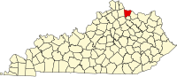 | |
|
Unincorporated communities | ||
| Ghost towns | ||
| Footnotes | ‡This populated place also has portions in an adjacent county or counties | |
Municipalities and communities of
Pendleton County, Kentucky, United States | ||
|---|---|---|
| Cities |  | |
|
Unincorporated communities | ||
| Footnotes | ‡This populated place also has portions in an adjacent county or counties | |
|
| This Bracken County, Kentucky state location article is a stub. You can help Wikipedia by expanding it. |
|
| This Pendleton County, Kentucky state location article is a stub. You can help Wikipedia by expanding it. |