Tolarville, Mississippi | |
|---|---|
 Tolarville  Tolarville | |
| Coordinates: 33°02′50″N 90°13′07″W / 33.04722°N 90.21861°W | |
| Country | United States |
| State | Mississippi |
| County | Holmes |
| Elevation | 351 ft (107 m) |
| Time zone | UTC-6 ( Central (CST)) |
| • Summer ( DST) | UTC-5 (CDT) |
| ZIP code | 39169 |
| Area code | 662 |
| GNIS feature ID | 692270 [1] |
Tolarville is an unincorporated community located in Holmes County, Mississippi, located approximately 5 miles (8.0 km) east of Thornton and approximately 9 miles (14 km) north of Coxburg. A post office operated under the name Tolarville from 1888 to 1914. [2]
References
- ^ U.S. Geological Survey Geographic Names Information System: Tolarville, Mississippi
- ^ "Holmes County". Jim Forte Postal History. Retrieved June 6, 2021.
Municipalities and communities of
Holmes County, Mississippi, United States | ||
|---|---|---|
| Cities | 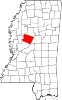 | |
| Towns | ||
|
Unincorporated communities | ||
| Ghost town | ||
|
| This Holmes County, Mississippi state location article is a stub. You can help Wikipedia by expanding it. |