Pickens, Mississippi | |
|---|---|
 Flag  Seal | |
 Location of Pickens, Mississippi | |
 Pickens, Mississippi Location in the United States | |
| Coordinates: 32°53′12″N 89°58′12″W / 32.88667°N 89.97000°W | |
| Country | United States |
| State | Mississippi |
| County | Holmes |
| Government | |
| • Mayor | Rayfield Washington |
| Area | |
| • Total | 1.30 sq mi (3.37 km2) |
| • Land | 1.28 sq mi (3.31 km2) |
| • Water | 0.02 sq mi (0.06 km2) |
| Elevation | 243 ft (74 m) |
| Population (
2020) | |
| • Total | 920 |
| • Density | 720.44/sq mi (278.24/km2) |
| Time zone | UTC-6 ( Central (CST)) |
| • Summer ( DST) | UTC-5 (CDT) |
| ZIP code | 39146 |
| Area code | 662 |
| FIPS code | 28-57200 |
| GNIS feature ID | 0675699 |
Pickens is a town in Holmes County, Mississippi, United States. Per the 2020 census, the population was 920. [2]
History
The town was named for landowner James Pickens [3] and was incorporated in 1858. [4]
On May 9, 1919, an African American veteran was lynched as part of the Red Summer of 1919 because of an “improper note” written to a white woman. [5]
Geography
Pickens is located in the southeast corner of Holmes County at 32°53′12″N 89°58′12″W / 32.88667°N 89.97000°W (32.886672, -89.970092), [6] on the west side of the Big Black River. It is bordered to the south by Yazoo County and to the east across the Big Black by Attala County.
U.S. Route 51 passes through the town, leading northeast 7 miles (11 km) to Goodman and south 19 miles (31 km) to Canton. Mississippi Highway 17 follows US 51 through Pickens, but leaves the highway south of town to lead southeast 13 miles (21 km) to Camden, and splits from US 51 north of Pickens to lead north 18 miles (29 km) to Lexington, the Holmes County seat. Mississippi Highway 432 leads west from Pickens 18 miles (29 km) to Benton. Interstate 55 passes 3 miles (5 km) west of Pickens, with access from Exit 139 (Highway 432) and Exit 144 (Highway 17). I-55 leads south 44 miles (71 km) to Jackson, the state capital, and north 70 miles (110 km) to Grenada.
According to the United States Census Bureau, the town of Pickens has a total area of 1.3 square miles (3.4 km2), of which 0.03 square miles (0.07 km2), or 1.96%, are water. [7]
Demographics
| Census | Pop. | Note | %± |
|---|---|---|---|
| 1880 | 122 | — | |
| 1900 | 504 | — | |
| 1910 | 619 | 22.8% | |
| 1920 | 457 | −26.2% | |
| 1930 | 635 | 38.9% | |
| 1940 | 688 | 8.3% | |
| 1950 | 638 | −7.3% | |
| 1960 | 727 | 13.9% | |
| 1970 | 1,012 | 39.2% | |
| 1980 | 1,386 | 37.0% | |
| 1990 | 1,285 | −7.3% | |
| 2000 | 1,325 | 3.1% | |
| 2010 | 1,157 | −12.7% | |
| 2020 | 920 | −20.5% | |
| U.S. Decennial Census
[8] 2010 [9] 2020 [10] | |||
2020 census
| Race / Ethnicity (NH = Non-Hispanic) | Pop 2010 [9] | Pop 2020 [10] | % 2010 | % 2020 |
|---|---|---|---|---|
| White alone (NH) | 138 | 62 | 11.93% | 6.74% |
| Black or African American alone (NH) | 1,003 | 847 | 86.69% | 92.07% |
| Native American or Alaska Native alone (NH) | 0 | 0 | 0.00% | 0.00% |
| Asian alone (NH) | 6 | 3 | 0.52% | 0.33% |
| Pacific Islander alone (NH) | 0 | 0 | 0.00% | 0.00% |
| Some Other Race alone (NH) | 0 | 0 | 0.00% | 0.00% |
| Mixed Race/Multi-Racial (NH) | 0 | 6 | 0.00% | 0.65% |
| Hispanic or Latino (any race) | 10 | 2 | 0.86% | 0.22% |
| Total | 1,157 | 920 | 100.00% | 100.00% |
2000 Census
As of the census [11] of 2000, there were 1,325 people, 452 households, and 333 families residing in the town. The population density was 1,062.3 inhabitants per square mile (410.2/km2). There were 496 housing units at an average density of 397.7 per square mile (153.6/km2). The racial makeup of the town was 11.92% White, 87.70% African American, 0.08% Native American, 0.08% from other races, and 0.23% from two or more races. Hispanic or Latino of any race were 1.28% of the population.
There were 452 households, out of which 34.3% had children under the age of 18 living with them, 34.7% were married couples living together, 33.8% had a female householder with no husband present, and 26.3% were non-families. 24.6% of all households were made up of individuals, and 11.1% had someone living alone who was 65 years of age or older. The average household size was 2.93 and the average family size was 3.52.
In the town, the population was spread out, with 30.9% under the age of 18, 11.2% from 18 to 24, 26.8% from 25 to 44, 19.7% from 45 to 64, and 11.4% who were 65 years of age or older. The median age was 30 years. For every 100 females, there were 89.3 males. For every 100 females age 18 and over, there were 81.5 males.
The median income for a household in the town was $17,330, and the median income for a family was $20,956. Males had a median income of $23,750 versus $17,574 for females. The per capita income for the town was $10,812. About 36.1% of families and 40.2% of the population were below the poverty line, including 51.4% of those under age 18 and 41.9% of those age 65 or over.
Education
The town of Pickens is served by the Holmes County School District. It is served by Goodman-Pickens Elementary School, between Pickens and Goodman. In 2006 the school had about 379 students. [12] High school students are zoned to Holmes County Central High School.
Notable people
- Gus Courts, civil rights activist [13]
- Odas Nicholson, attorney, judge and delegate to the Illinois Constitutional Convention
References
- ^ "2020 U.S. Gazetteer Files". United States Census Bureau. Retrieved July 24, 2022.
- ^ "Pickens town, Mississippi". United States Census Bureau. Retrieved April 15, 2022.
- ^ Rowland, Dunbar (1907). Encyclopedia of Mississippi History: Comprising Sketches of Counties, Towns, Events, Institutions and Persons|Pickens, Mississippi (page 426). S. A. Brant.
- ^ "Mississippi Rails|Pickens, Mississippi". www.msrailroads.com. Retrieved October 11, 2021.
- ^ Mikkelsen, Vincent (2007). Coming from Battle to Face a War: the Lynching of Black Soldiers in the World War I Era (PhD). The Florida State University.
- ^ "US Gazetteer files: 2010, 2000, and 1990". United States Census Bureau. February 12, 2011. Retrieved April 23, 2011.
- ^ "Geographic Identifiers: 2010 Census Summary File 1 (G001): Pickens town, Mississippi". American Factfinder. U.S. Census Bureau. Archived from the original on February 13, 2020. Retrieved August 18, 2017.
- ^ "Decennial Census of Population and Housing by Decades". US Census Bureau.
- ^ a b "P2 HISPANIC OR LATINO, AND NOT HISPANIC OR LATINO BY RACE – 2010: DEC Redistricting Data (PL 94-171) – Pickens town, Mississippi". United States Census Bureau.
- ^ a b "P2 HISPANIC OR LATINO, AND NOT HISPANIC OR LATINO BY RACE – 2020: DEC Redistricting Data (PL 94-171) – Pickens town, Mississippi". United States Census Bureau.
- ^ "U.S. Census website". United States Census Bureau. Retrieved January 31, 2008.
- ^ " Goodman-Pickens History." Goodman-Pickens Elementary School. May 4, 2006. Retrieved on July 9, 2017.
- ^ Jeffery B. Howell (March 22, 2017). Hazel Brannon Smith: The Female Crusading Scalawag. University Press of Mississippi. p. 53. ISBN 978-1-4968-1080-9.
Municipalities and communities of
Holmes County, Mississippi, United States | ||
|---|---|---|
| Cities | 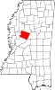 | |
| Towns | ||
|
Unincorporated communities | ||
| Ghost town | ||