Tequendama Province
Provincia de Tequendama | |
|---|---|
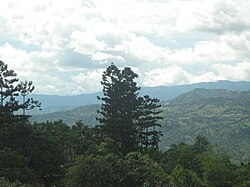
 View of
La Mesa | |
| Etymology: Tequendama | |
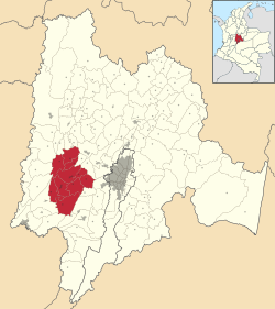
 Location of Tequendama Province in Colombia | |
| Coordinates: 4°37′58″N 74°21′08″W / 4.63278°N 74.35222°W | |
| Country | Colombia |
| Department | Cundinamarca |
| Capital | San Antonio del Tequendama |
| Municipalities | 10 |
| Time zone | UTC−05:00 ( COT) |
| Indigenous groups |
Panche Muisca |
Tequendama Province is one of the 15 provinces in the Cundinamarca Department, Colombia.
Etymology
The name Tequendama means in the Chibcha language of the Muisca; "he who precipitates downward". [1]
Subdivision
Tequendama Province comprises ten municipalities:
References
- ^ (in Spanish) Etymology Tequendama
Panorama
