Guatavita | |
|---|---|
Municipality and town | |
 Coliseum of Guatavita | |
 Flag  Seal | |
 Location of the municipality and town of Guatavita in the Cundinamarca Department of Colombia | |
 Guatavita Location in Colombia | |
| Coordinates: 4°56′4″N 73°50′4″W / 4.93444°N 73.83444°W | |
| Country | |
| Department | |
| Province | Guavio Province |
| Founded | 18 March 1593 |
| Founded by | Miguel de Ibarra |
| Government | |
| • Mayor | Robeth Yamit Peña Romero (2016-2019) |
| Area | |
| • Municipality and town | 247.3 km2 (95.5 sq mi) |
| • Urban | 6.84 km2 (2.64 sq mi) |
| Elevation | 2,680 m (8,790 ft) |
| Population (2015) | |
| • Municipality and town | 6,898 |
| • Density | 28/km2 (72/sq mi) |
| • Urban | 1,960 |
| Time zone | UTC-5 (Colombia Standard Time) |
| Website | Official website |
Guatavita is a municipality and town of Colombia in the Guavio Province of the department of Cundinamarca. Guatavita is located 75 km northeast of the capital Bogotá. It borders Sesquilé and Machetá in the north, Gachetá and Junín in the east, Guasca in the south and in the west are Tocancipá and Gachancipá. [1]
History
Before the Spanish conquest of the Muisca on the Altiplano Cundiboyacense, the central plateau in the Colombian Andes, the area was inhabited by the Muisca organized in their Muisca Confederation. Guatavita was ruled by a cacique who was a powerful figure consulted by the zipas of Bacatá and the zaques of Hunza. Guatavita was specialized in gold working. [1] An important temple honouring Sué, the Sun god in the religion of the Muisca was constructed in Guatavita. [2]
In the Guatavita Lake the new zipa was inaugurated in rituals performed by the cacique of Guatavita, represented by the famous golden Muisca raft. Around 1490 the Battle of Chocontá took place where zaque Michuá was supported by the cacique of Guatavita and lost with their outnumbered army of 60,000 guecha warriors against the zipa Saguamanchica. Both Muisca rulers died in this battle. [3]
Modern Guatavita was founded on March 18, 1593 by Miguel de Ibarra. [1]
Guatavita was rebuilt on higher ground in the mid 1960s due to the construction of the Tominé Reservoir, which intentionally flooded the area of the town.
Etymology
In the Chibcha language of the Muisca, Guachetá means "end of the farming fields" or "point of the mountain range". [1]
Economy
Main economical activities in Guatavita are agriculture, mining and tourism. In terms of agriculture most common are potatoes, maize, barley and peas. Tourism is mainly in the weekends when craft markets open in town. [1]
Guatavita Lake
The sacred and ceremonial Lake Guatavita, of the pre-Columbian Muisca is located nearby, within the Sesquilé municipality of Almeidas Province.
Gallery
-
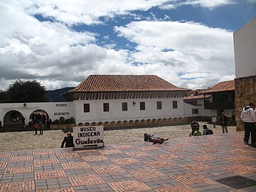 Central square
 -
 Obelisk
 -
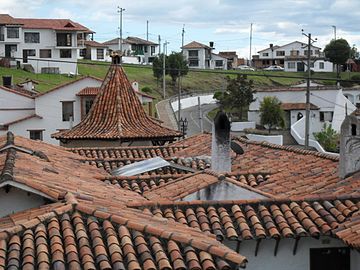 Typical houses
 -
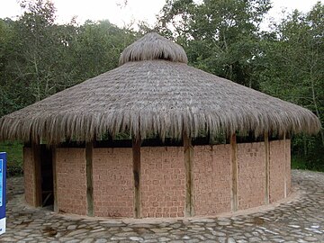 Reconstructed bohío of the Muisca


-
 Crafts market
 -
 Flowers and park
 -
 Rural area
 -
 Tominé Reservoir
.jpg)


References
- ^ a b c d e (in Spanish) Official website Guatavita Archived 2016-01-30 at the Wayback Machine - accessed 05-05-2016
- ^ Ocampo López, Javier. 2013. Mitos y leyendas indígenas de Colombia - Indigenous myths and legends of Colombia, 1-219. Plaza & Janes Editores Colombia S.A..
- ^ (in Spanish) History of the Muisca Archived 2020-10-28 at the Wayback Machine - Banco de la República - accessed 05-05-2016
External links
- Photos of Guatavita Archived 2012-02-13 at the Wayback Machine
- (in Spanish) Nature and Culture of Guatavita
| International | |
|---|---|
| National | |