| This page is an archive of past discussions. Do not edit the contents of this page. If you wish to start a new discussion or revive an old one, please do so on the current talk page. |
Suggestions, multiuse
The National Register is not a primary interest of mine, but I have dealt with many NR articles either from interest in historic architecture, or historic areas of the Nat'l Park System. However, I tried this template yesterday for " Tate House (Georgia)" and had some thoughts:
- Why not make the template multiuse, opening it up for two related NPS programs: Nat'l Historic Landmarks (as subset of the NR, anyway) and National Natural Landmarks? This could be done the same way the Template:Infobox Protected area differentiates IUCN categories. You would then need additional optional fields for NHL or NNL designation date.
- Change "Governing body" to "Owner"
- Have "Location" correspond to the place name in the NR database, with state name
- Drop "Nearest city" and add "County" -- again, another NR database column
- I would also be tempted to eliminate the locator dot option altogether, and promote a picture-only rather than a map option.
— Eoghanacht talk 12:21, 8 November 2006 (UTC)
- When I created the template, I basically copied the Protected area infobox and tweaked it a bit, just so we had something for the project. I expected/hoped that others would see ways to improve it. :)
- Now, regarding the suggestions:
- I do like the idea of distinguishing the Historic Landmarks, as they're automatically added to the Register as part of the process. And to my mind, they have more FA-article potential, so it'd be nice to bring out that aspect. As far as the Natural Landmark part, most of them don't seem to be on the Register, strangely enough. For example, only two of the ones in Florida are NRHP sites. We could add a category for it to the template, but I'm not sure there's enough overlap. Could maybe other folks look at the List of National Natural Landmarks and see how many in their states are also NRHP sites?
- Ah, the "Governing body"/"Owner" dichotomy. This one's tricky, b/c it's not always easy to tell who owns the properties. Governmental ones can usually be discovered (federal, state, county, city), but when it's privately owned, not so much. Could put an extra field for owner, though. Then maybe change "governing body" to "Administrated by" and have it automatically be NRHP.
- Can't tell you how many entries have wrong locations on the Register. Misspelled town names, even "City unavailable". Not to mention moving (e.g., a midget submarine listed on the Register in Key West was relocated to Texas years ago!). The correct city, with the state, sounds fine, though.
- If "location" becomes for city, a "county" field wouldn't be amiss. A number of archaeological sites down here in Florida aren't in any particular city, and often have their addresses restricted. But you can almost always tell what county they're in.
- I'd go for removing the map option, but so many of the sites don't have readily available pictures. Or decent ones, anyway. And it's nice to have some image in the infobox, even if it's a map. I've even noticed some folks using state maps, with the site's location within the state, which to me is even nicer. Admittedly, I've seen plenty of actor infoboxes with no pictures, and they're OK, I guess.
- Ultimately, though, all the fields are optional anyway. When not sure, I hope folks will leave them empty. Better no information than inaccurate would seem logical to me.
- I'll probably add at least one or two more of the optional fields, and see what feedback is overall. Much thanks for the ideas! :) - Ebyabe 13:53, 8 November 2006 (UTC)
- How about a category for National Monuments? Look at the List of National Monuments of the United States to see what I mean. There's not many, but I think they're mostly NRHP sites too. - Ebyabe 14:01, 8 November 2006 (UTC)
- Actually, now that I think about it, the National stuff is already pretty much covered in the Protected area infobox. Rather than add categories to this template, like the IUCN, I think it might be better to use the Protected area infobox. I figured the NRHP infobox more for "unprotected" areas (houses, commercial properties, etc.). Not wanting to reinvent the wheel, essentially, but paint it a new color. :) -- Ebyabe 15:04, 8 November 2006 (UTC)
- My thought for type/status (similar in coding used for the IUCN field on the Protected area infobox) would be to enter either "NR" "NHL" or "NNL" and it would automatically display a color coded banner under the property title indicating its designation. (Obviously, NHLs are automatically NRs also.) Adding an Nat'l Natural Landmark option made sense not because they are also NRs, but because it is a sister program of NHLs -- and therefore may benefit from a similar infobox. It was just a thought -- if you don't like it, ignor it.
- As for National Monuments (NMs), they are an odd breed. You cannot categorize them as a group easily -- here's why: All Nat'l Historic Sites, Historical Parks, Memorials, Battlefields and the like are automatically listed on the register as historic units of the National Park Service (NPS), as per the 1966 law (and therefore they are sub categories of the Wikipedia NR category). However, not all NMs are administered by the NPS. Also, the president can proclaim NMs for two reasons: 1) cultural value (i.e. historic) and 2) scientific value (i.e. natural). Many NMs were automatically added to the NR in 1966 (or when established afterwards) because they were cultural sites given to the NPS. But there are natural NMs under the NPS that are not on the register -- likewise there are cultural NMs under other agencies that have never been listed on the NR. A minor project of mine has been to wiki-categorize all NMs on the register by their state listing. I still have not finished. — Eoghanacht talk 16:47, 8 November 2006 (UTC)
- I added an option for National Historic Landmarks. Since protected areas only has an option for "Natural Monuments", which doesn't fit for buildings, I thought, "Why not?" See the article for the Cathedral Basilica of St. Augustine for an example, until we add a "how-to" here. -- Ebyabe 21:07, 8 November 2006 (UTC)
I'll take a look when I can (maybe not till early next week, though). — Eoghanacht talk 22:01, 9 November 2006 (UTC)
My infobox thoughts
- Yes, an optional line for NHLs, as I suggested over at the project talk page!
- How about setting it up a la the city and road infoboxes so it could include both an image and location map? That way you could use a map for a large historic district (there are many) if a picture won't do (Or use the pictures of individual buildings within it elsewhere in the article). Daniel Case 15:07, 8 November 2006 (UTC)
- Got a specific example? Any will do. Funny, my first major project for the Florida list was doing stubs for all the historic districts here (about 200), so I know what you mean. -- Ebyabe 15:12, 8 November 2006 (UTC)
- How does one link to a picture uploaded to the Commons? As of right now, it automatically enters image: in front of the syntax killing the link:
image:commons:image:StAnnesHillHDMap.svg
Thanks!-- Kjmoran 17:53, 23 January 2007 (UTC)
- I think there may have been a scaling problem in scaling that SVG file down to 288 pixels. When I tried it at 273 pixels (half the size of the old image), it worked fine, but 288 pixels just gave me a blank image. I took the liberty of editing your original SVG file from the Commons, scaling it to 288 pixels, and uploading it under a new name at the Commons. This appears to work properly in the infobox. Also, you don't need to specify attributes like the image width or thumbnails or anything else. I don't know if it'll break the infobox template, but it won't do what you want it to do. --
Elkman -
(Elkspeak) 18:29, 23 January 2007 (UTC)
- Thank you! -- Ebyabe 18:37, 23 January 2007 (UTC)
- I think there may have been a scaling problem in scaling that SVG file down to 288 pixels. When I tried it at 273 pixels (half the size of the old image), it worked fine, but 288 pixels just gave me a blank image. I took the liberty of editing your original SVG file from the Commons, scaling it to 288 pixels, and uploading it under a new name at the Commons. This appears to work properly in the infobox. Also, you don't need to specify attributes like the image width or thumbnails or anything else. I don't know if it'll break the infobox template, but it won't do what you want it to do. --
Elkman -
(Elkspeak) 18:29, 23 January 2007 (UTC)
- I hope this isn't a problem, but I changed the default with to 300px, since a lot of other infoboxes default to this. This change is particularly useful for those pages which use more than one infobox (such as San Francisco Armory), allowing the infoboxes to be stacked evenly. Peter G Werner 20:36, 25 April 2007 (UTC)
USA
- Should it be clarified that this is the United States National Register of Historic Places in the infobox? --
Dystopos 22:38, 15 February 2007 (UTC)
- You've got a point. Changed it to U.S., but links to United States. Don't wanna cram too many words in the box headings, that's all. Also changed the National Historic Landmark and Registered Historic District headings. -- Ebyabe 01:28, 16 February 2007 (UTC)
nrhp_type
What's the recommended way to deal with NHLs that are Historic Districts? What should be entered as nrhp_type? - Ipoellet 21:27, 26 March 2007 (UTC)
- nrhp_type is "hd" in this case. That gets expanded to {{
Infobox nrhp/NRHP hd}} when the main Infobox nrhp template is called. --
Elkman
(Elkspeak) 21:57, 26 March 2007 (UTC)
- That bothers me, though, because it loses some information. The tag "hd" leaves open whether the district is a NHL or just a NR district. My thought is to add a template subpage for {{
Infobox nrhp/NRHP nhld}}, which would display as "U.S. National Historic Landmark District". 'Course I don't know how to do that. Thoughts? -
Ipoellet 03:26, 27 March 2007 (UTC)
- You know, you're right. It's a small subset of the historic districts, but worth noting. In fact, when I was doing the stubs for List of Registered Historic Places in Florida, I started with the districts. And made the mistake of calling them all landmark districts in the articles before I understood the distinction. After I'd already finished them. So I'm still undoing that. Live and learn, I guess. Anyway, I'll cobble something together for the landmark districts, that's easy. Deciding what color, that's the hard part. :) -- Ebyabe 13:37, 27 March 2007 (UTC)
- That bothers me, though, because it loses some information. The tag "hd" leaves open whether the district is a NHL or just a NR district. My thought is to add a template subpage for {{
Infobox nrhp/NRHP nhld}}, which would display as "U.S. National Historic Landmark District". 'Course I don't know how to do that. Thoughts? -
Ipoellet 03:26, 27 March 2007 (UTC)
What about sites that are simply listed on the NRHP, but are not NHLs or HDs? Leave it blank? If so, how can a new editor know that info is not simply missing? I suggest putting "nrhp_type = nrhp" into this field in this case.-- BillFlis 23:16, 9 November 2007 (UTC)
- It defaults to that, essentially. One only needs to add a parameter if it's an HD or NHL or such. It's explained in the documentation above. - Ebyabe 00:11, 10 November 2007 (UTC)
Category:Historic districts and this infobox
Hey folks...a couple of things:
Category:Historic districts was getting unmanageably large, and since the majority of the articles were from the US, I split those out into Category:Historic districts in the United States. However, the new subcategory still has way more than 200 articles. The obvious solution would be to create subcategories for the states with the most historic district articles, but it turns out that the majority of the articles are being placed in the category by this infobox. I don't know enough about template code to get around this, or even if it's possible, but it would be great if someone did.
Also, Wikipedia:WikiProject National Register of Historic Places/Historic districts/Infobox example and this talk page are being placed in the Historic districts in the United States category. This should not be happening, as Wikipedia pages are not historic districts. - Nogood 09:26, 14 June 2007 (UTC)
Template:Location map vs Superimpose
The location map template seems to support lat / long, and since the template takes that as inputs, why not use this when they are present, and only use the superimpose when an x / y are present? pw 18:23, 19 July 2007 (UTC)
- I went ahead and made this change, it seems to work. If an image value is present it does the old behavior, if not, but lat and long are present, it uses the locator map. Let me know if any problems.
pw 16:38, 20 July 2007 (UTC)
- I added a locmapin parameter that will use a more specific location map, if one is available. See Template:Location map/doc for a listing of maps available for specific states. -- Elkman (Elkspeak) 20:58, 23 July 2007 (UTC)
How do I use this with...
...another infobox? I just created Columbia Bridge (New Hampshire) and added the NRHP infobox after the Bridges infobox. In Cornish-Windsor Covered Bridge, I added the Bridges infobox to an existing article containing the NRHP infobox. They both look clumsy. How should I do this? —The preceding unsigned comment was added by Denimadept ( talk • contribs) 03:39, August 23, 2007 (UTC).
Forced image size
The forced image size is oversized and quite large on most screens, and there seems to be no way to add a parameter to size the image used in the infobox smaller. If there is one, please explain how that is done, but if there isn't, could someone please add a parameter for optional image sizing? Thanks! Ariel ♥ Gold 02:07, 30 September 2007 (UTC)
New sizing parameters
10-Oct-2007: I am adding new sizing parameters named "imagesize" and "mapwidth" to the current revision of " Template:Infobox nrhp" defaulting as:
- imagesize=260px (current default, was 300px days ago)
- mapwidth=220 (new default, was 300 yesterday; omit "px")
Those sizing parameters are similar to options found in other infoboxes, such as for cities/towns. However, I also believe that an optional map should be displayed at the bottom, along with the top image, if available, in the manner of other infoboxes which can display both a top-image and bottom-map. For that reason, the "mapwidth" parameter is separate from the "imagesize" parameter. Changes to display both image+map are in testing for a later revision. - Wikid77 12:35, 10 October 2007 (UTC)
Bugs October 2007
10-Oct-2007: Coding of templates can be very tedious. As of 2007, the template MediaWiki language ("{{#if: ...}}") is still a beta technology, and so bugs have been difficult to detect. In particular, templates cannot (yet) detect commas in numbers or "px" added to a number, which is trivial in older computer languages.
Recent bugs have included:
- Invalid "px" for Template:Location_map width=260. Do not add "px" for the width parameter in Location_map, or else the map may expand across the screen.
- Showing "colspan=2" below "{{{name}}}" which was meant to span 2 columns, not appear as visible text. The text can be hidden by "<includeonly> colspan=2 </includeonly>". Wikitables tend to be very fragile for keyword placement, but those tables usually work quite well, if every detail is absolutely correct.
- Misspelled parameter names: The template MediaWiki language does not yet generate a concordance listing of names used, so misspelled parameter names are difficult to spot: proof-reading involves character-by-character validation across 30,000 characters or more. Yes, it is every bit that friggin wretched. Beware invalid "lon_degrees" should be "long_degrees" even though prefix "lon_" is common for longitude in other templates. A trick is to search for misspellings ("lon_" or such) to see if they occur where they shouldn't, or load a template into a spell-checker and scan the list of words used.
Please be patient about the templates; the technology is slowly improving, and everyone is suffering about templates. In a world where college dropouts are computer billionaires, it is good to have a huge sense of humor about compu-trash, but yes, phenomenally better technology is easy, when focusing beyond today's dinky computers. - Wikid77 22:36, 10 October 2007 (UTC)
- Whatever has been tweaked in the template, doesn't take, it must be somewhere else, because no version of this template shows correctly, the current revision is the one from Sept 29.
IvoShandor 17:01, 11 October 2007 (UTC)
- See above but this appears, for example: "Kellogg's Grove
(U.S. National Register of Historic Places) Optional parameters: * barcolor - background hue (default: PaleTurquoise)" IvoShandor 17:03, 11 October 2007 (UTC)
- That was actually a problem with {{ Infobox nrhp/NRHP nrhp}}. There was a "noinclude" tag missing in that template. I fixed that, and I reintroduced a "mapwidth" parameter that will be sent to the {{ Location map}} call. I experimented with this at Fort William and Mary, making the map 240 pixels instead of 300 pixels. The map gets forced to the right, instead of going to the center, but at least the dot shows up in the right place. (Right above my old school. (Ha ha.)) -- Elkman (Elkspeak) 19:18, 11 October 2007 (UTC)
More sizing parameters
12-Oct-2007: I am adding sizing parameter "boxwidth" along with "imagesize" and "mapwidth" to the current revision of " Template:Infobox nrhp" defaulting as:
- boxwidth=265px (use 300px to match prior Infobox width)
- imagesize=260px (new default, was 300px days ago)
- mapwidth=220 (current default, was 300 on 09Oct07; omit "px")
Those sizing parameters are similar to options found in other infoboxes, such as for cities/towns. However, I also believe that an optional map should be displayed at the bottom, along with the top image, if available, in the manner of other infoboxes which can display both a top-image and bottom-map. For that reason, the "mapwidth" parameter is separate from the "imagesize" parameter. Changes to display both image+map are in testing for a later revision (not in current template). - Wikid77 02:47, 12 October 2007 (UTC)
Centering stuff
12-Oct-2007: I am centering the Location_map by using both the parameter "float=center" and the wikitable directive (style="text-align: center;"). Remember, in a wikitable, after putting a cell bar ("|") in column 1, the cell-directives can be specified, such as:
colspan=2 style="text-align: center;"
Many templates have problems because the required wikitable vertical-bars do not get properly generated into column 1. I am working to fix the column-alignment bug still in the recent revisions of Template:Infobox_nrhp. - Wikid77 02:47, 12 October 2007 (UTC)
- I have also (just now) centered the top-image by adding wikitable directive "text-align:center;" to the cell containing the Superimpose template. The border around the top-image is still wide, but seems acceptable, for now. - Wikid77 14:26, 12 October 2007 (UTC)
Fixed colspan bug
12-Oct-2007: The display of the empty template was showing the literal text wrapped within 1 column rather than across 2 columns:
- colspan="2" {{Infobox nrhp/NRHP {{{nrhp_type}}} }}
The wikitable directive for "colspan" became visible due to a logic error in trying to show the literal template name "{{Infobox nrhp/NRHP..}}" in the midst of specifying the "colspan" directive without triggering the literal field by "|" (vertical-bar). Because the subtitle-template contains the 2nd half of the cell-directive, followed by the cell's literal field (designated by "|"), the mode setting is split between the Infobox-template and the subtitle-templates. The fix was to avoid calling the subtitle-template when displaying the blank-template, and simply force the cell's literal field to appear by generating "|" in the parent template, avoiding the "|" generated in the subtitle-template's literal field.
The problem is basically the issue of mode-confusion between 2 code modules: being in directive-mode and trying to show literal results, but literal-mode is triggered by the subtitle template which is never called, leaving the parent template in directive-mode and auto-forced into literal-mode showing all data, including the typically unseen directive ("colspan=2"), which is seen then but not processed. Again, the fix was to explicitly trigger the cell's literal-mode when needed, but only after the directives had been processed, not during. - Wikid77 04:23, 12 October 2007 (UTC)
Why Johnny can't wikicode
12-Oct-2007: In the spirit of "Why Johnny can't read" let me emphasize again that the template's MediaWiki language is a beta technology, an infant coding language, that is extremely error prone. (It is a "miracle" that templates work at all.) I guess the Wiki software developers have limited time to make improvements, so we're stuck with this bizarre MediaWiki language ({{#ifeq:...}}") that makes templates hard to develop.
The MediaWiki language is, very much, a toy-language, which aborts on larger templates. In computer technology, the wiki-code is a forced collision of the wikitable language, that expects row-tokens & cell-tokens ("|-" or "|" tokens) only in column-1 (egad!), jumbled together with a rambling expression language (not a statement language) that is very fragile about line breaks & code indentation, leading to rampant coding of long one-liner code sections within typical templates. The MediaWiki language doesn't even have local variables (which are trivial to implement), while supporting many template parameters, which must be re-calculated on each reference, because calculations cannot be stored in the "non-existent" local variables. Kids, don't do this: don't ever design computer languages that way: always support local variables and follow a string grammar allowing line breaks. Enough about all that. - Wikid77 14:53, 12 October 2007 (UTC)
Example locator map
The example locator map, rather than putting the dot in Florida, has the dot down in the corner. Some adjustment seems needed. ( SEWilco 18:01, 18 October 2007 (UTC))
Image size
Good lord! 200px, stop changing the infobox, everyone, please, it is stable now, and works, images shouldn't be that small in the lead anyway. IvoShandor 21:24, 22 October 2007 (UTC)
- Whether it is in the lead depends upon how many infoboxes there are. It might be Teddy Roosevelt's favorite historic Civil War railroad bridge through a city in Virginia's acquisition from the District of Columbia and get an infobox from all those characteristics. ( SEWilco 21:46, 22 October 2007 (UTC))
- Ah yes, the "let's make Wikipedia look like a spread from USA Today syndrome. Multiple infoboxes are annoying as hell. I wish we could just integrate them into one, meh, I suspect the Geoboxes will make this all a problem of the past eventually. IvoShandor ( talk) 12:52, 26 November 2007 (UTC)
Error in locator map display
There is some kind of error when using the locator pushpin function. Please see
http://en.wikipedia.org/?oldid=174093769 for an example. The error appears to be inside the {{
Superimpose}} call, specifically the line base_width = {{{imagesize|{{{image_size|260px}}}}}}. For some reason, when this nested format is used, if no size is absolutely specified in the template, Superimpose obtains blank data, which breaks functionality. It is because the two fields, imagesize and image_size, are nested in each other; when I tested sandboxed the template and tested it with just a size (260px) and without those fields, everything worked fine. This is really odd, because I've seen plenty of instances where this exact setup works fine. Any thoughts? It appears 260px should be forced as an image size, since using another size also causes minor display problems. --
Huntster
T •
@ •
C 08:05, 27 November 2007 (UTC)
NHL options
- For those working on National Historic Landmarks, I've added some new parameter options to the infobox:
- Feel free to create more for other states as needed. And if anyone can think of a more clever way to wikicode this, please do so. I just did this for a starting measure. -
Ebyabe (
talk) 21:44, 5 January 2008 (UTC)
- I think it would be more useful to use the "locmapin" parameter to classify the National Historic Landmarks by state. If "locmapin" is specified, it could go to "National Historic Landmarks in {{{locmapin}}}". We wouldn't have to create a number of other templates, and it would be a cleaner solution. (Well, I think so, anyway.) Any thoughts? --
Elkman
(Elkspeak) 22:55, 5 January 2008 (UTC)
- Looking at the code, I think I'd probably want to remove the
Category:National Historic Landmarks of the United States from {{
Infobox nrhp/NRHP nhl}} and do the categorization within this template itself ({{
infobox nrhp}}). It avoids having to pass another parameter to {{
Infobox nrhp/NRHP nhl}} (or everything else called from nrhp_type). --
Elkman
(Elkspeak) 23:02, 5 January 2008 (UTC)
- I did some experimentation in {{
X9}}, the template sandbox. See
this revision to see what I did. If I don't hear any objections, I'll add this categorization mechanism to {{
Infobox nrhp}} soon. --
Elkman
(Elkspeak) 23:25, 5 January 2008 (UTC)
- No objections here. I'm going to go ahead and remove the category from {{ Infobox nrhp/NRHP nhl}}. If need be, it can always be added back. - Ebyabe ( talk) 18:44, 12 January 2008 (UTC)
- I did some experimentation in {{
X9}}, the template sandbox. See
this revision to see what I did. If I don't hear any objections, I'll add this categorization mechanism to {{
Infobox nrhp}} soon. --
Elkman
(Elkspeak) 23:25, 5 January 2008 (UTC)
- Looking at the code, I think I'd probably want to remove the
Category:National Historic Landmarks of the United States from {{
Infobox nrhp/NRHP nhl}} and do the categorization within this template itself ({{
infobox nrhp}}). It avoids having to pass another parameter to {{
Infobox nrhp/NRHP nhl}} (or everything else called from nrhp_type). --
Elkman
(Elkspeak) 23:02, 5 January 2008 (UTC)
- I think it would be more useful to use the "locmapin" parameter to classify the National Historic Landmarks by state. If "locmapin" is specified, it could go to "National Historic Landmarks in {{{locmapin}}}". We wouldn't have to create a number of other templates, and it would be a cleaner solution. (Well, I think so, anyway.) Any thoughts? --
Elkman
(Elkspeak) 22:55, 5 January 2008 (UTC)
State locator map question
There is a consistent set of locator maps for all fifty US states that show county boundaries (or parishes in LA, boroughs in AK). Their color scheme matches that of Image:US_Locator_Blank.svg, and in the interest of full disclosure, I made all but one of them.
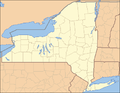
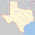
I note that the maps I made are used for 45 of the 50 states when specifying the "locmapin =" parameter. They are not currently used for California (which uses Image:California blank map.svg), Connecticut (which uses Image:Connecticut blank.svg), Louisiana (which uses Image:Lousiana-locator.png), New York (which uses Image:New York blank.svg), or Texas (which uses Image:Texas blank map.svg). None of the alternate maps shows counties (or parishes for LA), and the color schemes and inclusion or omission of major rivers in these maps is also inconsistent.
My question is (admitting my COI, so I am fine with whatever is consensus here) should the maps be consistent for all 50 states? If so, which set of maps should be used?
For comparison, here is a gallery of the maps used that do not match the other 45 states and the "consistent" alternate maps. Thanks, Ruhrfisch ><>°° 17:48, 6 February 2008 (UTC)
-
 Current CA map
 -
 Alternate CA map
 -
 Current CT map
 -
 Alternate CT map
 -
Current LA map
-
 Alternate LA map
 -
 Current NY map
 -
 Alternate NY map
 -
 Current TX map
 -
 Alternate TX map
 -
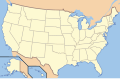 Current US Locator map, consistent with 45 state maps


- I figure it depends on what you're trying to display. It'd be best, IMO, to have one set with physical characteristics, and one set with political characteristics, from which you could choose depending on what the featured "place" was. For instance, I generally point out bridges. It makes more sense for my purposes to use a physical map, since bridges are generally used to cross physical discontinuities (rivers, valleys, river valleys...). Placing them on a political map doesn't say it as well. - Denimadept ( talk) 18:02, 6 February 2008 (UTC)
- I do like the faint county lines and consistent colors, but I see Denimadept's point too. Rivers may be more meaningful than county lines in some cases. The comprehensive solution would be to have two sets, either of which could be called, depending on the application. On another note, Rocketmaniac has created a map of GA with a small U.S. map in the corner: User:Rocketmaniac/Sandbox6. I really like the idea and I'm hoping that Ruhrfisch could create something similar for each state to replace the current locator maps. Currently, the "Infobox:protected area" is not using these state maps, but I have suggested their use at Wikipedia talk:WikiProject Protected areas#Maps for protected areas, parks, forests and other areas. They may be more inclined to use them if the U.S. map is incorporated as Rocketmania suggests. Thanks-- Appraiser ( talk) 20:22, 6 February 2008 (UTC)
- If Ruhrfisch was willing, would it be reasonable to combine both types of maps into one, wherein some shade of blue line is used alongside the faint gray lines to denote rivers? I don't see the two types of data seriously conflicting with each other visually, except in situations where the body of water forms a county's border. Even then, regular maps typically just use that water line to denote the border, rather than trying to accommodate both. As for the topic on hand, my preference lies with the maps with county borders, as that does assist visually in more circumstances than with just the rivers. — Huntster ( t • @ • c) 21:17, 6 February 2008 (UTC)

- Here is how I make these maps from US Census sources: User:Ruhrfisch/Resources#Making_Maps. I made a quick Louisiana map with both parish borders and rivers as taken from the Census at this scale. One problem is that the county borders and rivers are each one pixel wide at this level, and county and state borders take precedence over rivers. So the borders cover the rivers in several cases. The Census also does not show everthing at this level (I had to draw Lake Ponchartrain in by hand originally) so one river is missing compared to the current LA map.
- As for Rocketmaniac's map in the infobox, I like it but this only works for states with a blank area to put the US map in. Colorado or Wyoming (rectangles) have no room for an inset without covering some of the state. Even approximately square or rectangular states like Ohio or Pennsylvania or Kansas.
- Another possible way to deal with bridges and rivers is to have several maps - see for example Cogan House Covered Bridge which uses the Pennsylvania locator map and a US locator map (both in a Geobox), and a separate watershed map to show the position of the bridge on the creek. I like creeks a lot, so I can sympathize on the rivers maps. Ruhrfisch ><>°° 04:44, 7 February 2008 (UTC)
Maps with inserts
I've replaced the MN and AL maps with ones including small inserts of a US locator map (examples of usage: Chickasaw Shipyard Village Historic District and Good Templars Hall) and I have similar maps for all the states to migrate to. The rectangular states are slightly different, but with the same utility. Does anyone think this is not an improvement? I don't want to get too far into this without some feedback.-- Appraiser ( talk) 16:36, 3 March 2008 (UTC)
- First off, I like the idea and the examples shown are good. I would very much like to see an example of a rectangular state (looked at some of the others you've made on Commons, but did not see Colorado or Wyoming etc.).
- Second, some suggestions for improvement. I think that the Minnesota map should be redone so that the USA inset does not cover any of the state of MN. I also think the MN map should have a black border all the way around (it currently lacks a black border at the edge of the map at the US inset). I also think the USA inset map should have a black border all the way around it and that the borders of the inset and state maps should overlap on one edge (if on a side) or two edges (if on a corner). The US inset in the Alabama map does not have a black border all the way around and others I looked at were even more disconcerting without a border (see especially Image:Maryland Locator Map with US.PNG, where Canada on the inset blends in with Virginia and West Virginia on the Maryland map - a border would set the US inset map off more clearly).
- Third, please provide credit where credit is due - the US Census maps cited do not include any Canadian information so I drew in the Lake of the Woods on the Minnesota map by hand, or the borders of Siberia and Canada in the Alaska map or (because the Census lake borders are awful) Lake Ponchartrain in the Louisiana map (and several other lakes). If, as I strongly suspect, the state maps are the ones
User:VerruckteDan and I made, then we should also get some credit along with the Census and yourself, and the person(s) who made the US state locator inset maps should also be credited (indeed the GFDL requires this). Thanks,
Ruhrfisch
><>°° 19:30, 3 March 2008 (UTC)
- I apologize for failing to give you credit for your work on these. Indeed, I did modify yours and didn't realize that you had drawn in any features. I will absolutely correct my omission. Please accept my apology.
- I agree that a border around the inset would be an improvement and that the MN inset is slightly too large, overlapping a few acres of the state. I'm not clear about what you were saying about the border around the states. If the new border around the inset just touches the existing border around the state, does that take care of that issue?
- For the rectangular states, I had to add map space below the state map. It will require tricking the geo software by setting the southern edge to a fictitious latitude that would be equivalent if the map continued to the south using the same scale as the state map. Since it will take some work to get those running properly, I thought I'd do the others first.
- Special thanks to
User:VerruckteDan,
User:Ruhrfisch,
User:Huebi, and
User:Rocketmaniac, who have done lots of work and have come up with these ideas before I arrived. I in no way wish to overshadow their work.--
Appraiser (
talk) 20:18, 3 March 2008 (UTC)
- Oh dear. I almost didn't say anything about credit as I didn't want to make you feel bad. Please accept my apology and don't worry about it - it is just easier if the maps are credited so that if there is a problem and others fix it, they know where to go to get the source maps (the Other versions = parameter in the Commons information).
- As for the border question, I did not express myself very well or clearly. What I meant was that I think it looks neater if the boxes share a common 1 pixel wide black border where they touch. As a somewhat different example of what I mean, look at the border on the white box in the lower left corner of this map - see how there is just one border in the corner for both the map and the box (they share the border)? That is what I meant - I can make a map that does this as an example if you would rather. Thanks for all of your work on this, Ruhrfisch ><>°° 22:12, 3 March 2008 (UTC)
Params
What is the difference between the "designated", "added", and "established" parameters? The documentation only discusses added. Collectonian ( talk) 17:46, 30 March 2008 (UTC)
Place holder
Would anyone object to adding Image:HistoricPlacesNationalRegisterPlaque.JPG as an image placeholder if no image is listed within the infobox? §hep • ¡Talk to me! 22:03, 12 May 2008 (UTC)
- If nrhp2 template is used a map will appear as well as the image. If nrhp template is used, adding the placeholder will prevent a map from coming up. I'm in favor of maximizing information and I don't think the plaque adds anything. I'd rather people spend their time acquiring actual photographs. I spent a couple of hours last weekend searching
Flickr for free images and found several useful ones.--
Appraiser (
talk) 14:27, 13 May 2008 (UTC)
- Okay, I just saw other pages doing it and thought I'd suggest it. Thanks for your time. §hep • ¡Talk to me! 01:47, 14 May 2008 (UTC)
Cities and towns
I noticed this template being added to Prince Hall Mystic Cemetery, with an indication that the "nearest city" is Arlington, Massachusetts. In fact, Arlington is a town, and proud of it.
I could add an additional nearest_town parameter to the infobox, but I'm hoping there's a better solution. Ma t c hups 02:49, 27 May 2008 (UTC)
Add microformat mark-up
{{
edit protected}}
Please add an hCard microformat. To do this, please change:
{| class="infobox" style="width: {{{boxwidth|240px}}}; font-size: 90%;"
! colspan="2" style="font-size: larger; {{NRHP color}} text-align: center" | {{{name}}}<!--
to:
{| class="infobox vcard" style="width: {{{boxwidth|240px}}}; font-size: 90%;"
! colspan="2" style="font-size: larger; {{NRHP color}} text-align: center" | <span class="fn org">{{{name}}}</span><!--
and
{{{location}}}
to:
<span class="label">{{{location}}}</span>
(the latter class can be added to the TD if preferred); then add Category:Templates generating hCards and Geo to the template documentation.
Thank you. Andy Mabbett | Talk to Andy Mabbett 16:39, 21 August 2008 (UTC)
- Thank you, again. Andy Mabbett | Talk to Andy Mabbett 13:26, 23 August 2008 (UTC)
url parameter
Seems it would be a good idea to add this as an optional parameter, so that the subject's official website (if any) can be shown in the Infobox. JGHowes talk - 09:08, 23 August 2008 (UTC)
- Agreed. Andy Mabbett | Talk to Andy Mabbett 09:10, 23 August 2008 (UTC)
Coordinates display error
I'm noticing that the coordinates display incorrectly on both Firefox and Internet Explorer. They are duplicated and overlapping themselves. I uploaded a link so you can see what I mean, http://i206.photobucket.com/albums/bb293/timkloske/Coords.gif. I'm using Windows XP, 32-bit. Tkgd2007 ( talk) 14:47, 1 April 2008 (UTC)
- I expect that happens if there are coords coming from two different places, such as the nrhp infobox and the bridge infobox or one of the other sources. The fix is to not provide it more than once. - Denimadept ( talk) 14:50, 1 April 2008 (UTC)
- On that page, it's being provided by both the nrhp infobox and a Geolink template. Pick one. - Denimadept ( talk) 14:52, 1 April 2008 (UTC).
- I think the template was recently edited to show the coordinates in the top right corner as well as the infobox. That causes a problem at Haymarket affair, where the top corner shows the coordinates of the site of the Haymarket riot and the infobox shows the site of the Historic Landmark (the cemetery where those who were wrongly convicted were buried). Is it possible to restore the older version of the template, so the coordinates show only in the infobox? If somebody wants the coordinates to display in the top right corner, they can use one of the "coor title" templates. — Malik Shabazz ( talk · contribs) 00:34, 3 April 2008 (UTC)
- As an alternative, maybe the coordinate display in the top right corner could be made optional, so editors can "turn it off" when appropriate. I don't understand template coding well enough to make these sorts of changes myself. — Malik Shabazz ( talk · contribs) 00:37, 3 April 2008 (UTC)
- Agreed, we don't need the NRHP infobox to display title coord. We have plenty of other sources already doing this, so all this does is make a mess. - Denimadept ( talk) 12:40, 3 April 2008 (UTC)
- At Template talk:Coord#Display problem I point out that a style used in this infobox is causing the coordinate to be misplaced. I don't know what the most general solution would be. -- SEWilco ( talk) 18:48, 3 April 2008 (UTC)
This was happening at Woodland Terrace, Philadelphia, Pennsylvania. I fixed it by removing the coordinates from the template, but if there is a more universal solution I'd prefer that. Removing them from this template would be fine, since it does nothing but display them in the same way the Geolinks template does, but if we do that we will need to find all the instances that use this template for Geolinks and convert them.-- TexasDex ★ 20:52, 15 July 2008 (UTC)
The expression error from {{ coord}} is caused by empty values when a parameter is omitted. A solution is to supply default values of 0 to lat/long_seconds where coord is called.
{{#if: {{{lat_degrees<includeonly>|</includeonly>}}} |
{{!}} '''Coordinates:'''
{{!}} {{Coord|{{{lat_degrees|}}}|{{{lat_minutes|}}}|{{{lat_seconds|0}}}|{{{lat_direction|}}}<!--
             -->|{{{long_degrees|}}}|{{{long_minutes|}}}|{{{long_seconds|0}}}|{{{long_direction|}}}|region:US_type:landmark|display=inline,title}} }}
Maybe also to lat/long_minutes. – Leo Laursen – ☏ ⌘ 09:16, 18 July 2008 (UTC)
- Please don't pass false precision by using zero seconds. {[tl|coord}} allows D-M values. Try making the final separator conditional. Andy Mabbett (User:Pigsonthewing); Andy's talk; Andy's edits 21:49, 24 September 2008 (UTC)
Could we please change display=inline,title to just inline? - Denimadept ( talk) 15:24, 23 August 2008 (UTC)
- I agree. Since this template calls {{ coord}}, editors who use this template should have the option to tweak the display option. — Malik Shabazz ( talk · contribs) 21:12, 24 September 2008 (UTC)
nrhp_type trouble
When this template was added to
Palmer House (Dayton, Oregon), everything looked fine—in fact, the
original version still does. Now there are some garbage redlinks appearing at its top. (colspan=2
Template:Infobox nrhp/NRHP Architecture,
Exploration/Settlement) which first appeared when I added a value for the nrhp_type=. The documentation for using the template could be more succinct. Can someone help? —
EncMstr (
talk) 21:10, 25 August 2008 (UTC)
- Per Template:Infobox_nrhp#Parameters, the "nrhp_type" parameter is used to create a sub-banner which links to an article other than National Register of Historic Places. The parameter can only be one of the following: cp - Registered Historic District Contributing Property, hd - Registered Historic District, nbat - National Military Park, nhl - National Historic Landmark, nhld - National Historic Landmark District, nhs - National Historic Site, nmem - National Memorial, or nmon - National Monument) -- Dystopos ( talk) 22:46, 25 August 2008 (UTC)
Coord transform broken
If lat_seconds and long_seconds are omitted, an error occurs. Omitting these is desirable, especially for historical districts (e.g. Phoenixville Historic District). A brief look at the code seems to imply that they default to 0 if omitted. I'd guess the default needs to be 00 to avoid the error. However since seconds are optional to {{ Coord}}, this code should be changed to omit passing seconds paramter to Coord if they are not supplied. -- J Clear ( talk) 19:25, 21 September 2008 (UTC)
- This might be related: I have recently fixed a couple if instances of {{ Infobox Protected area}}, ( example) where the display was horribly broken because no seconds had been entered in the coordinates. The only way to resolve the problem in the short term was to add zero seconds, but this is obviously not an optimal solution. I reported the problem on its talk page over two weeks ago, but no-one has responded. See also my note on WT:GEO. Andy Mabbett (User:Pigsonthewing); Andy's talk; Andy's edits 19:51, 21 September 2008 (UTC)
- Still happening. Andy Mabbett (User:Pigsonthewing); Andy's talk; Andy's edits 19:39, 26 October 2008 (UTC)
- That's what many other infoboxes do. We could add support for {{ coord}}, run a bot to change all instances, then remove the current coding. Any objections? Andy Mabbett (User:Pigsonthewing); Andy's talk; Andy's edits 07:45, 29 October 2008 (UTC)
Minor image display quirk under Firefox v3.0.3
I noticed that when an image is narrower than the available box (for example, Moore Theatre (Seattle, Washington)) ... under Firefox 3.0.3, the image is left aligned; but under IE-7 the image is centered (I can check IE-6 in the morning to see if it works there as well). From looking at the code, it appears that centering is the correct formatting. Is anyone more familiar with multi-browser coding who could identify what needs adjusted here to get it to work in Firefox as well? --- Barek ( talk • contribs) - 03:46, 2 October 2008 (UTC)
- I don't know the answer to the question, but why is the image size specified anyway? Just remove that and let it fill up the box.--
Appraiser (
talk) 14:33, 2 October 2008 (UTC)
- Not sure, that's a good question. It looks like the person who put it in at first set the size. I tried blanking the value, and the image wouldn't display ... so I just removed the line completely and that seems to have resolved it. So, there seems to be some bugs in the template, but they can be avoided by just using the default value. --- Barek ( talk • contribs) - 15:04, 2 October 2008 (UTC)
Category change
I've created Category:National Register of Historic Places templates, into which this would reasonably fit; but although I'm an administrator, I can't move this there, since I don't know the coding well enough to move it. Could someone who knows the coding please move it to the new category from the current Category:National Register of Historic Places? Nyttend ( talk) 13:22, 1 December 2008 (UTC)
- I made this change to the /doc file, but I don't know if it will have any effect until the template is edited. -- J Clear ( talk) 17:57, 14 December 2008 (UTC)
New fields
{{
editprotected}}
Can the following be added to the template after the "established" parameter:
|-
{{#if: {{{delistednrhp<includeonly>|</includeonly>}}} |
{{!}} '''Removed from [[National Register of Historic Places|NRHP]]:'''
{{!}} {{{delistednrhp}}} }}
and then after the "designated" field add:
|-
{{#if: {{{removednhl<includeonly>|</includeonly>}}} |
{{!}} '''Removed as [[National Historic Landmark|NHL]]:'''
{{!}} {{{removednhl}}} }}
Thank you. Aboutmovies ( talk) 07:52, 9 January 2009 (UTC)
Contributing property
When the type is contributing property, presumably the name field should be the property. Shouldn't there be a parameter to display the parent historic district name? mpsub seems close, but, as documented, seems not quite right. -- J Clear ( talk) 12:48, 11 October 2008 (UTC)
- Offhand, that is a very reasonable suggestion. This Talk page is not very active though. It would be a good topic at wt:NRHP. If you are editing/creating NRHP articles, perhaps you should consider joining wp:NRHP, too. doncram ( talk) 12:12, 16 February 2009 (UTC)
Suggestion
There should be an optional field in the infobox where one could add a state-level historic landmark number. Such as a California Historical Landmark number. Killiondude ( talk) 04:47, 6 December 2008 (UTC)
- Actually this is implemented in new version of infobox NRHP, just deployed. See Manzanar example in the new documentation. Also, this Talk page is very inactive. Perhaps it's best to post at wt:NRHP. doncram ( talk) 12:14, 16 February 2009 (UTC)
Copy code from Template:Infobox nrhp2
{{ editprotected}}
After much discussion and preparation over at WT:NRHP, we are now ready to copy over the code from Template:Infobox nrhp2. The new code is completely backwards-compatible with this code and adds many more features, such as the ability to display both a map and an image, display local designations (state landmarks, city landmarks, etc.), and display more than one NPS designation. Also, Template:Infobox nrhp2/doc should be copied over to Template:Infobox nrhp/doc because it explains/documents the new features. Can an administrator copy over the code from these two places? If you need confirmation, the discussion can be viewed here. Thanks! -- Dudemanfellabra ( talk) 22:32, 15 February 2009 (UTC)
- Done. Cheers.-- Fuhghettaboutit ( talk) 11:45, 16 February 2009 (UTC)
Caption without image
{{ editprotected}} The template behaves badly if you have a caption but no image. --—— Gadget850 (Ed) talk - 19:33, 20 February 2009 (UTC)
{{Infobox nrhp2
|name=Foo park
|caption=Foo foo foo
}}
- I updated the code on
Template:Infobox nrhp2, the test version of this infobox. Your example shows the update now; if there isn't an image, the caption won't display.
This diff shows what changes need to be made. Can an administrator make the edit? (BTW, should we unprotect this template? or at least downgrade it to semi-protection, so I can edit it directly?) --
Dudemanfellabra (
talk) 16:46, 21 February 2009 (UTC)
- Edit done. --- RockMFR 18:44, 23 February 2009 (UTC)
Destroyed sites?
What if a site is destroyed, such as the Herndon Building (tornado) or Gilmer County Courthouse (demolition)? I would assume that the date of demise would be put in the "delisted=" field. – radiojon ( talk) 19:37, 26 February 2009 (UTC)
- Not necessarily.. to my knowledge, a site can be demolished or destroyed yet still remain on the register. I think the delisted field is only for when the site is removed from the register. --
Dudemanfellabra (
talk) 20:10, 26 February 2009 (UTC)
- Here's an example: Bedell Covered Bridge - Denimadept ( talk) 20:18, 26 February 2009 (UTC)
Code update (also question about unprotecting template)
Would anyone oppose the edits made in this diff? I added {{uc:text}} around all of the designated_othern_abbr parameters, so even if the editor doesn't write the abbreviation in capital letters, the infobox will display it in capital letters. The infobox already does this with nps designations (i.e. setting nrhp_type to nhl will display in the info section as "Designated NHL" instead of "Designated nhl").
Also, I removed the blue background color from the title bar because the nrhp bar is always shown and its background color is blue; two bars with the same color is not necessary. Also, if a site is delisted, the nrhp bar turns grey, but the title bar is still blue, so it looks awkward. Removing the blue from the title bar makes it more aesthetically pleasing.
If no one objects, I'll tag this with an editprotected request to get it done. While I'm talking about editprotected stuff, would anyone oppose reducing the protection of this template to semi-protection instead of full? Some of these edits are very minor, and involving an administrator to do them just seems like too much of a hassle. The template is sufficiently watched (if by no one else but me), so unwarranted edits will be quickly removed. Any opposition? -- Dudemanfellabra ( talk) 15:51, 11 March 2009 (UTC)
- I have no opinion about the changes. As for full protection, this template is used on tens—if not hundreds—of thousands of articles. Even if a vandal were quickly reverted, this still creates a large number of jobs in the
job queue which the servers would be working through for quite some time. I keep a close eye on this page most of the time, so when a change needs to be made, I'll probably respond to it faster than the usual
{{
editprotected}}
mechanism anyway. — EncMstr ( talk) 16:55, 11 March 2009 (UTC)
- About the changes, certainly the uc:text thing sounds fine and I think shouldn't need further discussion.
- Not sure about the blue background color change, that would actually change the overall appearance aesthetically from what has been long accepted and widely implemented, it is not so minor a change. I hear what u r saying about how it doesn't look right for delisted sites, but there are very few instances of delisted site NRHP infoboxes. Perhaps some other changes are needed for the delisted site special cases, without changing the mainstream version. Perhaps these and some further changes should be batched up and a proposal made at wt:NRHP, for discussion there or here. However, I'd rather wait a bit, both to get more into the batch for others' consideration, and to give other NRHP editors a rest about this template. Another priority for the infobox is better treatment of its use for contributing properties (e.g. to clarify that a refnum and NRHP listing date is for the NRHP, not a distinct number and date for the contributing property, and to give the NRHP name, plus perhaps more related changes).
- About protection and the problem of getting minor changes implemented, upon agreement just here, perhaps we need to get admin status for more editors who are involved here. There are numerous admins among the wt:NRHP regulars who could do this, but perhaps none interested in templates and/or they are otherwise overstretched. I'd like to nominate Dudemanfellabra, let's discuss that possibility elsewhere. doncram ( talk) 17:35, 11 March 2009 (UTC)
- Ok, so from a discussion at WT:NRHP, I've come up with a new code edit. Sometimes the infobox can be embedded into other infoboxes, so it appears that only one infobox is present. I added a new parameter embed=yes to the code at User:Dudemanfellabra/Sandbox. I readded the background color since no one was really going along with it, but the embed parameter and the uc thing have so far worked flawlessly (at least in my opinion). Comments? -- Dudemanfellabra ( talk) 21:49, 12 March 2009 (UTC)
- Sea Cliff (LIRR station), Farmingdale (LIRR station), and Greenport (LIRR station). -- Dudemanfellabra ( talk) 03:51, 13 March 2009 (UTC)
- Those test cases relating to railroad station infoboxes look okay to me. But how does this relate to use of the NRHP infobox within bridge, lighthouse, and ship infoboxes. There are some dozens of such uses. One ship infobox including NRHP infobox is
USS Pampanito, which doesn't look so great to me by the way. Would it be an option to use the embed=yes there, to improve it, and also does embed=yes have to be changed everywhere NRHP infobox is already included in another infobox. If this embed=yes option is put in, documentation should probably be revised to describe application with each of bridge, lighthouse, ship infoboxes. Examples of railroad and each of these should be included in the
Template:infobox nrhp/testcases area to be available for use in testing future changes too.
doncram (
talk) 16:15, 14 March 2009 (UTC)
- I put Manzanar, Sea Cliff (LIRR station), and USS Pampanito into the infobox nrhp/testcases area, showing what infobox nrhp/sandbox produces. Testing wise, the Dudemanfellabra/sandbox version should be put at infobox_nrhp/sandbox, and then the infobox nrhp/testcases would show the difference vs. live versions. And live versions of Sea Cliff, Farmingdale, Greenpoint articles should be put back to calling infobox nrhp, not Dudemanfellabra/Sandbox. doncram ( talk) 16:35, 14 March 2009 (UTC)
- Those test cases relating to railroad station infoboxes look okay to me. But how does this relate to use of the NRHP infobox within bridge, lighthouse, and ship infoboxes. There are some dozens of such uses. One ship infobox including NRHP infobox is
USS Pampanito, which doesn't look so great to me by the way. Would it be an option to use the embed=yes there, to improve it, and also does embed=yes have to be changed everywhere NRHP infobox is already included in another infobox. If this embed=yes option is put in, documentation should probably be revised to describe application with each of bridge, lighthouse, ship infoboxes. Examples of railroad and each of these should be included in the
Template:infobox nrhp/testcases area to be available for use in testing future changes too.
doncram (
talk) 16:15, 14 March 2009 (UTC)
- (outdent) I edited all the examples on the sandbox page to show the code in action. I also removed the links to User:Dudemanfellabra/Sandbox (but I left the "embed=yes" parameter in case this passes). I even successfully combined a lighthouse infobox with the NRHP infobox :). --
Dudemanfellabra (
talk) 17:24, 14 March 2009 (UTC)
- I was still a bit confused, as logically it seems to me we need to review the effect of the code change on infoboxes with and without additional editing in each article. So I added back test cases not using additional use of new "embed=yes" feature (by just deleting embed=yes, which I am assuming is the only difference). For the Pampanito ship example, neither the code change nor the addition of embed=yes seems to change anything. I thought maybe the embed=yes would narrow the rather wide banner for NRHP, like it is narrower for Sea Cliff. Is the difference because Pampanito does not have a pic or a map in the NRHP section? For the Sea Cliff example I am pretty sure the code change affects nothing, but then the further use of embed=yes helps. Nice work to make the lighthouse example work, it looks great, but there is no apples-to-apples comparison as the live version of the article doesn't have a merged infobox at all. Overall i am not seeing problems, and there is some advantage for the train station articles i guess, not sure why/how it helps them though, perhaps as personally i'm not that interested in train stations. :) I guess I am at "weak support" for this update now, not sure what more would bring me higher.
- Before this code, some nrhp infoboxes were able to be combined with others perfectly (for reasons unknown to me), but others were not able to be combined (again, for reasons unknown to me). The addition of this code makes the infobox embeddable in ALL situations. As in the Pampanito ship example, some infoboxes won't appear to change at all, but as in the others on the page, most will embed much better than before. I can come up with some documentation in the near future to explain methods of embedding, so it can be added to Infobox nrhp/doc, but I've been a little busy lately (I'm on spring break haha), so it'll take a while. -- Dudemanfellabra ( talk) 17:47, 16 March 2009 (UTC)
- No problem, no rush. I now strongly support making the update to allow embed=yes. Dudeman has jumped through a lot of hoops here, and there is some grumbling out there (at wt:NRHP and at DTD's comments to some other users at their Talk pages) about when is this going to be ready to go. To any Administrator who could copy in the sandbox code, I say please go ahead, and Dudeman will follow up responsibly about updating documentation (which he always has done in the past, and which should not precede the code change either unless, hmm, it is embedded in the sandbox code(?) ). Anyhow, go ahead and he'll put it into the next sandbox update. doncram ( talk) 00:07, 21 March 2009 (UTC)
One small change perhaps for this template update would be to include code that puts articles still using the designated= legacy field (rather than the designated_nrhp_type field) into a category, perhaps a hidden one, named say "Category:Cleanup on designated field needed for nrhp infobox". I have been using AWB to hunt down remaining instances of designated= but I cannot be sure to find them all (as they are not all necessarily in NHL categories where i've been hunting, and some are "designated =" or perhaps "designated =" with 2 or more spaces, etc.). This would be temporary code, to be removed after all instances addressed by AWB cleanup.
Also, in the process of hunting those (actually when searching the NHL category for instances where designated_nrhp_type= is NOT found), I noticed that there are nrhp_type=NHL or NHLD articles where there is no use of either designated= or designated_nrhp_type. If a category for these could be installed, say "Category:Cleanup on NHL date or reference needed" that would be very helpful. All of these either are to be improved by adding an NHL or NHLD designation date (available for every NHL and NHLD) and these probably lack the NHL webpage reference at the NPS that should be added. Or, they are cases where a site is labelled as being NHL or NHLD when it is not one. I observed and fixed cases of both. This also would be temporary code, to be removed after cleanup drive involving many editors manually editing, adding references, etc. doncram ( talk) 22:36, 14 March 2009 (UTC) doncram ( talk) 22:36, 14 March 2009 (UTC)
- Sure, this can be done I think. I'll work something up in the code later. Give me some redlinks for categories, and I'll create them! --
Dudemanfellabra (
talk) 17:47, 16 March 2009 (UTC)
- Okay, call them Category:NRHP infobox cleanup on legacy designated field needed and Category:NRHP infobox NHL date and reference needed. The category names can't matter too much, as they are temporary and as they will be hidden anyhow for most wikipedia users who haven't set their preferences to see hidden categories.
- Then, to make those hidden categories, I think all one needs to do is to put {{ hiddencat}} into the category pages. doncram ( talk) 18:35, 18 March 2009 (UTC)
Please eradicate the "US Registered Historic District" terminology
The infobox type "HD" identifies a property as a "Registered Historic District", but there's no such thing (this is a Wikipedia neologism being misrepresented as an official National Park Service term). What will it take to eradicate this from the template? A correct term would be "Historic District" or "National Register historic district". -- Orlady ( talk) 05:22, 6 June 2009 (UTC)
- I agree that the term in the infobox seems not correct, but it is also not clear what it should be replaced with. I think this problem has been noted before. So, the request to change it is not immediately actionable. Perhaps an acceptable terminology could be sorted out somewhere else. In a previous discussion at wt:NRHP on some similar naming issues, some of the more helpful contributions to the discussion seemed to focus on what was actual usage in practice as evidenced by google searches and references to specific NPS guidelines and documents and various state webpages. If such research could be done, and if a discussion about what would be a better term for this could be conducted civilly and come to a resolution, then indeed it would be just a technical matter to get a change into the next update of this template. doncram ( talk) 05:50, 6 June 2009 (UTC)
- As you note, this issue was discussed at great length over a period of several months. The word "Registered" was determined not to be part of the NPS nomenclature. The main Wikipedia articles about the National Register are well-researched and documented, and they are good sources regarding the correct nomenclature. The issue at discussion has not been "what are the correct terms?" but rather "what shorthand expressions should Wikipedia use in list-article titles, category names, infoboxes, etc.?"
- These are "historic districts", as correctly described in the article Historic district (United States), which is linked from the template entry and which does not anywhere use the word "registered". Simple removal of the word "Registered" from the infobox would remove the inaccuracy. Since all infoboxes for National Register-listed historic districts include the NRHP listing, it might not be necessary to repeat it in the HD header. However, to be most fully informative, the infobox could designate a district as a "National Register historic district". ("National Register" is the NPS' preferred short identifier for the National Register of Historic Places.) -- Orlady ( talk) 18:44, 6 June 2009 (UTC)
- I agree with Orlady; I think we should just remove the word "Registered". "US Historic district" concisely and accurately portrays the subject matter, so I think it is the best term to use. If no one objects, I'll remove it (The text actually comes from {{ NRHPconv}}, a backdoor template, so it is not protected.) -- Dudemanfellabra ( talk) 02:36, 9 June 2009 (UTC)
- "Registered" removed. -- Dudemanfellabra ( talk) 06:56, 11 June 2009 (UTC)
Kansas map display error
Hey I am not sure where the source of the problem is, but NRHP infoboxes in Kansas are messed up, below the map display area, when map display is chosen. Examples are Rainbow Bridge (Kansas) and Garden City High School (Kansas). I tried several KS entries at List of RHPs in KS and see the same problem. doncram ( talk) 08:05, 12 June 2009 (UTC)
- Hey never mind, i was just able to fix it, by this edit, over in the Kansas map file, which is apparently not protected and had gotten a random IP edit, probably an accident. doncram ( talk) 08:22, 12 June 2009 (UTC)
Official Structures
Sorry i could not come up with examples of the "Official Structures" in National Park Service areas earlier. I just came across McLean House (Appomattox, Virginia), which is one, within Appomattox Court House National Historical Park. Woodson Law Office is another, and about a dozen more are listed in the navbox within those articles. I am not going to argue this is the most important thing to address in wikipedia, because there are not very many wikipedia articles on these separate NPS Official Structures, but ideally I think these should be handled differently, to allow the Official Structure database number, to show the parent National Historical Park name and color rather than the NRHP name and color, and in other ways. They do not seem to me the same as contributing properties in an NRHP historic district. I think Peterson House would be one of these, probably is in that database. The Woodson Law Office and another were covered in an AfD, where there was discussion that eventually uncovered the NPS database for these. There are, I recall, more than 1,000 such structures. Many such structures do not need wikipedia articles though, while others like these ones that survived AfD seem to be okay. doncram ( talk) 05:35, 15 June 2009 (UTC)
- This is for some future refinement of the NRHP infobox, not for now. doncram ( talk) 20:23, 29 June 2009 (UTC)
Historic districts categories
Please note that I've started a discussion regarding categories on this template at Wikipedia talk:WikiProject National Register of Historic Places#Category:Historic districts in the United States. Nyttend ( talk) 14:04, 27 June 2009 (UTC)
Fix microformat
{{ editprotected}} In a recent edit, and despite the warning in the template's documentation, the required hCard microformat property "fn org" was lost, rendering the microformats emitted by this template invalid. To fix his, please change:
colspan=2 style="font-size:100%; text-align:center; background:{{NRHPconv|color|nrhp}}"|{{{name<includeonly>|{{PAGENAME}}
to:
colspan=2 class="fn org" style="font-size:100%; text-align:center; background:{{NRHPconv|color|nrhp}}"|{{{name<includeonly>|{{PAGENAME}}
Thank you. Andy Mabbett (User:Pigsonthewing); Andy's talk; Andy's edits 21:25, 25 July 2009 (UTC)
- Done. ---
RockMFR 21:32, 25 July 2009 (UTC)
- And quickly. Thank you. Andy Mabbett (User:Pigsonthewing); Andy's talk; Andy's edits 21:50, 25 July 2009 (UTC)
Coordinate display
I edited this template's documentation to show the coordinate display property to |display=inline,title, but
was reverted by
User:Dudemanfellabra, with an edit summary asserting "Those aren't the default". Wikipedia-wide convention is to display coordinates in the "title" position; that way, the article is added to Google Maps and Google Earth. Is there any good reason why my edit cannot be restored?
Andy Mabbett (User:Pigsonthewing);
Andy's talk;
Andy's edits
- Some people feel that infoboxes shouldn't affect anything outside their boundaries. Perhaps that editor is one of them? You might want to point him to this discussion. - Denimadept ( talk) 21:01, 4 August 2009 (UTC)
- I only reverted your edits because those are not the default in the infobox's code.. Your edit didn't make title display the default display; it only changed the documentation (changing the documentation doesn't change the template itself). I'm fine with changing the template to by default place the coordinates at the top of the article as well as inline, but I think we should get a few more people involved in this discussion before we change the layout of thousands of pages. Currently the default is to display coordinates only inline. --
Dudemanfellabra (
talk) 04:55, 5 August 2009 (UTC)
- My edits made no difference, nor reference, to "the default in the infobox's code"; that's a separate issue. They were to examples of how to use an optional parameter to override that default.
Andy Mabbett (User:Pigsonthewing);
Andy's talk;
Andy's edits 17:31, 5 August 2009 (UTC)
- The first part of your edit changed the template under the "Blank Template With ALL Possible Parameters" section. This section reflects the defaults of the template code. If there is no default, that parameter is left blank. If a parameter is to be changed in this section, it should be changed in the template as well. If the template is not changed, this section should not be changed. As for the example further down the page, I see what you mean. I didn't think when I was writing the documentation apparently. That can be changed to whatever you'd like. Sorry for the mix-up! --
Dudemanfellabra (
talk) 18:09, 5 August 2009 (UTC)
- Thank you, but I don't believe that the various assertions in your first second to fifth sentences, inclusive, are correct.
Andy Mabbett (User:Pigsonthewing);
Andy's talk;
Andy's edits 22:00, 5 August 2009 (UTC)
- Would you like to supply me with (a) reason(s) for your disbelief? I'm the one who wrote the documentation.. and in fact coded most of the template. I'm pretty sure I know what the section is for.--
Dudemanfellabra (
talk) 22:16, 5 August 2009 (UTC)
- My disbelief stems from my experience with hundreds of other Infobox templates on Wikipedia. And
WP:OWN.
Andy Mabbett (User:Pigsonthewing);
Andy's talk;
Andy's edits 22:31, 5 August 2009 (UTC)
- I didn't say I owned the template.. I said I coded it and knew how it worked/what it was meant for. My intention when I wrote the documentation was to make that section reflect the defaults of the parameters in the template. Regardless of whether or not "hundreds of other infobox templates" don't work that way, this one does. If you'd like to change the way it works, that's fine with me, but as of now, it's my word vs. yours, which will never get anything done, so why don't we invite more people to join this conversation – as I suggested before. --
Dudemanfellabra (
talk) 22:43, 5 August 2009 (UTC)
- And I didn't say that you said that you owned the template. Andy Mabbett (User:Pigsonthewing); Andy's talk; Andy's edits 22:47, 5 August 2009 (UTC)
- I didn't say I owned the template.. I said I coded it and knew how it worked/what it was meant for. My intention when I wrote the documentation was to make that section reflect the defaults of the parameters in the template. Regardless of whether or not "hundreds of other infobox templates" don't work that way, this one does. If you'd like to change the way it works, that's fine with me, but as of now, it's my word vs. yours, which will never get anything done, so why don't we invite more people to join this conversation – as I suggested before. --
Dudemanfellabra (
talk) 22:43, 5 August 2009 (UTC)
- My disbelief stems from my experience with hundreds of other Infobox templates on Wikipedia. And
WP:OWN.
Andy Mabbett (User:Pigsonthewing);
Andy's talk;
Andy's edits 22:31, 5 August 2009 (UTC)
- Would you like to supply me with (a) reason(s) for your disbelief? I'm the one who wrote the documentation.. and in fact coded most of the template. I'm pretty sure I know what the section is for.--
Dudemanfellabra (
talk) 22:16, 5 August 2009 (UTC)
- Thank you, but I don't believe that the various assertions in your first second to fifth sentences, inclusive, are correct.
Andy Mabbett (User:Pigsonthewing);
Andy's talk;
Andy's edits 22:00, 5 August 2009 (UTC)
- The first part of your edit changed the template under the "Blank Template With ALL Possible Parameters" section. This section reflects the defaults of the template code. If there is no default, that parameter is left blank. If a parameter is to be changed in this section, it should be changed in the template as well. If the template is not changed, this section should not be changed. As for the example further down the page, I see what you mean. I didn't think when I was writing the documentation apparently. That can be changed to whatever you'd like. Sorry for the mix-up! --
Dudemanfellabra (
talk) 18:09, 5 August 2009 (UTC)
- My edits made no difference, nor reference, to "the default in the infobox's code"; that's a separate issue. They were to examples of how to use an optional parameter to override that default.
Andy Mabbett (User:Pigsonthewing);
Andy's talk;
Andy's edits 17:31, 5 August 2009 (UTC)
(out) I like the "embed = yes" option. I use it all over the place. - Denimadept ( talk) 22:59, 5 August 2009 (UTC)
Alright, this discussion is getting a bit ridiculous, however I would like to agree with the original point, it would be nice to have coordinates shown in the title as well as inline. Perhaps this could be done with an extra parameter "coord_title=yes" or some such. What do you guys think? Sligocki ( talk) 13:23, 17 August 2009 (UTC)
- The coordinates can already be displayed in the title by using
coord_display = inline, title(coord_display=titlecan be used too, but that would make the coordinates not display in the infobox, so that is discouraged.... at least by me). Currently the default is to only display the coords in the infobox, though, so this discussion is about changing the default to show the coords in the title too. -- Dudemanfellabra ( talk) 16:00, 17 August 2009 (UTC)
The discussion seems also to me to be a bit ridiculous, especially the WP:OWN accusation and then the partial denial by User Pigsonthewing/Andrew Mabbett that he meant to be making a wp:OWN type accusation. (Or whatever, i disagree with the accusation, and don't follow the refinement that maybe the accusation wasn't meant.) Sligocki, what is the benefit of having coords show in the title line? At least for now, I think having coordinates show in the NRHP infobox, alone, is appropriate and best, to avoid unnecessary redundancy. One coords link in an article is plenty, IMHO. doncram ( talk) 19:19, 17 August 2009 (UTC)
- I have made no such denial (and neither has Andrew Mabbett). I meant what I said; no more, and no less. As to your question, I think you will find that I answered that in my first post under this heading. There will be no "unnecessary redundancy". Andy Mabbett (User:Pigsonthewing); Andy's talk; Andy's edits 19:40, 17 August 2009 (UTC)
Personally, I think the current situation is sufficient. It displays in the infobox unless it's told otherwise. What could be better? For situations where display=title is already done elsewhere, such as in another infobox, we don't want redundancy. I'd like to be able to provide the coordinates to the infobox so it will create a Location Map, but maybe not display them at all since it might be redundant with other displayers (???), like another infobox where this one is embedded. Maybe that's an answer: if "embed = yes", don't display anywhere. - Denimadept ( talk) 20:41, 17 August 2009 (UTC)
- What would be better would be to adopt the Wikipedia-wide convention for the coordinates to display in the infobox and in the "title" position; that way, the article is added to Google Maps and Google Earth. Which is exactly what I said here on 4 August. Andy Mabbett (User:Pigsonthewing); Andy's talk; Andy's edits 21:01, 17 August 2009 (UTC)
Add alt text support for accessibility
{{
editprotected}}
For
WP:ACCESSIBILITY by visually impaired readers, this template should support alt text as per
WP:ALT. I added alt text support to the sandbox in the form of new alt= and map_alt= parameters,
tested it with the test cases, and
documented the new parameters. Please install
this sandbox patch. Thanks.
Eubulides (
talk) 02:48, 16 August 2009 (UTC)
![]() Done
Hersfold (
t/
a/
c) 04:35, 16 August 2009 (UTC)
Done
Hersfold (
t/
a/
c) 04:35, 16 August 2009 (UTC)
Map Pin in wrong location
The map pin placed by this template appears in the wrong location. For both the Riverside Art Museum and Mission Inn articles, the red map pin shows on the map in San Bernardino County, not Riverside County. San Bernardino County is the large county (the largest in California) where the red map pin appears. Riverside County is the county just below it. Does anyone know how to resolve this problem? Thank you. MissionInn.Jim ( talk) 02:58, 21 August 2009 (UTC)
- Actually, the problem was with the scaling of {{ Location map California}}. I tested this by making a fake infobox for the border monument between the USA and Mexico in Tijuana. Then, I just monkeyed with the scaling at {{ Location map California}} until I got it right. I also checked the northern border with Oregon, and that looks OK. The scaling problem was probably affecting everything in southern California, with more error as you got further south. -- Elkman (Elkspeak) 04:38, 21 August 2009 (UTC)