Tatev
Տաթև | |
|---|---|
 | |
| Coordinates: 39°25′N 46°18′E / 39.417°N 46.300°E | |
| Country | Armenia |
| Province | Syunik |
| Formed | 24 November 2015 |
| Administrative centre | Shinuhayr |
| Government | |
| • Mayor | Murad Simonyan |
| Population (2011 census) | |
| • Total | 6,260 |
| Time zone | AMT ( UTC+04) |
| Postal code | 3201–3519 |
| ISO 3166 code | AM-SU |
| FIPS 10-4 | AM08 |
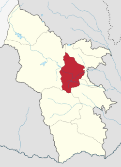
Tatev Municipality, referred to as Tatev Community ( Armenian: Տաթև Համայնք Tatev Hamaynk), is a rural community and administrative subdivision of Syunik Province of Armenia, at the south of the country. Consisted of a group of settlements, its administrative centre is the village of Shinuhayr. [1]
Included settlements
| Settlement | Type | Population (2011 census) [2] |
|---|---|---|
| Shinuhayr | Village, administrative centre | 2,661 |
| Halidzor | Village | 551 |
| Harzhis | Village | 879 |
| Kashuni | Village | 11 |
| Khot | Village | 942 |
| Svarants | Village | 264 |
| Tandzatap | Village | 88 |
| Tatev | Village | 864 |
