Shrvenants
Շրվենանց | |
|---|---|
 | |
 Shrvenants  Shrvenants | |
| Coordinates: 39°17′00″N 46°23′29″E / 39.28333°N 46.39139°E | |
| Country | |
| Province | Syunik |
| Municipality | Kapan |
| Area | |
| • Total | 5.83 km2 (2.25 sq mi) |
| Population | |
| • Total | 76 |
| • Density | 13/km2 (34/sq mi) |
| Time zone | UTC+4 ( AMT) |
Shrvenants ( Armenian: Շրվենանց) is a village in the Kapan Municipality of the Syunik Province in Armenia.
Etymology
The village was previously known as Daymadaglu.
Demographics
The Statistical Committee of Armenia reported its population was 76 in 2010, [3] down from 72 at the 2001 census. [4]
Gallery
-

-

-
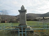 WWII memorial
 -
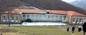 Village school
 -


References
Wikimedia Commons has media related to
Shrvenants.
- ^ "Syunik regional e-Governance System" (in Armenian). Syunik Province provincial government. Click on link entitled "Համայնքներ" (community) and search for the place by Armenian name.
- ^ Statistical Committee of Armenia. "The results of the 2011 Population Census of Armenia" (PDF).
- ^ "Marzes of Armenia and Yerevan City in Figures, 2010" (PDF). Statistical Committee of Armenia.
- ^ Report of the results of the 2001 Armenian Census, Statistical Committee of Armenia

|
| This article about a location in Syunik Province, Armenia is a stub. You can help Wikipedia by expanding it. |