| Site of Special Scientific Interest | |
 | |
| Location | Norfolk |
|---|---|
| Grid reference | TM 013 931 [1] |
| Interest | Biological |
| Area | 48.4 hectares (120 acres) [1] |
| Notification | 1984 [1] |
| Location map | Magic Map |
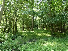
Swangey Fen, Attleborough is a 48.4-hectare (120-acre) biological Site of Special Scientific Interest south-west of Attleborough in Norfolk. [1] [2] It is part of the Norfolk Valley Fens Special Area of Conservation. [3]
Part of this site is spring fed fen with diverse flora, including grass of Parnassus, marsh helleborine and several rare mosses. The fen is surrounded by wet woodland and grassland. [4]
Much of this site is private but there is public access to an area formerly managed by the Norfolk Wildlife Trust off Fen Street
Wikimedia Commons has media related to
Swangey Fen.
References
- ^ a b c d "Designated Sites View: Swangey Fen, Attleborough". Sites of Special Scientific Interest. Natural England. Retrieved 22 July 2018.
- ^ "Map of Swangey Fen, Attleborough". Sites of Special Scientific Interest. Natural England. Retrieved 22 July 2018.
- ^ "Designated Sites View: Norfolk Valley Fens". Special Areas of Conservation. Natural England. Retrieved 25 May 2018.
- ^ "Swangey Fen, Attleborough citation". Sites of Special Scientific Interest. Natural England. Retrieved 22 July 2018.