Sint Philipsland | |
|---|---|
Village | |
 Street view with Dutch Reformed church | |
 Flag  Coat of arms | |
 Sint Philipsland Location in the province of Zeeland in the Netherlands  Sint Philipsland Sint Philipsland (Netherlands) | |
| Coordinates: 51°37′1″N 4°9′52″E / 51.61694°N 4.16444°E | |
| Country | Netherlands |
| Province | Zeeland |
| Municipality | Tholen |
| Area | |
| • Total | 25.58 km2 (9.88 sq mi) |
| Elevation | 0.7 m (2.3 ft) |
| Population (2021)
[1] | |
| • Total | 2,440 |
| • Density | 95/km2 (250/sq mi) |
| Time zone | UTC+1 ( CET) |
| • Summer ( DST) | UTC+2 ( CEST) |
| Postal code | 4675
[1] |
| Dialing code | 0167 |
Sint Philipsland is a village in the Dutch province of Zeeland. Sint Philpsland is also the name of the (former) island on which the village lies. It is a part of the municipality of Tholen, and lies about 16 km northwest of Bergen op Zoom.
History
The village was first mentioned between 1490 and 1495 as "Ecclesia sti Philippi Apostoli, St. Philipskerc", and is named after Philip the Apostle. The area was diked in 1487 by order of Anna van Bourgondië, the illegitimate daughter of Philip the Good. [3] The first village was flooded in 1509 and 1530, and subsequently abandoned. In 1642, the land was reclaimed again and a regular patterned village with front and back street was constructed. [4]
The Dutch Reformed church was built in 1668 in a neoclassic style with Doric columns. In 1953, an association building was attached to the western side of the church. [4]
Sint Philipsland was home to 654 people in 1840. [5] In 1884, Sint Philipsland was connected to North Brabant via the Slaakdam and no longer an island. [4] Sint Philipsland was severely affected by the North Sea flood of 1953 and ten people were killed. [6]
Sint Philipsland was a separate municipality until 1995, when it was merged with Tholen. [7]
Notable people
- Leen Quist (1942–2014), ceramist
Gallery
-
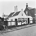 House in Sint Philipsland
 -
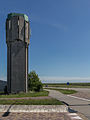 Water tower of Sint Philipsland


References
- ^
a
b
c
"Kerncijfers wijken en buurten 2021". Central Bureau of Statistics. Retrieved 22 April 2022.
two entries
- ^ "Postcodetool for 4675AP". Actueel Hoogtebestand Nederland (in Dutch). Het Waterschapshuis. Retrieved 22 April 2022.
- ^ "Sint Philipsland - (geografische naam)". Etymologiebank (in Dutch). Retrieved 22 April 2022.
- ^ a b c Piet van Cruyningen & Ronald Stenvert (2003). Sint Philipsland (in Dutch). Zwolle: Waanders. ISBN 90 400 8830 6. Retrieved 22 April 2022.
- ^ "Sint Philipsland". Plaatsengids (in Dutch). Retrieved 22 April 2022.
- ^ "Sint Philipsland". Zalig Zeeland (in Dutch). Retrieved 22 April 2022.
- ^ Ad van der Meer and Onno Boonstra, Repertorium van Nederlandse gemeenten, KNAW, 2011.