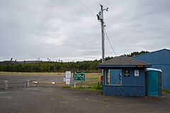
Siletz Bay State Airport | |||||||||||
|---|---|---|---|---|---|---|---|---|---|---|---|
 | |||||||||||
| Summary | |||||||||||
| Airport type | Public | ||||||||||
| Operator | Oregon Department of Aviation | ||||||||||
| Location | Gleneden Beach, Oregon | ||||||||||
| Elevation AMSL | 69 ft / 21 m | ||||||||||
| Coordinates | 44°52′36.9200″N 124°01′42.67″W / 44.876922222°N 124.0285194°W | ||||||||||
| Runways | |||||||||||
| |||||||||||
Siletz Bay State Airport ( FAA LID: S45) is a public airport located one mile (1.6 km) southeast of Gleneden Beach in Lincoln County, Oregon, United States. The airfield is located to the south of its namesake Siletz Bay.
External links
- Aerial photo of the airport by "drmargy" at Flickr
- Resources for this airport:
- FAA airport information for S45
- AirNav airport information for S45
- FlightAware airport information and live flight tracker
- SkyVector aeronautical chart for S45