Shapuri Bridge پل اشکسه | |
|---|---|
 | |
| Coordinates | 33°28′05″N 48°20′19″E / 33.468108°N 48.338663°E |
| Locale | Khorramabad, Iran |
| Other name(s) | Broken bridge |
| Characteristics | |
| Total length | 312 |
| Height | 10.75 |
| History | |
| Construction end | Sassanid Empire era |
| Location | |
|
| |
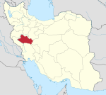
Shapuri Bridge ( Persian: پل شاپوری) or Broken Bridge ( Persian: پل شکسته) (in Lurish called: طاقِ پیلِ اِشکِسَه) is a historical bridge dating from the Sassanid era, it is located south of Khorramabad, in the Lorestan province of Iran. The bridge has 28 arches, of which only 6 remain, and 27 Pile bridges, each 61 square meters; five of its arches are intact and the others have been destroyed by natural factors. [1] The arches of the bridge have been constructed of stone, whereas the bridge itself is a mixture of stone and mortar. [2] Shapoori Bridge is registered on the list of National Monuments. [1]
References
- ^ a b "On a Bridge From Past to Present". Financial tribune. Retrieved 26 September 2017.
- ^ "Shapouri Bridge, Khoram Abad". Virtual Country. Virtual Country. Retrieved 26 September 2017.

