
| Marine habitats |
|---|
| Coastal habitats |
| Ocean surface |
| Open ocean |
| Sea floor |
The seabed (also known as the seafloor, sea floor, ocean floor, and ocean bottom) is the bottom of the ocean. All floors of the ocean are known as 'seabeds'.
The structure of the seabed of the global ocean is governed by plate tectonics. Most of the ocean is very deep, where the seabed is known as the abyssal plain. Seafloor spreading creates mid-ocean ridges along the center line of major ocean basins, where the seabed is slightly shallower than the surrounding abyssal plain. From the abyssal plain, the seabed slopes upward toward the continents and becomes, in order from deep to shallow, the continental rise, slope, and shelf. The depth within the seabed itself, such as the depth down through a sediment core, is known as the "depth below seafloor". The ecological environment of the seabed and the deepest waters are collectively known, as a habitat for creatures, as the " benthos".
Most of the seabed throughout the world's oceans is covered in layers of marine sediments. Categorized by where the materials come from or composition, these sediments are classified as either: from land ( terrigenous), from biological organisms (biogenous), from chemical reactions (hydrogenous), and from space (cosmogenous). Categorized by size, these sediments range from very small particles called clays and silts, known as mud, to larger particles from sand to boulders.
Features of the seabed are governed by the physics of sediment transport and by the biology of the creatures living in the seabed and in the ocean waters above. Physically, seabed sediments often come from the erosion of material on land and from other rarer sources, such as volcanic ash. Sea currents transport sediments, especially in shallow waters where tidal energy and wave energy cause resuspension of seabed sediments. Biologically, microorganisms living within the seabed sediments change seabed chemistry. Marine organisms create sediments, both within the seabed and in the water above. For example, phytoplankton with silicate or calcium carbonate shells grow in abundance in the upper ocean, and when they die, their shells sink to the seafloor to become seabed sediments.
Human impacts on the seabed are diverse. Examples of human effects on the seabed include exploration, plastic pollution, and exploitation by mining and dredging operations. To map the seabed, ships use acoustic technology to map water depths throughout the world. Submersible vehicles help researchers study unique seabed ecosystems such as hydrothermal vents. Plastic pollution is a global phenomenon, and because the ocean is the ultimate destination for global waterways, much of the world's plastic ends up in the ocean and some sinks to the seabed. Exploitation of the seabed involves extracting valuable minerals from sulfide deposits via deep sea mining, as well as dredging sand from shallow environments for construction and beach nourishment.
Structure


Most of the oceans have a common structure, created by common physical phenomena, mainly from tectonic movement, and sediment from various sources. The structure of the oceans, starting with the continents, begins usually with a continental shelf, continues to the continental slope – which is a steep descent into the ocean, until reaching the abyssal plain – a topographic plain, the beginning of the seabed, and its main area. The border between the continental slope and the abyssal plain usually has a more gradual descent, and is called the continental rise, which is caused by sediment cascading down the continental slope.[ citation needed]
The mid-ocean ridge, as its name implies, is a mountainous rise through the middle of all the oceans, between the continents. Typically a rift runs along the edge of this ridge. Along tectonic plate edges there are typically oceanic trenches – deep valleys, created by the mantle circulation movement from the mid-ocean mountain ridge to the oceanic trench. [1]
Hotspot volcanic island ridges are created by volcanic activity, erupting periodically, as the tectonic plates pass over a hotspot. In areas with volcanic activity and in the oceanic trenches there are hydrothermal vents – releasing high pressure and extremely hot water and chemicals into the typically freezing water around it.
Deep ocean water is divided into layers or zones, each with typical features of salinity, pressure, temperature and marine life, according to their depth. Lying along the top of the abyssal plain is the abyssal zone, whose lower boundary lies at about 6,000 m (20,000 ft). The hadal zone – which includes the oceanic trenches, lies between 6,000 and 11,000 metres (20,000–36,000 ft) and is the deepest oceanic zone. [2] [3]
Depth below seafloor
Depth below seafloor is a vertical coordinate used in geology, paleontology, oceanography, and petrology (see ocean drilling). The acronym "mbsf" (meaning "meters below the seafloor") is a common convention used for depths below the seafloor. [4] [5]
- Different seabeds in the world's oceans
-
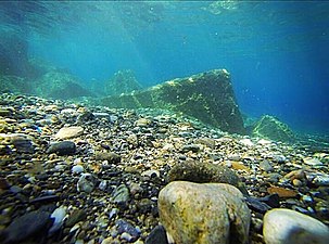 gravel seabed in Italy
 -
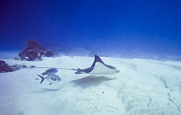 white sand seabed in Mexico
 -
 sand seabed in Greece
 -
 hydrothermal vents

_in_Cozumel,_Mexico.jpg)

.jpg)
Sediments
.jpg)
Sediments in the seabed vary in origin, from eroded land materials carried into the ocean by rivers or wind flow, waste and decompositions of sea creatures, and precipitation of chemicals within the sea water itself, including some from outer space. [6] There are four basic types of sediment of the sea floor:
- Terrigenous (also lithogenous) describes the sediment from continents eroded by rain, rivers, and glaciers, as well as sediment blown into the ocean by the wind, such as dust and volcanic ash.
- Biogenous material is the sediment made up of the hard parts of sea creatures, mainly phytoplankton, that accumulate on the bottom of the ocean.
- Hydrogenous sediment is material that precipitates in the ocean when oceanic conditions change, or material created in hydrothermal vent systems.
- Cosmogenous sediment comes from extraterrestrial sources. [7]
Terrigenous and biogenous

.jpg)
Terrigenous sediment is the most abundant sediment found on the seafloor. Terrigenous sediments come from the continents. These materials are eroded from continents and transported by wind and water to the ocean. Fluvial sediments are transported from land by rivers and glaciers, such as clay, silt, mud, and glacial flour. Aeolian sediments are transported by wind, such as dust and volcanic ash. [8]
Biogenous sediment is the next most abundant material on the seafloor. Biogenous sediments are biologically produced by living creatures. Sediments made up of at least 30% biogenous material are called "oozes." There are two types of oozes: Calcareous oozes and Siliceous oozes. Plankton grow in ocean waters and create the materials that become oozes on the seabed. Calcareous oozes are predominantly composed of calcium shells found in phytoplankton such as coccolithophores and zooplankton like the foraminiferans. These calcareous oozes are never found deeper than about 4,000 to 5,000 meters because at further depths the calcium dissolves. [9] Similarly, Siliceous oozes are dominated by the siliceous shells of phytoplankton like diatoms and zooplankton such as radiolarians. Depending on the productivity of these planktonic organisms, the shell material that collects when these organisms die may build up at a rate anywhere from 1 mm to 1 cm every 1000 years. [9]
Hydrogenous and cosmogenous

Hydrogenous sediments are uncommon. They only occur with changes in oceanic conditions such as temperature and pressure. Rarer still are cosmogenous sediments. Hydrogenous sediments are formed from dissolved chemicals that precipitate from the ocean water, or along the mid-ocean ridges, they can form by metallic elements binding onto rocks that have water of more than 300 °C circulating around them. When these elements mix with the cold sea water they precipitate from the cooling water. [9] Known as manganese nodules, they are composed of layers of different metals like manganese, iron, nickel, cobalt, and copper, and they are always found on the surface of the ocean floor. [9]
Cosmogenous sediments are the remains of space debris such as comets and asteroids, made up of silicates and various metals that have impacted the Earth. [10]
Size classification

Another way that sediments are described is through their descriptive classification. These sediments vary in size, anywhere from 1/4096 of a mm to greater than 256 mm. The different types are: boulder, cobble, pebble, granule, sand, silt, and clay, each type becoming finer in grain. The grain size indicates the type of sediment and the environment in which it was created. Larger grains sink faster and can only be pushed by rapid flowing water (high energy environment) whereas small grains sink very slowly and can be suspended by slight water movement, accumulating in conditions where water is not moving so quickly. [12] This means that larger grains of sediment may come together in higher energy conditions and smaller grains in lower energy conditions.
Benthos

Benthos (from Ancient Greek βένθος (bénthos) 'the depths [of the sea]'), also known as benthon, is the community of organisms that live on, in, or near the bottom of a sea, river, lake, or stream, also known as the benthic zone. [13] This community lives in or near marine or freshwater sedimentary environments, from tidal pools along the foreshore, out to the continental shelf, and then down to the abyssal depths.
Many organisms adapted to deep-water pressure cannot survive in the upper parts of the water column. The pressure difference can be very significant (approximately one atmosphere for every 10 metres of water depth). [14]
Because light is absorbed before it can reach deep ocean water, the energy source for deep benthic ecosystems is often organic matter from higher up in the water column that drifts down to the depths. This dead and decaying matter sustains the benthic food chain; most organisms in the benthic zone are scavengers or detritivores.
The term benthos, coined by Haeckel in 1891, [15] comes from the Greek noun βένθος 'depth of the sea'. [13] [16] Benthos is used in freshwater biology to refer to organisms at the bottom of freshwater bodies of water, such as lakes, rivers, and streams. [17] There is also a redundant synonym, Benton. [18]Topography

Seabed topography (ocean topography or marine topography) refers to the shape of the land ( topography) when it interfaces with the ocean. These shapes are obvious along coastlines, but they occur also in significant ways underwater. The effectiveness of marine habitats is partially defined by these shapes, including the way they interact with and shape ocean currents, and the way sunlight diminishes when these landforms occupy increasing depths. Tidal networks depend on the balance between sedimentary processes and hydrodynamics however, anthropogenic influences can impact the natural system more than any physical driver. [19]
Marine topographies include coastal and oceanic landforms ranging from coastal estuaries and shorelines to continental shelves and coral reefs. Further out in the open ocean, they include underwater and deep sea features such as ocean rises and seamounts. The submerged surface has mountainous features, including a globe-spanning mid-ocean ridge system, as well as undersea volcanoes, [20] oceanic trenches, submarine canyons, oceanic plateaus and abyssal plains.
The mass of the oceans is approximately 1.35×10¹⁸ metric tons, or about 1/4400 of the total mass of the Earth. The oceans cover an area of 3.618×10⁸ km2 with a mean depth of 3,682 m, resulting in an estimated volume of 1.332×10⁹ km3. [21]
Features

Each region of the seabed has typical features such as common sediment composition, typical topography, salinity of water layers above it, marine life, magnetic direction of rocks, and sedimentation. Some features of the seabed include flat abyssal plains, mid-ocean ridges, deep trenches, and hydrothermal vents.
Seabed topography is flat where layers of sediments cover the tectonic features. For example, the abyssal plain regions of the ocean are relatively flat and covered in many layers of sediments. [22] Sediments in these flat areas come from various sources, including but not limited to: land erosion sediments from rivers, chemically precipitated sediments from hydrothermal vents, Microorganism activity, sea currents eroding the seabed and transporting sediments to the deeper ocean, and phytoplankton shell materials.
Where the seafloor is actively spreading and sedimentation is relatively light, such as in the northern and eastern Atlantic Ocean, the original tectonic activity can be clearly seen as straight line "cracks" or "vents" thousands of kilometers long. These underwater mountain ranges are known as mid-ocean ridges. [7]
Other seabed environments include hydrothermal vents, cold seeps, and shallow areas. Marine life is abundant in the deep sea around hydrothermal vents. [23] Large deep sea communities of marine life have been discovered around black and white smokers — vents emitting chemicals toxic to humans and most vertebrates. This marine life receives its energy both from the extreme temperature difference (typically a drop of 150 degrees) and from chemosynthesis by bacteria. Brine pools are another seabed feature, [24] usually connected to cold seeps. In shallow areas, the seabed can host sediments created by marine life such as corals, fish, algae, crabs, marine plants and other organisms.
Human impact
Exploration
The seabed has been explored by submersibles such as Alvin and, to some extent, scuba divers with special equipment. Hydrothermal vents were discovered in 1977 by researchers using an underwater camera platform. [23] In recent years satellite measurements of ocean surface topography show very clear maps of the seabed, [25] and these satellite-derived maps are used extensively in the study and exploration of the ocean floor.
Plastic pollution
In 2020 scientists created what may be the first scientific estimate of how much microplastic currently resides in Earth's seafloor, after investigating six areas of ~3 km depth ~300 km off the Australian coast. They found the highly variable microplastic counts to be proportionate to plastic on the surface and the angle of the seafloor slope. By averaging the microplastic mass per cm3, they estimated that Earth's seafloor contains ~14 million tons of microplastic – about double the amount they estimated based on data from earlier studies – despite calling both estimates "conservative" as coastal areas are known to contain much more microplastic pollution. These estimates are about one to two times the amount of plastic thought – per Jambeck et al., 2015 – to currently enter the oceans annually. [26] [27] [28]
Exploitation
.png)
Deep sea mining is the extraction of minerals from the ocean floor at depths of 200 metres (660 ft) [30] [31] to 6,500 metres (21,300 ft). [32] [33] [34]
Deep-sea mining uses hydraulic pumps or bucket systems that carry deposits to the surface for processing.
The environmental impact of deep sea mining is controversial. [35] [36] Environmental advocacy groups such as Greenpeace and the Deep Sea Mining Campaign [37] claimed that seabed mining has the potential to damage deep sea ecosystems and spread pollution from heavy metal-laden plumes. [38] Critics have called for moratoria [39] [40] or permanent bans. [41] Opposition campaigns enlisted the support of some industry figures, including firms reliant on the target metals. Individual countries with significant deposits within their exclusive economic zones (EEZ's) are exploring the subject. [42] [43]
As of 2022, no commercial deep sea mining was underway. However, the International Seabed Authority granted 19 exploration licenses for polymetallic nodules within the Clarion Clipperton Zone. [44] China has exclusive rights to mine 92,000 square miles (240,000 km2) or 17 percent of the area. Mining is set to begin in 2025. [45] In 2022 the Cook Islands Seabed Minerals Authority (SBMA) granted 3 exploration licenses for polymetallic nodules within their EEZ. [46] Papua New Guinea was the first country to approve a DSM permit, to Solwara 1, even though three independent reviews of the environmental impact statement mine alleged significant gaps and flaws in the underlying science. [47]
Related technologies include robotic mining machines, as surface ships, and offshore and onshore metal refineries. [48] [49]
Wind farms, solar energy, electric cars, and battery technologies use many of the deep-sea metals. [48]
As of 2021, the majority of marine mining used dredging operations at depths of about 200 m, where sand, silt and mud for construction purposes is abundant, along with mineral rich sands containing ilmenite and diamonds. [50] [51]In art and culture
Some children's play songs include elements such as "There's a hole at the bottom of the sea", or "A sailor went to sea... but all that he could see was the bottom of the deep blue sea".
On and under the seabed are archaeological sites of historic interest, such as shipwrecks and sunken towns. This underwater cultural heritage is protected by the UNESCO Convention on the Protection of the Underwater Cultural Heritage. The convention aims at preventing looting and the destruction or loss of historic and cultural information by providing an international legal framework. [52]
See also
- Bottom trawling – Fishing method for fishing trawlers
- Demersal fish – Fish that live and feed on or near the bottom of seas or lakes
- Human outpost – Human habitats located in environments inhospitable for humans
- International waters – Water outside of national jurisdiction
- Manganese nodule – Mineral concretion on the sea bottom made of concentric layers of iron/manganese hydroxides
- Methane clathrate – Methane-water lattice compound
- Nepheloid layer – layer of water in the deep ocean basin, above the ocean floor, that contains significant amounts of suspended sediment
- New Zealand foreshore and seabed controversy – Indigenous rights controversy
- Offshore geotechnical engineering – Sub-field of engineering concerned with human-made structures in the sea
- Petrological Database of the Ocean Floor ( PetBD)
- Plate tectonics – Movement of Earth's lithosphere
- Research vessel – Ship or boat designed, modified, or equipped to carry out research at sea
- Seabed characterization – Partitioning of a seabed acoustic image into discrete physical entities or classes
- Seafloor mapping – Study of underwater depth of lake or ocean floors
- Seafloor massive sulfide deposits – Mineral deposits from seafloor hydrothermal vents
- Sediment Profile Imagery ( SPI) – Technique for photographing the interface between the seabed and the overlying water
References
- ^ Kump, Lee R.; Kasting, James F.; Crane, Robert G. (2010). "Chapter 7. Circulation of the Solid Earth". The Earth System (3rd ed.). New Jersey: Pearson Education, Inc. pp. 122–148. ISBN 978-0-321-59779-3.
- ^ "Open Ocean – Oceans, Coasts, and Seashores". National Park Service. U.S. Department of the Interior. Retrieved 13 October 2021.
- ^ NOAA. "Ocean floor features". National Oceanic and Atmospheric Administration. Retrieved 13 October 2021.
-
^ Flood, Roger D.; Piper, D.J.W. (1997). "Preface: Depth Below Seafloor Conventions". In Flood; Piper; Klaus, A.; Peterson, L.C. (eds.). Proceedings of the Ocean Drilling Program, Scientific Results. Vol. 155. p. 3.
doi:
10.2973/odp.proc.sr.155.200.1997.
we follow Ocean Drilling Program (ODP) meters below seafloor (mbsf) convention
-
^ Parkes, R. John; Henrik Sass (2007).
Sulphate-reducing bacteria environmental and engineered systems. Edited by Larry L. Barton University of New Mexico. Cambridge University Press. pp. 329–358.
doi:
10.1017/CBO9780511541490.012.
ISBN
978-0-521-85485-6. Retrieved 11 June 2010.
metres below the seafloor (mbsf)
{{ cite book}}:|work=ignored ( help) - ^ Murray, Richard W. " Ocean-Floor Sediments," Water Encyclopedia
- ^ a b Chester, Roy; Jickells, Tim (2012). "Chapter 15. The components of marine sediments". Marine Geochemistry (3rd ed.). Blackwell Publishing Ltd. pp. 321–351. ISBN 978-1-4051-8734-3.
- ^ Chester, Roy; Jickells, Tim (2012). "Chapter 13. Marine sediments". Marine Geochemistry (3rd ed.). Blackwell Publishing Ltd. pp. 273–289. ISBN 978-1-4051-8734-3.
- ^ a b c d " The Bottom of the Ocean," Marine Science
- ^ " Types of Marine Sediments", Article Myriad
-
^ Grobe, Hannes; Kiekmann, Bernhard; Hillenbrand, Claus-Dieter.
"The memory of polar oceans" (PDF): 37–45.
{{
cite journal}}
: Cite journal requires|journal=( help) - ^ Tripati, Aradhna, Lab 6-Marine Sediments, Marine Sediments Reading, E&SSCI15-1, UCLA, 2012
- ^ a b Benthos from the Census of Antarctic Marine Life website
- ^ US Department of Commerce, National Oceanic and Atmospheric Administration. "How does pressure change with ocean depth?". oceanservice.NOAA.gov.
- ^ Haeckel, E. 1891. Plankton-Studien. Jenaische Zeitschrift für Naturwissenschaft 25 / (Neue Folge) 18: 232-336. BHL.
- ^ βένθος. Liddell, Henry George; Scott, Robert; A Greek–English Lexicon at the Perseus Project.
- ^ "North American Benthological Society website". Archived from the original on 2008-07-05. Retrieved 2008-08-16.
- ^ Nehring, S. & Albrecht, U. (1997). Benthos und das redundant Benton: Neologismen in der deutschsprachigen Limnologie. Lauterbornia 31: 17-30, [1].
- ^ Giovanni Coco, Z. Zhou, B. van Maanen, M. Olabarrieta, R. Tinoco, I. Townend. Morphodynamics of tidal networks: Advances and challenges. Marine Geology Journal. 1 December 2013.
- ^ Sandwell, D. T.; Smith, W. H. F. (2006-07-07). "Exploring the Ocean Basins with Satellite Altimeter Data". NOAA/NGDC. Retrieved 2007-04-21.
- ^ Charette, Matthew A.; Smith, Walter H. F. (June 2010). "The Volume of Earth's Ocean". Oceanography. 23 (2): 112–114. doi: 10.5670/oceanog.2010.51. hdl: 1912/3862.
-
^ Braathen, Alvar; Brekke, Harald (7 January 2020).
Chapter 1 Characterizing the Seabed: a Geoscience Perspective. Brill Nijhoff. pp. 21–35.
doi:
10.1163/9789004391567_003.
ISBN
9789004391567.
S2CID
210979539. Retrieved 13 October 2021.
{{ cite book}}:|website=ignored ( help) - ^ a b "The Discovery of Hydrothermal Vents". Woods Hole Oceanographic Institution. 11 June 2018. Retrieved 13 October 2021.
- ^ Wefer, Gerold; Billet, David; Hebbeln, Dierk; Jorgensen, Bo Barker; Schlüter, Michael; Weering, Tjeerd C. E. Van (2013-11-11). Ocean Margin Systems. Springer Science & Business Media. ISBN 978-3-662-05127-6.
- ^ "Ocean Surface Topography". Science Mission Directorate. 31 March 2010. Retrieved 13 October 2021.
- ^ May, Tiffany (7 October 2020). "Hidden Beneath the Ocean's Surface, Nearly 16 Million Tons of Microplastic". The New York Times. Retrieved 30 November 2020.
- ^ "14 million tonnes of microplastics on sea floor: Australian study". phys.org. Retrieved 9 November 2020.
-
^ Barrett, Justine;
Chase, Zanna; Zhang, Jing; Holl, Mark M. Banaszak; Willis, Kathryn; Williams, Alan; Hardesty, Britta D.; Wilcox, Chris (2020).
"Microplastic Pollution in Deep-Sea Sediments From the Great Australian Bight". Frontiers in Marine Science. 7.
doi:
10.3389/fmars.2020.576170.
ISSN
2296-7745.
S2CID
222125532.
 Available under
CC BY 4.0.
Available under
CC BY 4.0.
- ^ Muñoz-Royo, Carlos; Peacock, Thomas; Alford, Matthew H.; Smith, Jerome A.; Le Boyer, Arnaud; Kulkarni, Chinmay S.; Lermusiaux, Pierre F. J.; Haley, Patrick J.; Mirabito, Chris; Wang, Dayang; Adams, E. Eric; Ouillon, Raphael; Breugem, Alexander; Decrop, Boudewijn; Lanckriet, Thijs (2021-07-27). "Extent of impact of deep-sea nodule mining midwater plumes is influenced by sediment loading, turbulence and thresholds". Communications Earth & Environment. 2 (1): 1–16. doi: 10.1038/s43247-021-00213-8. hdl: 1721.1/138864.2. ISSN 2662-4435.
- ^ "Seabed Mining". The Ocean Foundation. 2010-08-07. Archived from the original on 2021-02-28. Retrieved 2021-04-02.
- ^ "SPC-EU Deep Sea Minerals Project - Publications and Reports". dsm.gsd.spc.int. Archived from the original on 2021-09-06. Retrieved 2021-09-06.
- ^ SITNFlash (2019-09-26). "The Next Gold Rush: Mining in the deep sea". Science in the News. Archived from the original on 2022-10-04. Retrieved 2023-02-17.
- ^ Poston, Jonathan. "Deeperminers". site name. Archived from the original on 2023-01-19. Retrieved 2023-02-17.
- ^ Nascimento, Decio. "Council Post: Could Deep-Sea Mining Rescue The Future Of The Renewable Transition?". Forbes. Archived from the original on 2022-12-06. Retrieved 2023-02-17.
- ^ Kim, Rakhyun E. (August 2017). "Should deep seabed mining be allowed?". Marine Policy. 82: 134–137. doi: 10.1016/j.marpol.2017.05.010.
- ^ Costa, Corrado; Fanelli, Emanuela; Marini, Simone; Danovaro, Roberto; Aguzzi, Jacopo (2020). "Global Deep-Sea Biodiversity Research Trends Highlighted by Science Mapping Approach". Frontiers in Marine Science. 7: 384. doi: 10.3389/fmars.2020.00384. hdl: 10261/216646.
- ^ Rosenbaum, Dr. Helen (November 2011). "Out of Our Depth: Mining the Ocean Floor in Papua New Guinea". Deep Sea Mining Campaign. MiningWatch Canada, CELCoR, Packard Foundation. Archived from the original on 13 December 2019. Retrieved 2 May 2020.
- ^ Halfar, Jochen; Fujita, Rodney M. (18 May 2007). "Danger of Deep-Sea Mining". Science. 316 (5827): 987. doi: 10.1126/science.1138289. S2CID 128645876.
- ^ "Collapse of PNG deep-sea mining venture sparks calls for moratorium". the Guardian. 2019-09-15. Archived from the original on 2021-04-11. Retrieved 2021-04-02.
- ^ "David Attenborough calls for ban on 'devastating' deep sea mining". the Guardian. 2020-03-12. Archived from the original on 2021-09-06. Retrieved 2021-09-06.
- ^ "Google, BMW, Volvo, and Samsung SDI sign up to WWF call for temporary ban on deep-sea mining". Reuters. 2021-03-31. Archived from the original on 2021-09-06. Retrieved 2021-09-06.
- ^ "SPC-EU Deep Sea Minerals Project - Home". dsm.gsd.spc.int. Archived from the original on 2021-09-06. Retrieved 2021-09-06.
- ^ "The Environmental Protection Authority (EPA) has refused an application by Chatham Rock Phosphate Limited (CRP)". Deepwater group. 2015. Archived from the original on 2016-01-24. Retrieved 6 September 2021.
- ^ "Exploration Contracts | International Seabed Authority". isa.org.jm. Archived from the original on 2021-02-05. Retrieved 2021-09-06.
- ^ Kuo, Lily (October 19, 2023). "China is set to dominate the deep sea and its wealth of rare metals". Washington Post. Retrieved 2024-02-14.
- ^ "Cook Islands Seabed Minerals Authority - Map". Archived from the original on 2022-06-30. Retrieved 2022-07-06.
- ^ "Campaign Reports | Deep Sea Mining: Out Of Our Depth". 2011-11-19. Archived from the original on 2019-12-13. Retrieved 2021-09-06.
- ^ a b SPC (2013). Deep Sea Minerals: Deep Sea Minerals and the Green Economy Archived 2021-11-04 at the Wayback Machine. Baker, E., and Beaudoin, Y. (Eds.) Vol. 2, Secretariat of the Pacific Community
- ^ "Breaking Free From Mining" (PDF). Archived from the original (PDF) on 2021-12-23.
- ^ John J. Gurney, Alfred A. Levinson, and H. Stuart Smith (1991) Marine mining of diamonds off the West Coast of Southern Africa, Gems & Gemology, p. 206
- ^ "Seabed Mining". The Ocean Foundation. 2010-08-07. Archived from the original on 2021-09-08. Retrieved 2021-09-06.
- ^ Safeguarding the Underwater Cultural Heritage UNESCO. Retrieved 12 September 2012.
Further reading
- Roger Hekinian: Sea Floor Exploration: Scientific Adventures Diving into the Abyss. Springer, 2014. ISBN 978-3-319-03202-3 (print); ISBN 978-3-319-03203-0 (eBook)
- Stéphane Sainson: Electromagnetic Seabed Logging. A new tool for geoscientists. Springer, 2016. ISBN 978-3-319-45353-8 (print); ISBN 978-3-319-45355-2 (eBook)
External links
- Understanding the Seafloor presentation from Cosee – the Center for Ocean Sciences Educational Excellence.
- Ocean Explorer (www.oceanexplorer.noaa.gov) – Public outreach site for explorations sponsored by the Office of Ocean Exploration.
- NOAA, Ocean Explorer Gallery, Submarine Ring of Fire 2006 Gallery, Submarine Ring of Fire 2004 Gallery – A rich collection of images, video, audio and podcast.
- NOAA, Ocean Explorer YouTube Channel
- Submarine Ring of Fire, Mariana Arc – Explore the volcanoes of the Mariana Arc, Submarine Ring of Fire.
- Age of the Ocean Floor National Geophysical Data Center
- Astonishing deep sea life on TED (conference)

