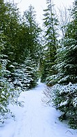
Rowleys Bay, Wisconsin | |
|---|---|
| Coordinates: 45°13′11″N 87°02′07″W / 45.21972°N 87.03528°W | |
| Country | |
| State | |
| County | Door |
| Town | Liberty Grove |
| Time zone | UTC-6 ( Central (CST)) |
| • Summer ( DST) | UTC-5 (CDT) |
| Area code | 920 |
| GNIS feature ID | 1572692 [1] |
Rowleys Bay ( /ˈroʊliz ˈbeɪ/ ROH-leez BAY) [2] is an unincorporated community located on Lake Michigan in northern Door County, Wisconsin, in the town of Liberty Grove. [1] [3] The community is named after Peter Rowley who settled in the area in 1835. [4]
Gallery
References
- ^ a b "Rowleys Bay". Geographic Names Information System. United States Geological Survey, United States Department of the Interior. Retrieved July 5, 2009.
- ^ MissPronouncer.com: A HALFWAY DECENT AUDIO PRONUNCIATION GUIDE FOR WISCONSIN
- ^ "Topographic map". United States Geological Survey. Microsoft Research Maps. Retrieved July 5, 2009.
- ^ Heim, Michael (2004). Exploring America's Highways. Exploring America's Highway. p. 200. ISBN 0-9744358-0-5.


