Ringe | |
|---|---|
 Ringe Location of the community of Ringe within Olmsted County  Ringe Ringe (the United States) | |
| Coordinates: 44°06′29″N 92°23′58″W / 44.10806°N 92.39944°W | |
| Country | United States |
| State | Minnesota |
| County | Olmsted |
| Township | Farmington Township and Haverhill Township |
| Elevation | 1,207 ft (368 m) |
| Time zone | UTC-6 ( Central (CST)) |
| • Summer ( DST) | UTC-5 (CDT) |
| ZIP code | 55906 |
| Area code | 507 |
| GNIS feature ID | 654905 [1] |
Ringe is an unincorporated community in Olmsted County, Minnesota, United States, near Rochester. The community is located along 75th Street NE near 40th Avenue NE. Ringe is located within Farmington Township and Haverhill Township.
References
Municipalities and communities of
Olmsted County, Minnesota, United States | ||
|---|---|---|
| Cities | 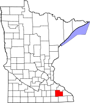 | |
| Townships | ||
| CDPs | ||
|
Unincorporated communities | ||
| Footnotes | ‡This populated place also has portions in an adjacent county or counties | |