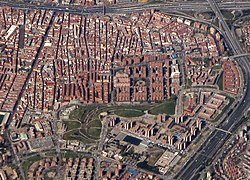
Numancia | |
|---|---|
 | |
 | |
| Country | Spain |
| Region | Community of Madrid |
| Municipality | Madrid |
| District | Ciudad Lineal |
| Area | |
| • Total | 1.849172 km2 (0.713969 sq mi) |
| Population (2020) | |
| • Total | 48,815 |
| • Density | 26,000/km2 (68,000/sq mi) |
|
| |
Numancia is an administrative neighborhood (barrio) of Madrid belonging to the district of Puente de Vallecas.
It has an area of 1.849172 km2 (0.713969 sq mi). [1] As of 1 March 2020, it has a population of 48,815. [2]
References
- ^ "Callejero vigente. Barrios". Ayuntamiento de Madrid.
- ^ "Población por distrito y barrio". Ayuntamiento de Madrid. Retrieved 20 March 2020.
Wikimedia Commons has media related to
Numancia neighborhood, Madrid.