.jpg)
Norwood is an unincorporated community in Nelson County, Virginia, United States. [1] It was among the communities severely affected by flash flooding from Hurricane Camille in 1969. [2]
Montezuma was listed on the National Register of Historic Places in 1980. [3]
References
- ^ "Norwood". Geographic Names Information System. United States Geological Survey, United States Department of the Interior.
- ^ Garnett P. Williams and Harold P. Guy. Erosional and Depositional Aspects of Hurricane Camille in Virginia, 1969. United States Government Printing Office, 1973, pp. 1.
- ^ "National Register Information System". National Register of Historic Places. National Park Service. July 9, 2010.
Municipalities and communities of
Nelson County, Virginia, United States | ||
|---|---|---|
| CDPs | 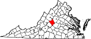 | |
|
Other communities |
| |
| Footnotes | ‡This populated place also has portions in an adjacent county or counties | |
37°38′36″N 78°48′32″W / 37.64333°N 78.80889°W
|
| This Nelson County, Virginia state location article is a stub. You can help Wikipedia by expanding it. |