
This is a list of the National Register of Historic Places listings in Hawkins County, Tennessee.
This is intended to be a complete list of the properties and districts on the National Register of Historic Places in Hawkins County, Tennessee, United States. Latitude and longitude coordinates are provided for many National Register properties and districts; these locations may be seen together in a map. [1]
There are 12 properties and districts listed on the National Register in the county.
| Anderson – Bedford – Benton – Bledsoe – Blount – Bradley – Campbell – Cannon – Carroll – Carter – Cheatham – Chester – Claiborne – Clay – Cocke – Coffee – Crockett – Cumberland – Davidson – Decatur – DeKalb – Dickson – Dyer – Fayette – Fentress – Franklin – Gibson – Giles – Grainger – Greene – Grundy – Hamblen – Hamilton – Hancock – Hardeman – Hardin – Hawkins – Haywood – Henderson – Henry – Hickman – Houston – Humphreys – Jackson – Jefferson – Johnson – Knox – Lake – Lauderdale – Lawrence – Lewis – Lincoln – Loudon – Macon – Madison – Marion – Marshall – Maury – McMinn – McNairy – Meigs – Monroe – Montgomery – Moore – Morgan – Obion – Overton – Perry – Pickett – Polk – Putnam – Rhea – Roane – Robertson – Rutherford – Scott – Sequatchie – Sevier – Shelby – Smith – Stewart – Sullivan – Sumner – Tipton – Trousdale – Unicoi – Union – Van Buren – Warren – Washington – Wayne – Weakley – White – Williamson – Wilson |
This
National Park Service list is complete through
NPS recent listings posted April 12, 2024.
[2]
Current listings
| [3] | Name on the Register [4] | Image | Date listed [5] | Location | City or town | Description |
|---|---|---|---|---|---|---|
| 1 | Amis House |  |
June 19, 1973 ( #73001786) |
East of Rogersville on Burem Pike 36°25′10″N 82°57′21″W / 36.419444°N 82.955833°W | Rogersville | Built in the 1780s by Hawkins County pioneer Thomas Amis. Inventory form. |
| 2 | Boatyard Historic District |  |
December 12, 1973 ( #73001785) |
Southwest of Kingsport on Holston and the South Fork of the
Holston River 36°33′02″N 82°36′17″W / 36.550556°N 82.604722°W | Kingsport | |
| 3 | Bulls Gap Historic District |  |
July 30, 1987 ( #87001232) |
S. Main, Church, McGregor, Price, and Mill Sts. 36°15′11″N 83°05′15″W / 36.253056°N 83.0875°W | Bulls Gap | |
| 4 | Fudge Farm |  |
December 12, 1976 ( #76001783) |
Northeast of Surgoinsville on
U.S. Route 11W 36°29′11″N 82°49′36″W / 36.486389°N 82.826667°W | Surgoinsville | Built in the early 1850s by local planter Conrad Fudge. Inventory form. |
| 5 | Long Meadow |  |
January 11, 1974 ( #74001915) |
North of Surgoinsville off
U.S. Route 11W 36°30′05″N 82°51′20″W / 36.50139°N 82.85556°W | Surgoinsville | 18th-century house located in Carters Valley. Inventory form. |
| 6 | Moore Family Farm | May 3, 2006 ( #06000343) |
483 VFW Rd. 36°16′01″N 83°04′02″W / 36.266944°N 83.067222°W | Bulls Gap | ||
| 7 | New Providence Presbyterian Church, Academy, and Cemetery |  |
December 1, 1978 ( #78002600) |
Northeast of Surgoinsville off
U.S. Route 11W 36°29′43″N 82°49′26″W / 36.495278°N 82.823889°W | Surgoinsville | Inventory form. |
| 8 | Pressmen's Home Historic District |  |
November 20, 1985 ( #85002970) |
State Route 94 36°27′00″N 83°03′15″W / 36.45°N 83.054167°W | Pressmen's Home | |
| 9 | Price Public Elementary School |  |
November 10, 1988 ( #88002538) |
Hasson and Spring Sts. 36°24′34″N 83°00′32″W / 36.409444°N 83.008889°W | Rogersville | Built in 1922 for the town's African-American community; now a community center and museum. Inventory form. |
| 10 | Rogersville Historic District |  |
February 23, 1973 ( #73001787) |
Bounded by N. Boyd, Kyle, Clinch, and N. Bend Sts., McKinney Ave., and S. Rogen Rd. 36°24′26″N 83°00′19″W / 36.407222°N 83.005278°W | Rogersville | Contributing properties in the district include Hale Springs Inn, ca. 1824; Hawkins County Courthouse, ca. 1836; and Overton Lodge, ca. 1840. |
| 11 | St. Marks Presbyterian Church |  |
March 10, 2006 ( #06000132) |
Junction of N. Hassen and W. Kyle Sts. 36°24′34″N 83°00′29″W / 36.409444°N 83.008056°W | Rogersville | Built in 1912 by Rogersville's African-American community; Inventory form. |
| 12 | Stony Point |  |
April 26, 1973 ( #73001788) |
Northeast of Surgoinsville on
U.S. Route 11W 36°29′21″N 82°49′17″W / 36.489167°N 82.821389°W | Surgoinsville |
See also
Wikimedia Commons has media related to
National Register of Historic Places in Hawkins County, Tennessee.
- List of National Historic Landmarks in Tennessee
- National Register of Historic Places listings in Tennessee
References
- ^ The latitude and longitude information provided in this table was derived originally from the National Register Information System, which has been found to be fairly accurate for about 99% of listings. Some locations in this table may have been corrected to current GPS standards.
- ^ National Park Service, United States Department of the Interior, "National Register of Historic Places: Weekly List Actions", retrieved April 12, 2024.
- ^ Numbers represent an alphabetical ordering by significant words. Various colorings, defined here, differentiate National Historic Landmarks and historic districts from other NRHP buildings, structures, sites or objects.
- ^ "National Register Information System". National Register of Historic Places. National Park Service. April 24, 2008.
- ^ The eight-digit number below each date is the number assigned to each location in the National Register Information System database, which can be viewed by clicking the number.
| Topics | |
|---|---|
| Lists by state |
|
| Lists by insular areas | |
| Lists by associated state | |
| Other areas | |
| Related | |
Municipalities and communities of
Hawkins County, Tennessee, United States | ||
|---|---|---|
| Cities | 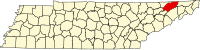 | |
| Towns | ||
| CDP | ||
|
Unincorporated communities | ||
| Ghost town | ||
| Footnotes | ‡This populated place also has portions in an adjacent county or counties | |