Municipality of Ankaran
| |
|---|---|
 | |
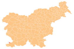
 Location of the Municipality of Ankaran in Slovenia | |
| Coordinates: 45°35′N 13°44′E / 45.583°N 13.733°E | |
| Country | |
| Government | |
| • Mayor | Gregor Strmčnik |
| Area | |
| • Total | 8.0 km2 (3.1 sq mi) |
| Population (2016)
[1] | |
| • Total | 3,227 |
| • Density | 400/km2 (1,000/sq mi) |
| Time zone | UTC+01 ( CET) |
| • Summer ( DST) | UTC+02 ( CEST) |
| Website |
www |
The Municipality of Ankaran (pronounced [aŋkaˈɾaːn]; Slovene: Občina Ankaran) is a municipality on the coast of the Adriatic Sea in southwestern Slovenia. Its seat and only settlement is Ankaran. It was formed in 2011, when it was split from the Municipality of Koper. [2]
References
- ^ a b "Občina Ankaran". Statistični urad Republike Slovenije. Retrieved February 5, 2020.
- ^ "Decision on the Establishment of the Municipality of Ankaran". Official Gazette. June 9, 2011. Retrieved 18 June 2017.
External links
-
 Media related to
Municipality of Ankaran at Wikimedia Commons
 - Municipality of Ankaran on Geopedia
- Official site
