| Mount Blue | |
|---|---|
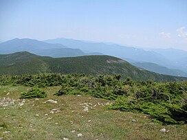
 Mount Blue from near the summit of
Mount Moosilauke | |
| Highest point | |
| Elevation | 4,529 ft (1,380 m) [1] |
| Prominence | 129 ft (39 m) [1] |
| Coordinates | 44°01′51″N 71°49′13″W / 44.0308998°N 71.8203616°W [2] |
| Geography | |
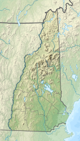
| Location | Grafton County, New Hampshire |
| Parent range | White Mountains |
| Topo map | USGS Mount Moosilauke |
Mount Blue is a mountain in the White Mountains, located in Benton, New Hampshire. In spite of its height over 4,000 feet, it is not usually considered one of the four-thousand footers of New Hampshire, because its prominence is less than 200 feet, making it a sub-peak of Mount Moosilauke.
References
- ^ a b "Mount Blue, New Hampshire". Peakbagger.com. Retrieved 2013-02-02.
- ^ "Mount Blue". Geographic Names Information System. United States Geological Survey, United States Department of the Interior. Retrieved 2009-02-22.
