
Mayday is a ghost town in La Plata County, Colorado, United States. [1] It was named for the Mayday Mine. [2]
History
The Mayday post office opened on September 4, 1913, but closed on December 31, 1914. [3]
Geography
Mayday is located at 37°21′02″N 108°04′36″W / 37.3506°N 108.0767°W. It lies 8,734 feet (2,662 m) above sea level. [1]
See also
References
- ^ a b U.S. Geological Survey Geographic Names Information System: Mayday
- ^ "Mayday - Colorado Ghost Town". ghosttowns.com. Retrieved May 1, 2016.
- ^ Bauer, William H.; Ozment, James L.; Willard, John H. (1990). Colorado Post Offices 1859–1989. Golden, Colorado: Colorado Railroad Historical Foundation. ISBN 0-918654-42-4.
External links
Wikimedia Commons has media related to
Mayday, Colorado.
- Mayday - Colorado Ghost Town at GhostTowns.com
Municipalities and communities of
La Plata County, Colorado, United States | ||
|---|---|---|
| City | 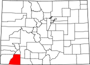 | |
| Towns | ||
| CDPs | ||
|
Unincorporated communities | ||
| Ghost towns | ||
|
Indian reservations | ||
| Footnotes | ‡This populated place also has portions in an adjacent county or counties | |
|
| This Colorado state location article is a stub. You can help Wikipedia by expanding it. |